MyTopo
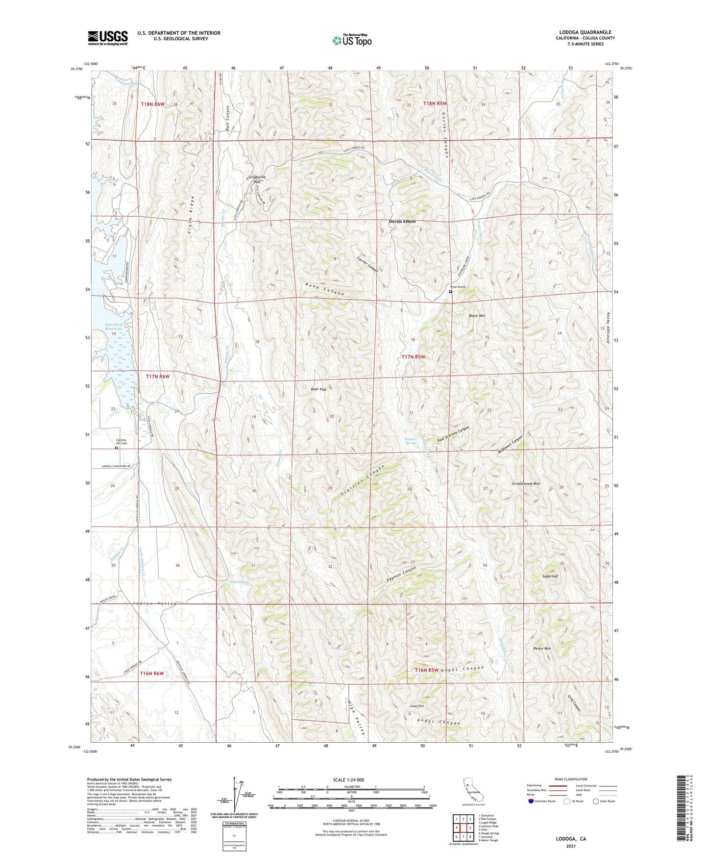
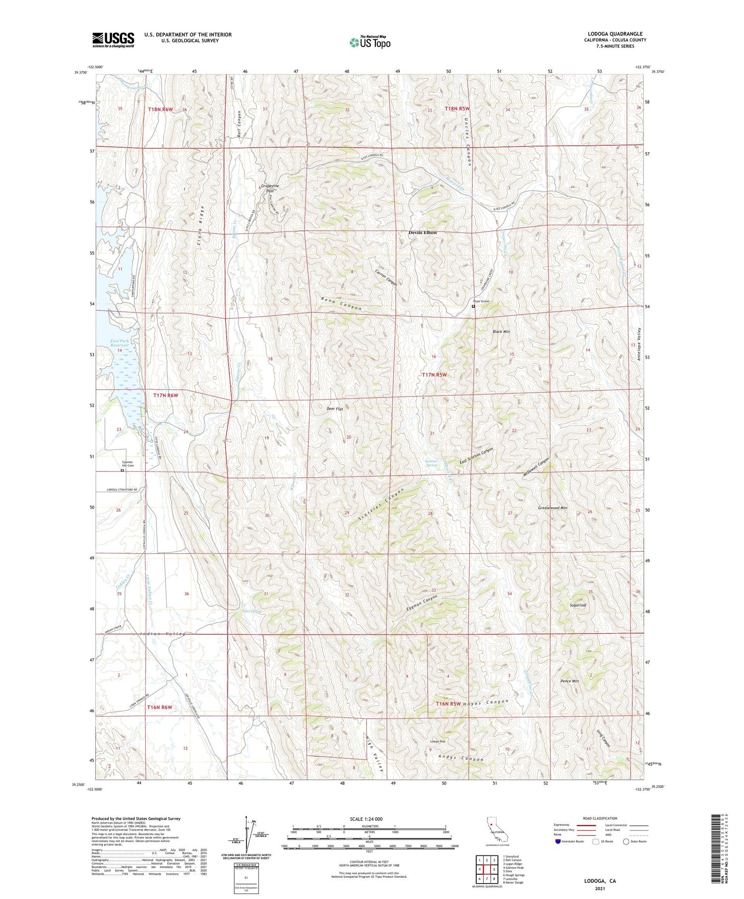
Lodoga California US Topo Map
Couldn't load pickup availability
2023 topographic map quadrangle Lodoga in the state of California. Scale: 1:24000. Based on the newly updated USGS 7.5' US Topo map series, this map is in the following counties: Colusa. The map contains contour data, water features, and other items you are used to seeing on USGS maps, but also has updated roads and other features. This is the next generation of topographic maps. Printed on high-quality waterproof paper with UV fade-resistant inks.
Quads adjacent to this one:
West: Gilmore Peak
Northwest: Stonyford
North: Rail Canyon
Northeast: Logan Ridge
East: Sites
Southeast: Manor Slough
South: Leesville
Southwest: Hough Springs
This map covers the same area as the classic USGS quad with code o39122c4.
Contains the following named places: Andys Canyon, Black Mountain, Black Mountain School, Carrier Canyon, Clark Ridge, Cypress Hill Cemetery, Deer Flat, Devils Elbow, East Scotties Canyon, Eggman Canyon, Grapevine Pass, Greasewood Mountain, Hayes Canyon, Howard Creek, Indian Creek, Indian Ranch Airport, Little Antelope Grade, Little Indian Creek, Little Stony School, Lodoga, Lodoga Peak, McDowell Canyon, Pence Mountain, Pryor Grave, Rena Canyon, Scotties Canyon, Scotties Spring, Squaw Creek, Stites Spring, Sugarloaf, Uncles Canyon, Wilson Creek