MyTopo
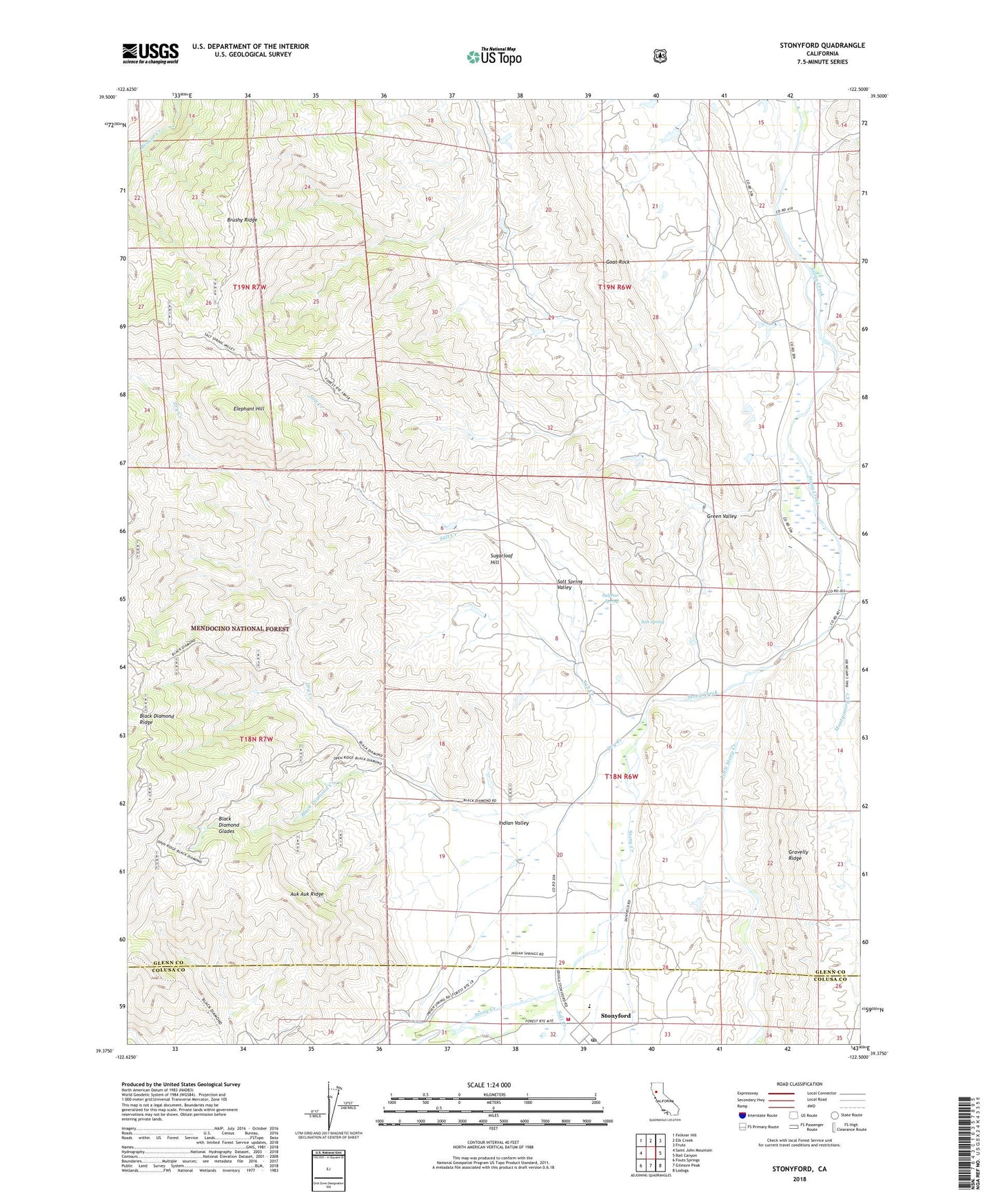
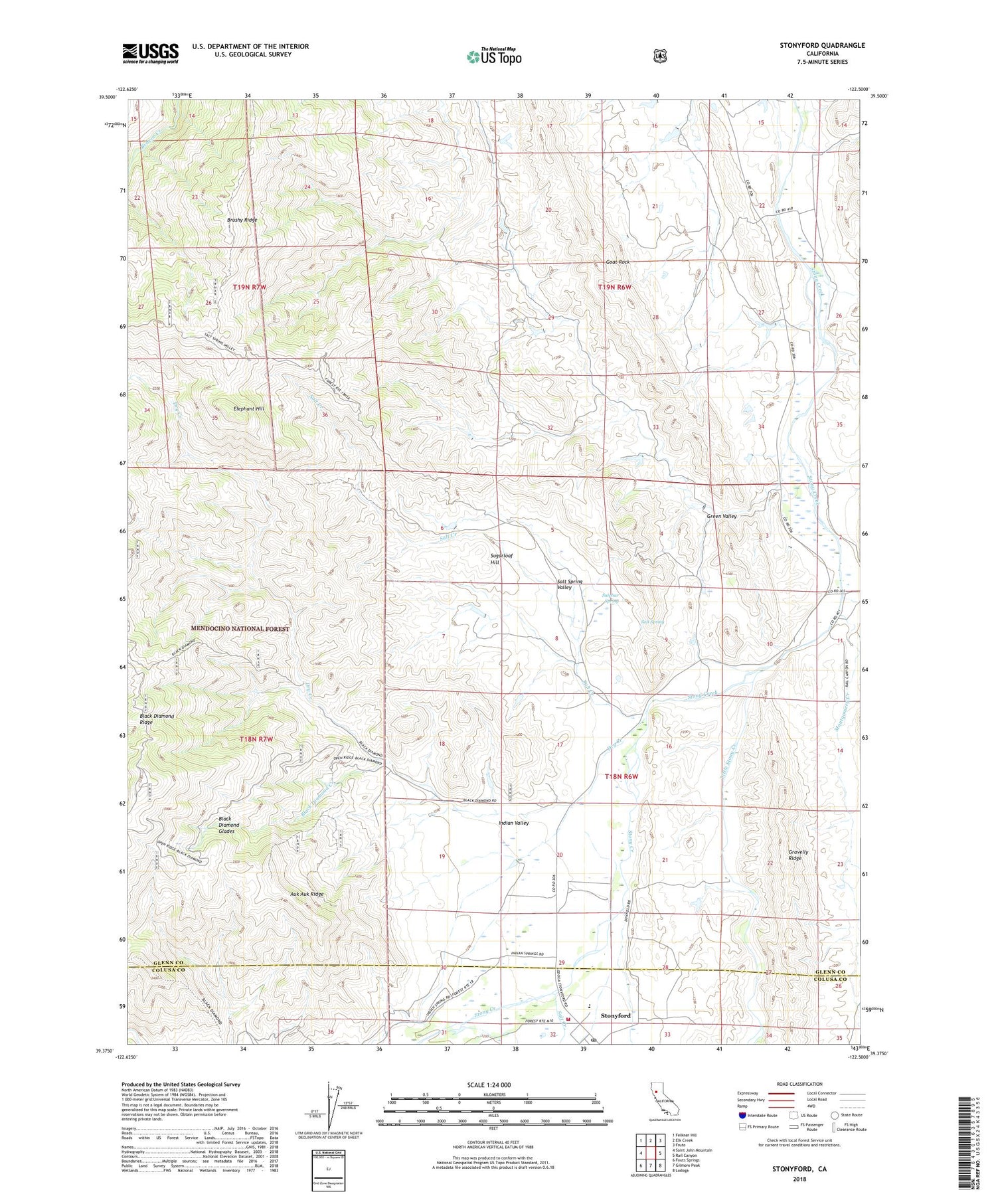
Stonyford California US Topo Map
Couldn't load pickup availability
Also explore the Stonyford Forest Service Topo of this same quad for updated USFS data
2022 topographic map quadrangle Stonyford in the state of California. Scale: 1:24000. Based on the newly updated USGS 7.5' US Topo map series, this map is in the following counties: Glenn, Colusa. The map contains contour data, water features, and other items you are used to seeing on USGS maps, but also has updated roads and other features. This is the next generation of topographic maps. Printed on high-quality waterproof paper with UV fade-resistant inks.
Quads adjacent to this one:
West: Saint John Mountain
Northwest: Felkner Hill
North: Elk Creek
Northeast: Fruto
East: Rail Canyon
Southeast: Lodoga
South: Gilmore Peak
Southwest: Fouts Springs
This map covers the same area as the classic USGS quad with code o39122d5.
Contains the following named places: Auk Auk Ridge, Bear Valley - Indian Valley Fire Protection District, Black Diamond Creek, Black Diamond Glades, Black Diamond Ridge, Brushy Ridge, Dry Creek, Elephant Hill, Goat Rock, Green Valley, Indian Valley, Indian Valley School, Little Stony Creek, Montgomery Creek, Pigeon Creek, Saint Mary of the Mountain Church, Salt Creek, Salt Spring, Salt Spring Valley, Stonyford, Stonyford Post Office, Stonyford Rancheria, Stonyford Work Center, Sugarloaf Hill, Sulphur Spring