
MyTopo
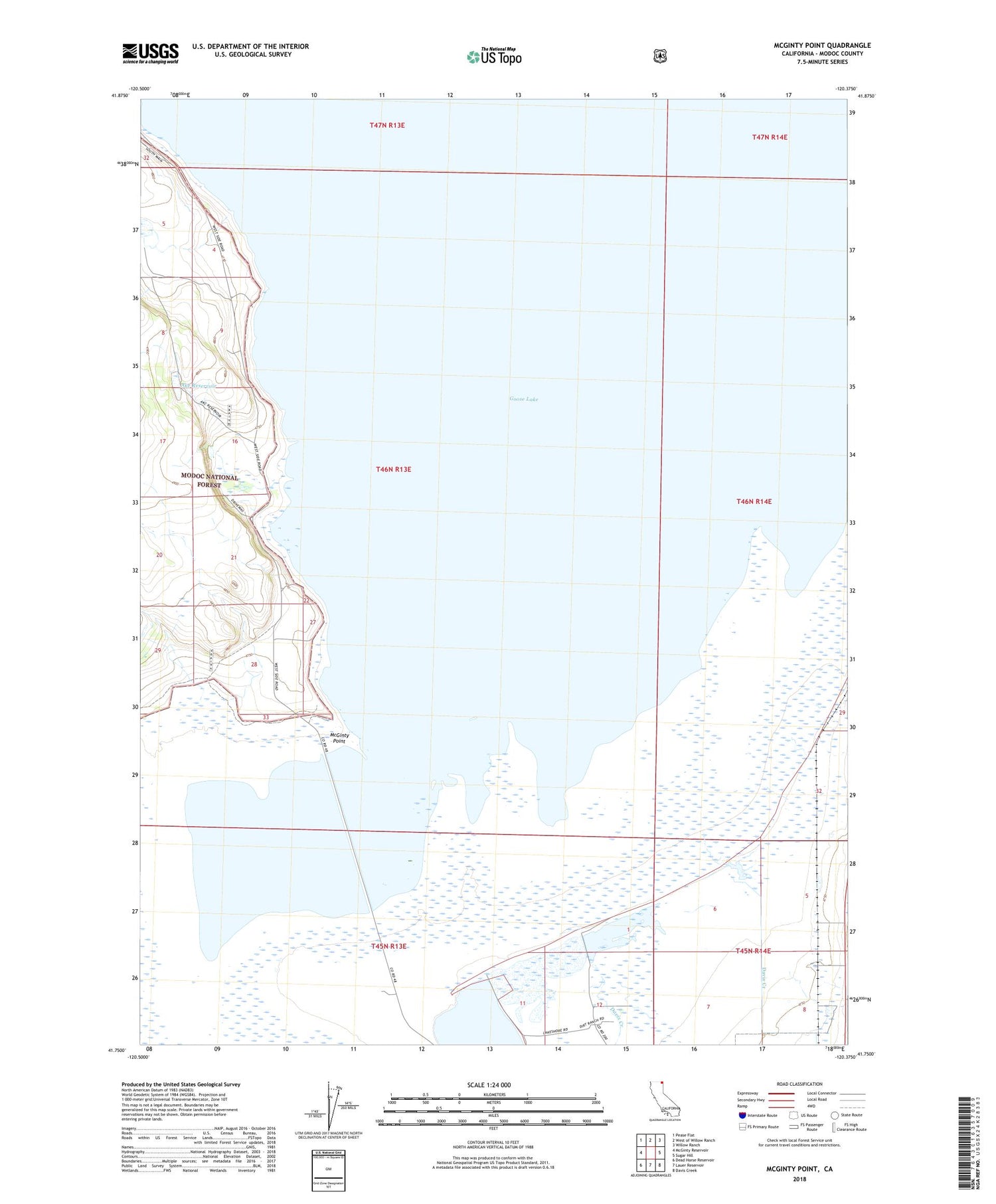
McGinty Point California US Topo Map
Couldn't load pickup availability
Also explore the McGinty Point Forest Service Topo of this same quad for updated USFS data
2022 topographic map quadrangle McGinty Point in the state of California. Scale: 1:24000. Based on the newly updated USGS 7.5' US Topo map series, this map is in the following counties: Modoc. The map contains contour data, water features, and other items you are used to seeing on USGS maps, but also has updated roads and other features. This is the next generation of topographic maps. Printed on high-quality waterproof paper with UV fade-resistant inks.
Quads adjacent to this one:
West: McGinty Reservoir
Northwest: Pease Flat
North: West of Willow Ranch
Northeast: Willow Ranch
East: Sugar Hill
Southeast: Davis Creek
South: Lauer Reservoir
Southwest: Dead Horse Reservoir
This map covers the same area as the classic USGS quad with code o41120g4.
Contains the following named places: Ake Reservoir, Davis Creek, Lakeshore Ranch, McGinty Point, ZIP Code: 96108


