
MyTopo
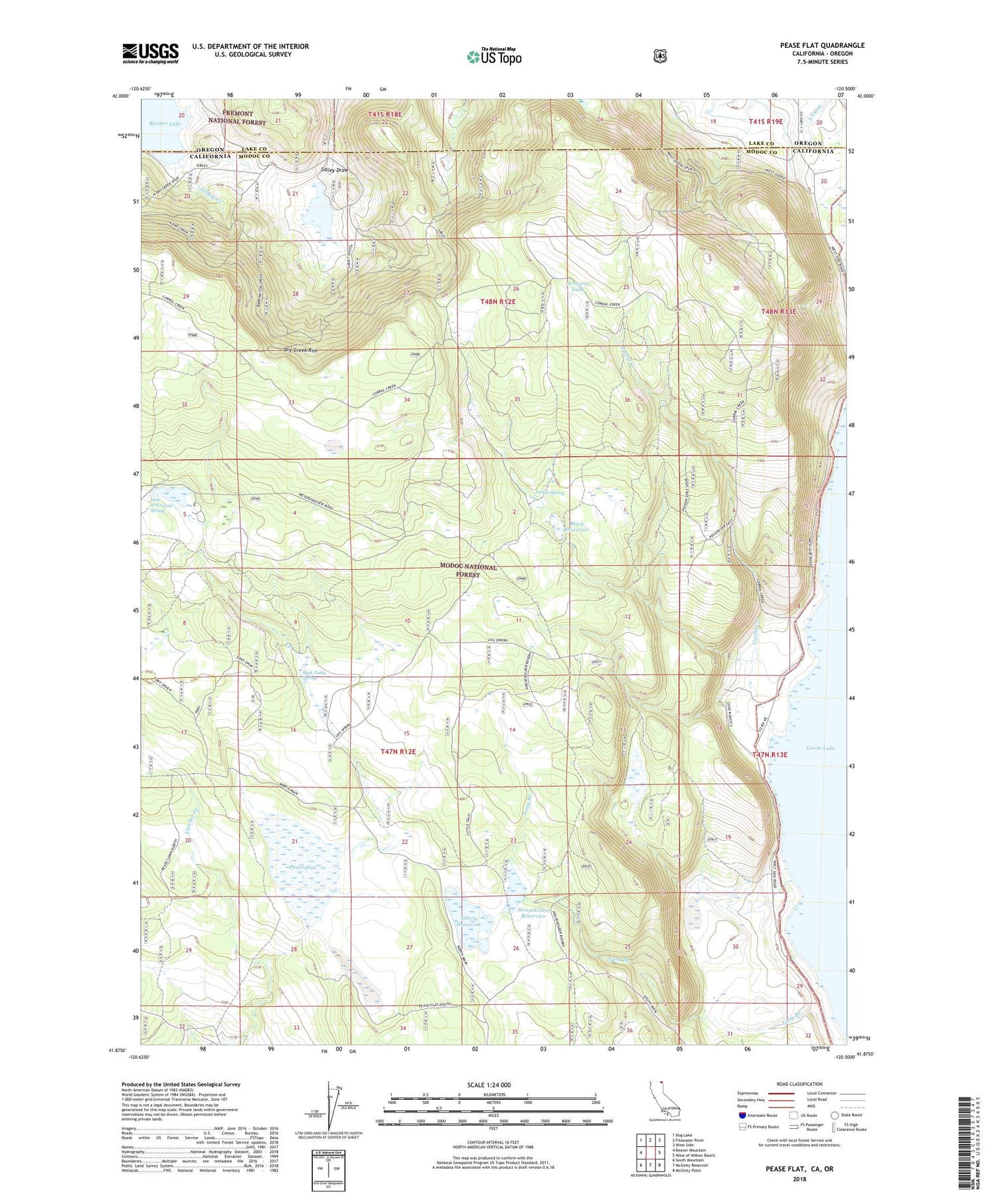
Pease Flat California US Topo Map
Couldn't load pickup availability
Also explore the Pease Flat Forest Service Topo of this same quad for updated USFS data
2022 topographic map quadrangle Pease Flat in the state of California. Scale: 1:24000. Based on the newly updated USGS 7.5' US Topo map series, this map is in the following counties: Modoc, Lake. The map contains contour data, water features, and other items you are used to seeing on USGS maps, but also has updated roads and other features. This is the next generation of topographic maps. Printed on high-quality waterproof paper with UV fade-resistant inks.
Quads adjacent to this one:
West: Beaver Mountain
Northwest: Dog Lake
North: Fitzwater Point
Northeast: West Side
East: West of Willow Ranch
Southeast: McGinty Point
South: McGinty Reservoir
Southwest: South Mountain
Contains the following named places: Back Tuttle Spring, Black Reservoir, Corral Creek, Cove Ranch, Dry Creek Rim, Enquist 158 Dam, Enquist Reservoir, Everly Ranch, Everly Reservoir, Gillum Creek, Hole-in-Ground Spring, Householder Dam, Householder Reservoir, Long Branch, Meteorite Tank, Pease Cabin, Pease Flat, Point Ranch, Poison Spring, Renner Sibley Creek 1119 Dam


