MyTopo
Moonridge California US Topo Map
Couldn't load pickup availability
Also explore the Moonridge Forest Service Topo of this same quad for updated USFS data
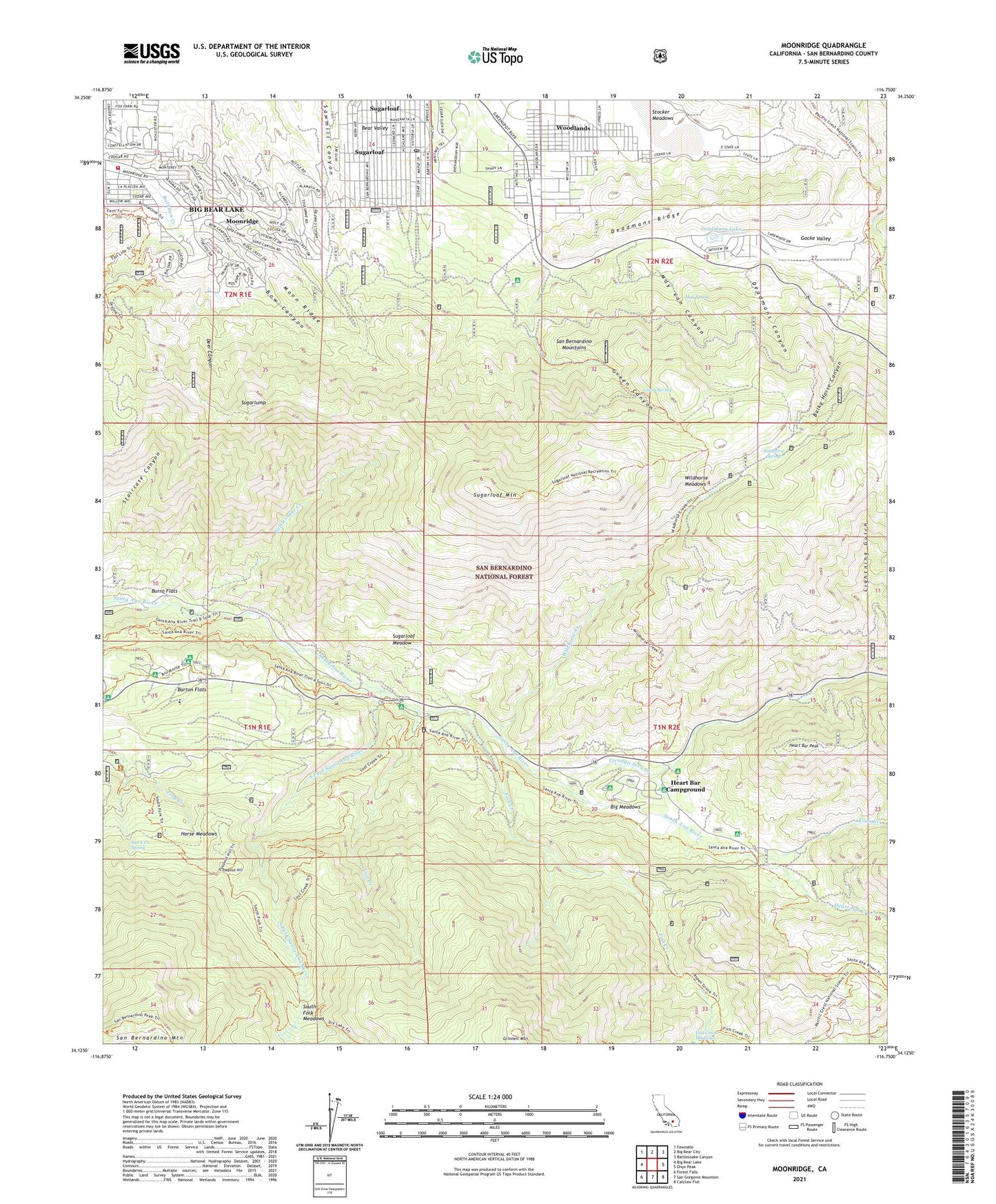
2021 topographic map quadrangle Moonridge in the state of California. Scale: 1:24000. Based on the newly updated USGS 7.5' US Topo map series, this map is in the following counties: San Bernardino. The map contains contour data, water features, and other items you are used to seeing on USGS maps, but also has updated roads and other features. This is the next generation of topographic maps. Printed on high-quality waterproof paper with UV fade-resistant inks.
Quads adjacent to this one:
West: Big Bear Lake
Northwest: Fawnskin
North: Big Bear City
Northeast: Rattlesnake Canyon
East: Onyx Peak
Southeast: Catclaw Flat
South: San Gorgonio Mountain
Southwest: Forest Falls
This map covers the same area as the classic USGS quad with code o34116b7.
Contains the following named places: Animal Park, Aspen Grove, Balky Horse Canyon, Barker Dam, Barton Flats, Big Bear Lake Fire Protection District Moonridge Station, Big Meadows, Bow Canyon, Burro Flats, Camp Akela, Camp Conrad, Camp Edwards, Camp Good News, Camp JCA, Camp Nawakwa, Camp Norris, Camp Oakes, Camp Osceola, Camp River Glen, Camp Tautona, Camp Tulake, Cienaga Seca Creek, College Camp, Coon Creek, Deadmans Canyon, Deadmans Lake, Deadmans Ridge, Deer Canyon, Dollar Lake Trail, Erwin Lake, Fish Creek, Gocke Valley, Gold Mine Golf Course, Gold Mine Ski Area, Green Canyon, Green Canyon Group Camp, Green Spot, Green Spot Picnic Area, Green Spring, Grinnell Mountain, Heart Bar Campground, Heart Bar Creek, Heart Bar Peak, Heart Bar Ranch, Heart Bar State Park, Horse Meadows, KBBL-TV (Big Bear Lake), KTOT-FM (Big Bear Lake), Lightning Gulch, Lost Creek, May Spring, May Van Canyon, Mile High Pines Camp, Moon Ridge, Moonridge, Moonridge Zoo, Oso-Lobo Campground, Poopout Hill, Promised Land Camp, Rattlesnake Creek, San Gorgonio Campground, San Y Ca Spring, Sand Canyon, South Fork Campground, South Fork Meadows, South Fork Santa Ana River, South Fork Trail, Stocker Meadows, Sugarloaf, Sugarloaf Meadow, Sugarloaf Mountain, Sugarloaf Post Office, Sugarlump, University Camp, Vaquero Campsite, Wildhorse Creek, Wildhorse Meadows, Wildhorse Spring, Woodlands, ZIP Codes: 92305, 92386


