
MyTopo
Nebo California US Topo Map
Couldn't load pickup availability
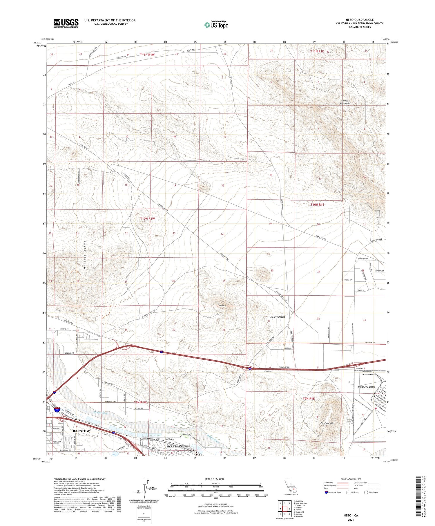
2021 topographic map quadrangle Nebo in the state of California. Scale: 1:24000. Based on the newly updated USGS 7.5' US Topo map series, this map is in the following counties: San Bernardino. The map contains contour data, water features, and other items you are used to seeing on USGS maps, but also has updated roads and other features. This is the next generation of topographic maps. Printed on high-quality waterproof paper with UV fade-resistant inks.
Quads adjacent to this one:
West: Barstow
Northwest: Mud Hills
North: Lane Mountain
Northeast: Coyote Lake
East: Yermo
Southeast: Minneola
South: Daggett
Southwest: Barstow SE
This map covers the same area as the classic USGS quad with code o34116h8.
Contains the following named places: Barium Queen Mine, Barstow Mall Shopping Center, Brubaker Beige Rock Quarry, Burcham Mine, Elephant Mountain, Hi-Desert Christian Center, Lead Mountain, Logistics Base Golf Course, Marine Corps Logistics Base Fire Station Yermo, Mitchel Range, Montara Elementary School, Nebo, Obregon Park, Silver Bow Mine, Silver Valley High School, Sorensen Field, Sturnacle Park, ZIP Code: 92311


