MyTopo
Minneola California US Topo Map
Couldn't load pickup availability
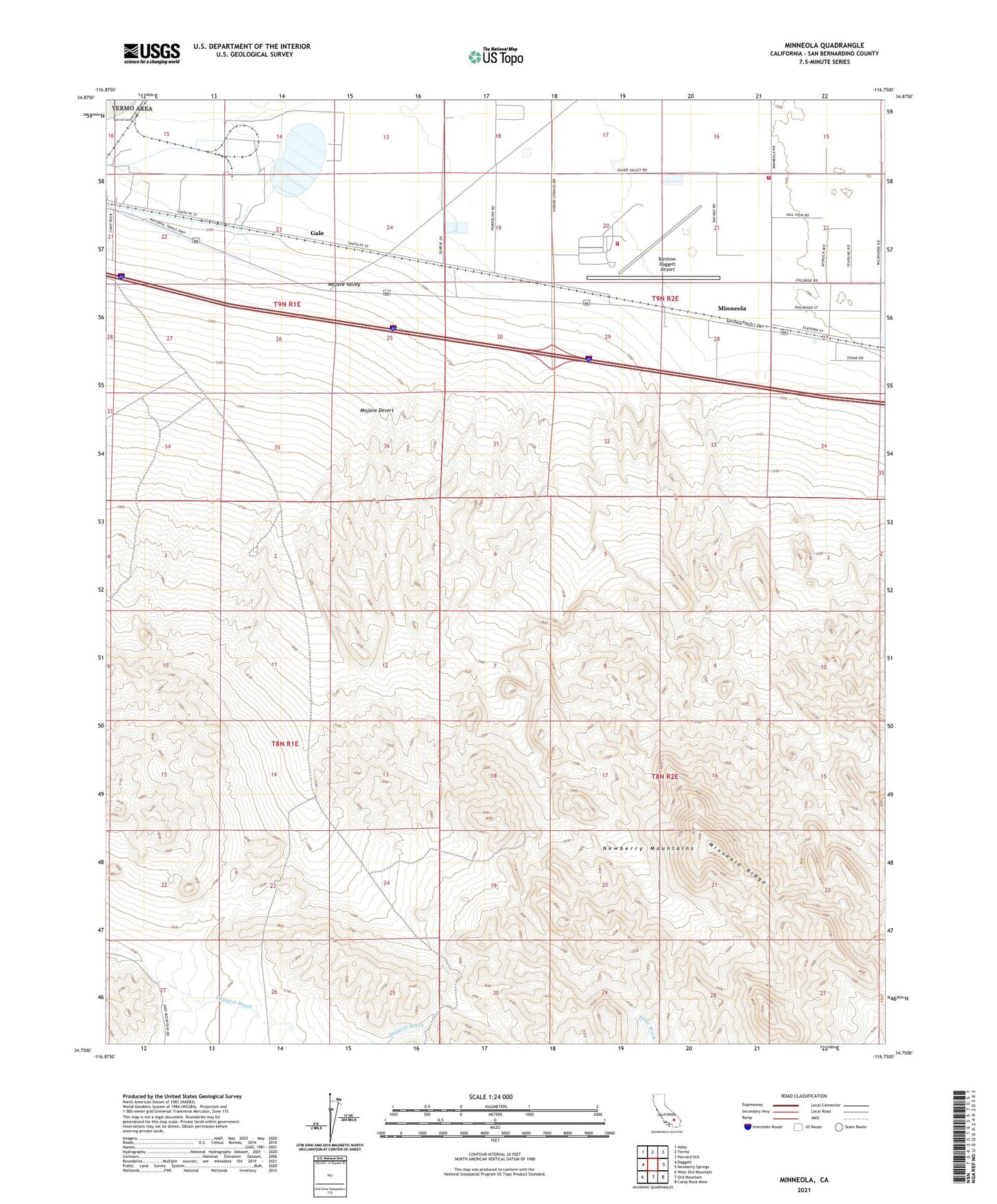
2021 topographic map quadrangle Minneola in the state of California. Scale: 1:24000. Based on the newly updated USGS 7.5' US Topo map series, this map is in the following counties: San Bernardino. The map contains contour data, water features, and other items you are used to seeing on USGS maps, but also has updated roads and other features. This is the next generation of topographic maps. Printed on high-quality waterproof paper with UV fade-resistant inks.
Quads adjacent to this one:
West: Daggett
Northwest: Nebo
North: Yermo
Northeast: Harvard Hill
East: Newberry Springs
Southeast: Camp Rock Mine
South: Ord Mountain
Southwest: West Ord Mountain
This map covers the same area as the classic USGS quad with code o34116g7.
Contains the following named places: Azucar Mine, Barstow-Daggett Airport, Cool Water Generating Station, Daggett Community Services District Fire Station 3, Fort Irwin Fire Department Station 413, Gale, Marine Corps Supply Center, Minneola, Minneola Ridge, Newberry Mountains, Newberry Mountains Wilderness, SCE Solar I Heliport, ZIP Code: 92327