MyTopo
Otay Mesa California US Topo Map
Couldn't load pickup availability
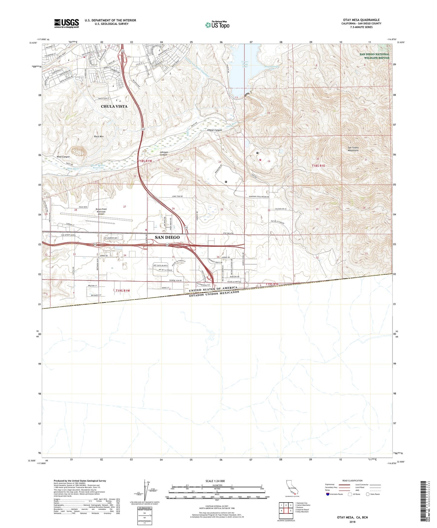
2021 topographic map quadrangle Otay Mesa in the state of California. Scale: 1:24000. Based on the newly updated USGS 7.5' US Topo map series, this map is in the following counties: San Diego. The map contains contour data, water features, and other items you are used to seeing on USGS maps, but also has updated roads and other features. This is the next generation of topographic maps. Printed on high-quality waterproof paper with UV fade-resistant inks.
Quads adjacent to this one:
West: Imperial Beach
Northwest: National City
North: Jamul Mountains
Northeast: Dulzura
East: Otay Mountain
This map covers the same area as the classic USGS quad with code o32116e8.
Contains the following named places: Alta School, Bird Ranch, Britannia Commerce Center, Brown Field Municipal Airport, Buschalaugh Cove, California Department of Forestry and Fire Protection Otay Fire Station 38, California Department of Forestry and Fire Protection Station 26 Donovan, Chula Vista Fire Department Station 7, Coronado Wye, De la Fuente Business Park, East Mesa Detention Facility, Empire Center, George F Bailey Detention Facility, Johnson Canyon, Kuebler Ranch, La Media Business Park, Lower Otay Camping Area, Lower Otay Filtration Plant, Martinez Ranch, O'Neal Canyon, Otay, Otay County Open Space Preserve, Otay la Mesa Business Center, Otay Lake County Park, Otay Mesa, Otay Mesa Industrial Park, Otay Mesa International Center, Otay Quarry, Otay Ranch, Piper Ranch Business Park, Richard J Donovan Correctional Facility, River Botton Reservoir, Rock Mountain, Salt Creek, San Diego Business Park, San Diego City Jail, San Diego Correctional Facility, San Diego Fire - Rescue Department Station 43, Savage Dam, Siempre Viva Business Park, Siempre Viva Industrial Center, Wolf Canyon, ZIP Codes: 91913, 91915