MyTopo
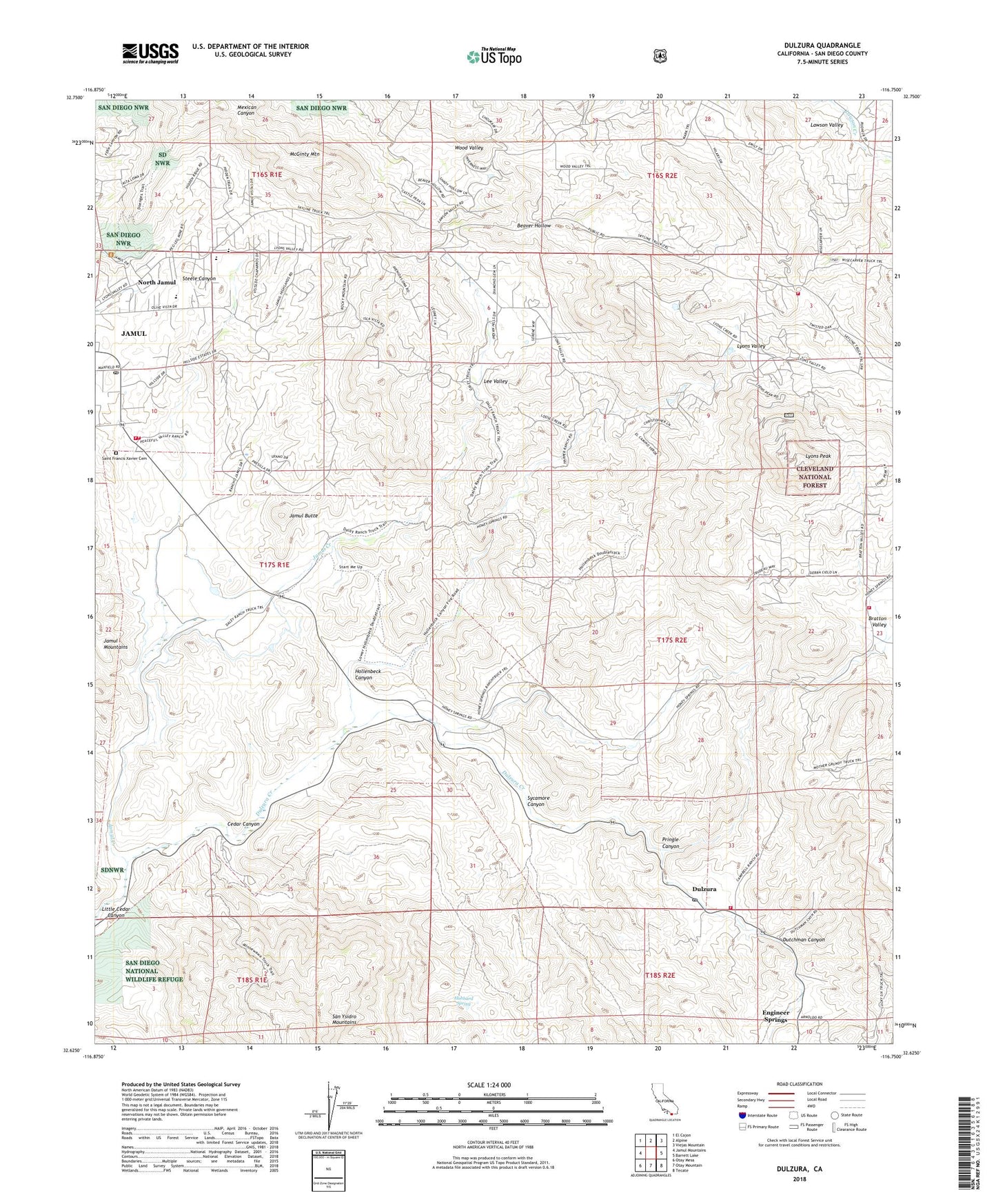
Dulzura California US Topo Map
Couldn't load pickup availability
Also explore the Dulzura Forest Service Topo of this same quad for updated USFS data
2021 topographic map quadrangle Dulzura in the state of California. Scale: 1:24000. Based on the newly updated USGS 7.5' US Topo map series, this map is in the following counties: San Diego. The map contains contour data, water features, and other items you are used to seeing on USGS maps, but also has updated roads and other features. This is the next generation of topographic maps. Printed on high-quality waterproof paper with UV fade-resistant inks.
Quads adjacent to this one:
West: Jamul Mountains
Northwest: El Cajon
North: Alpine
Northeast: Viejas Mountain
East: Barrett Lake
Southeast: Tecate
South: Otay Mountain
Southwest: Otay Mesa
This map covers the same area as the classic USGS quad with code o32116f7.
Contains the following named places: Bratton Ranch, Bratton Valley, California Department of Forestry and Fire Protection District Station 30, California Department of Forestry and Fire Protection District Station 32 - Lyons Valley, California Department of Forestry and Fire Protection District Station 37 - Deerhorn Valley, California Department of Forestry and Fire Protection Jamul Fire Station 36, California Department of Forestry and Fire Protection Station 34 - Lee Valley, California Riding and Hiking Trail, Camp Minnewawa, Cedar Canyon, Daley Ranch, Diamond Jack Campground, Dulzura, Dulzura Creek, Dulzura Post Office, Dutchman Canyon, Engineer Springs, Gasoline Curve, Harper Ranch, Hollenbeck Canyon, Honey Springs Ranch, Hubbard Spring, Indian Church, Jamul, Jamul Butte, Jamul Census Designated Place, Jamul Community Church, Jamul Division, Jamul Elementary School, Jamul Indian Village, Jamul Post Office, Las Flores School, Lawson Valley, Lee Valley, Little Cedar Canyon, Lyons Peak, Lyons Peak Lookout, Lyons Valley, McGinty Mountain, Mellor Ranch, Mocogo Ranch, Mother Grundy Truck Trail, Mountain Shadows Ranch, North Jamul, Oak Grove Middle School, Peg Leg Mine, Phelps Corner, Pringle Canyon, Saint Francis Xavier Cemetery, Saint Pius X Catholic Church, San Diego County Fire Station 36, Skyline Ranch, Skyline Ranch Campground, Sycamore Canyon, Wisecarver Truck Trail, Wood Valley, ZIP Code: 91935