MyTopo
Panamint Butte California US Topo Map
Couldn't load pickup availability
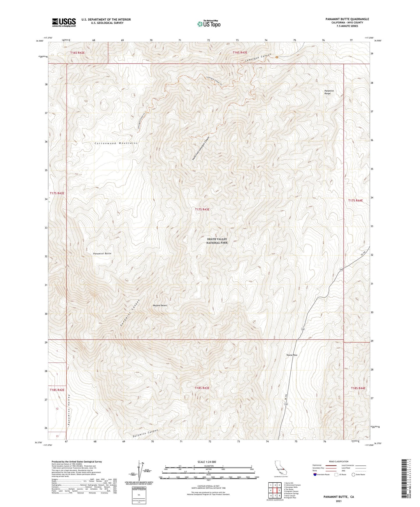
2021 topographic map quadrangle Panamint Butte in the state of California. Scale: 1:24000. Based on the newly updated USGS 7.5' US Topo map series, this map is in the following counties: Inyo. The map contains contour data, water features, and other items you are used to seeing on USGS maps, but also has updated roads and other features. This is the next generation of topographic maps. Printed on high-quality waterproof paper with UV fade-resistant inks.
Quads adjacent to this one:
West: The Dunes
Northwest: Harris Hill
North: Cottonwood Canyon
Northeast: Stovepipe Wells
East: Emigrant Canyon
Southeast: Emigrant Pass
South: Nova Canyon
Southwest: Panamint Springs
This map covers the same area as the classic USGS quad with code o36117d3.
Contains the following named places: Kerdell Prospect, Lemoigne Mine, Panamint Butte, Panamint Canyon, South Fork Lemoigne Canyon, Towne Pass