
MyTopo
Panoche Pass California US Topo Map
Couldn't load pickup availability
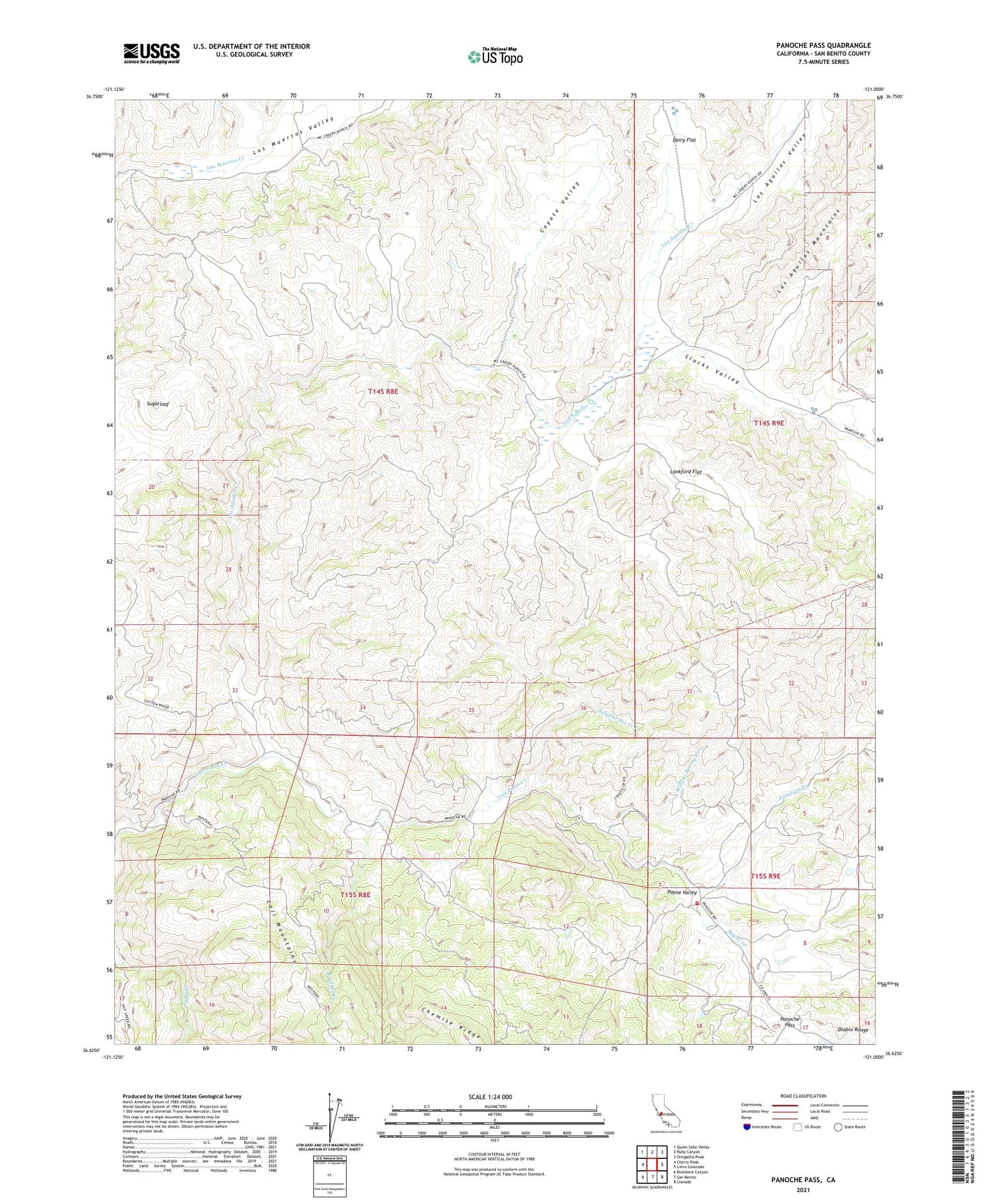
2021 topographic map quadrangle Panoche Pass in the state of California. Scale: 1:24000. Based on the newly updated USGS 7.5' US Topo map series, this map is in the following counties: San Benito. The map contains contour data, water features, and other items you are used to seeing on USGS maps, but also has updated roads and other features. This is the next generation of topographic maps. Printed on high-quality waterproof paper with UV fade-resistant inks.
Quads adjacent to this one:
West: Cherry Peak
Northwest: Quien Sabe Valley
North: Ruby Canyon
Northeast: Ortigalita Peak
East: Cerro Colorado
Southeast: Llanada
South: San Benito
Southwest: Bickmore Canyon
This map covers the same area as the classic USGS quad with code o36121f1.
Contains the following named places: Antelope Creek, Antelope Fire Control Station, Antelope School, Boulder Creek, Bradford Mine, Call Mountains, Chemise Ridge, Coyote Valley, Dairy Flat, Department of Forestry and Fire Protection Antelope Fire Station, Lankford Flat, Las Aguilas Creek, Las Aguilas Mountains, Las Aguilas Valley, Los Muertos Valley, McCreery Ranch, Panoche Pass, Payne Creek, Payne Valley, Real De Las Aguilas, Slacks Valley, Sugarloaf, Sulphuritos Creek, Willow Spring Creek


