MyTopo
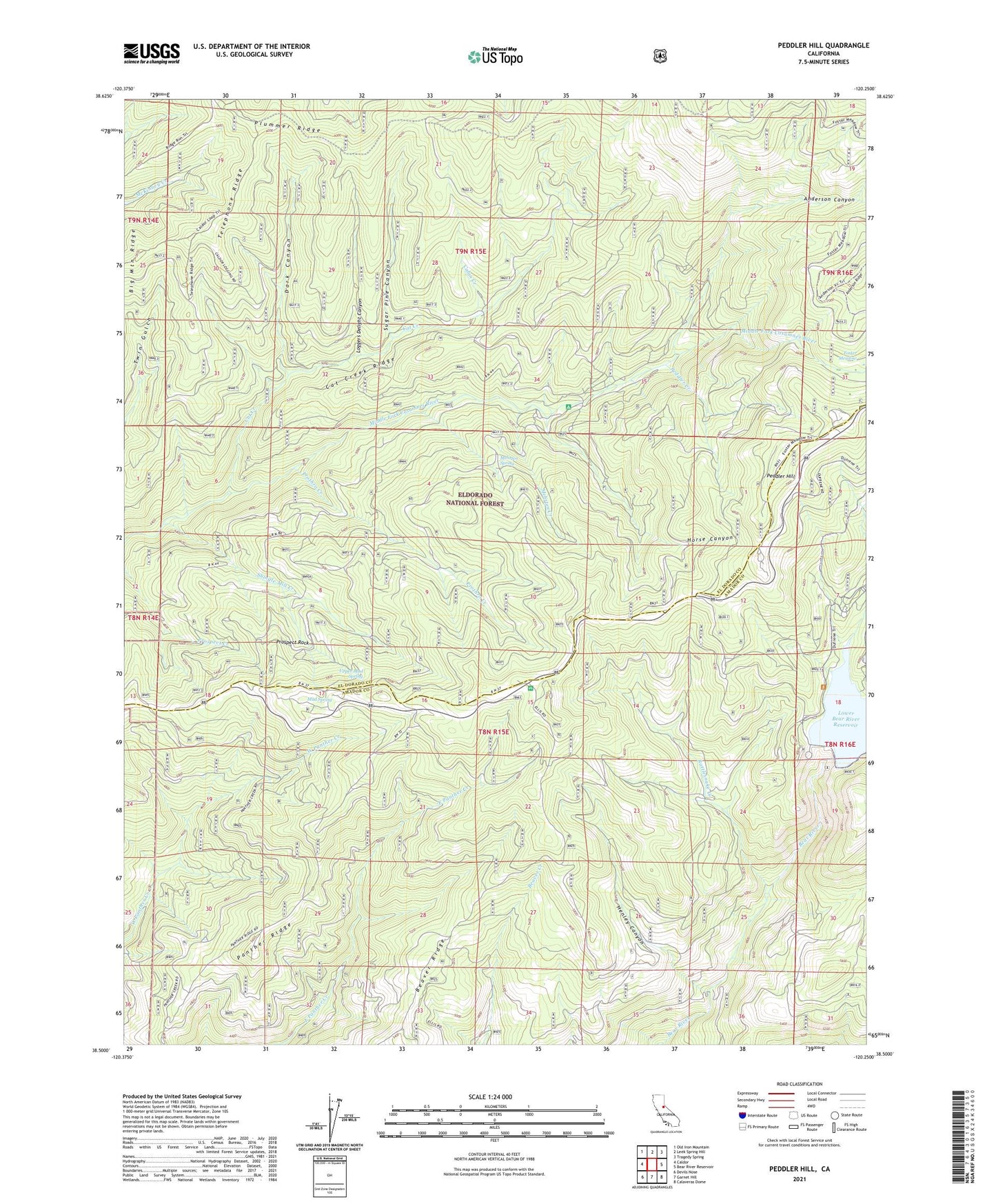
Peddler Hill California US Topo Map
Couldn't load pickup availability
Also explore the Peddler Hill Forest Service Topo of this same quad for updated USFS data
2021 topographic map quadrangle Peddler Hill in the state of California. Scale: 1:24000. Based on the newly updated USGS 7.5' US Topo map series, this map is in the following counties: El Dorado, Amador. The map contains contour data, water features, and other items you are used to seeing on USGS maps, but also has updated roads and other features. This is the next generation of topographic maps. Printed on high-quality waterproof paper with UV fade-resistant inks.
Quads adjacent to this one:
West: Caldor
Northwest: Old Iron Mountain
North: Leek Spring Hill
Northeast: Tragedy Spring
East: Bear River Reservoir
Southeast: Calaveras Dome
South: Garnet Hill
Southwest: Devils Nose
This map covers the same area as the classic USGS quad with code o38120e3.
Contains the following named places: Anderson Canyon, Bear River Resort, Bear River Resort Ski Area, Beaver Ridge, Big Mountain Ridge, Cabin Creek, Cat Creek, Cat Creek Ridge, Dark Canyon, Ellis Fire Tank, Foster Meadow, Greilich Camp, Henley Canyon, Horse Canyon, Little Bear River, Loggers Delight Canyon, Lower Bear River 97-115 Dam, Lower Bear River Campground, Lumberyard Campground, Lumberyard Ranger Station, Lynch Dam, Mehrten Creek, Mehrten Spring, Mud Spring, Panther Ridge, Peddler Creek, Peddler Hill, Peddler Hill Scenic Viewpoint, Pine Grove-Silver Lake Division, Prospect Rock, Prothro Creek, Rattlesnake Creek, Shingle Mill Creek, Sugar Pine Canyon, Telephone Ridge, Tiger Mine, Twin Gulch Fire Tank, Upper Mud Spring