MyTopo
Caldor California US Topo Map
Couldn't load pickup availability
Also explore the Caldor Forest Service Topo of this same quad for updated USFS data
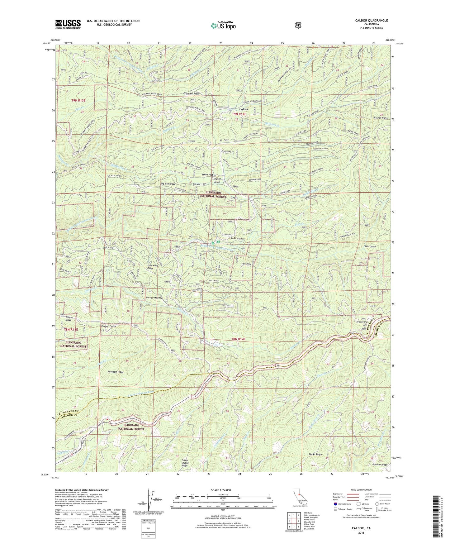
2021 topographic map quadrangle Caldor in the state of California. Scale: 1:24000. Based on the newly updated USGS 7.5' US Topo map series, this map is in the following counties: El Dorado, Amador. The map contains contour data, water features, and other items you are used to seeing on USGS maps, but also has updated roads and other features. This is the next generation of topographic maps. Printed on high-quality waterproof paper with UV fade-resistant inks.
Quads adjacent to this one:
West: Omo Ranch
Northwest: Sly Park
North: Old Iron Mountain
Northeast: Leek Spring Hill
East: Peddler Hill
Southeast: Garnet Hill
South: Devils Nose
Southwest: West Point
This map covers the same area as the classic USGS quad with code o38120e4.
Contains the following named places: Arbor Mine, Armstrong Hill, Armstrong Hill Lookout, Barney Meadow, Barney Ridge, Blacks Station, Caldor, Caldor Ranger Station, California Department of Forestry and Fire Protection Dew Drop Fire Station, Cooks Station, Cooks Station Ridge, Croft, Dew Drop, Dew Drop Fire Control Station, Doaks Ridge, Elkins Flat, Farnham Ridge, Five Corners, Fort Grizzly Site, Gold Note Ridge, Haase, Hams Station, John Schell Mine, Leoni Fire Tank, Louis Jordan Mine, McKinney Creek, Middle Dry Creek, Myers Fire Tank, North Steely Creek, Pi-Pi Campground, Pi-Pi Creek, Pi-Pi Valley, Plummer Ridge Forest Service Station, Prospect Creek, Red Gold Mine, Simpson Gulch, South Steely Creek, Spread Eagle Mine, Tie Cabin Fire Tank, Twin Gulch, ZIP Codes: 95636, 95666