
MyTopo
Plantation California US Topo Map
Couldn't load pickup availability
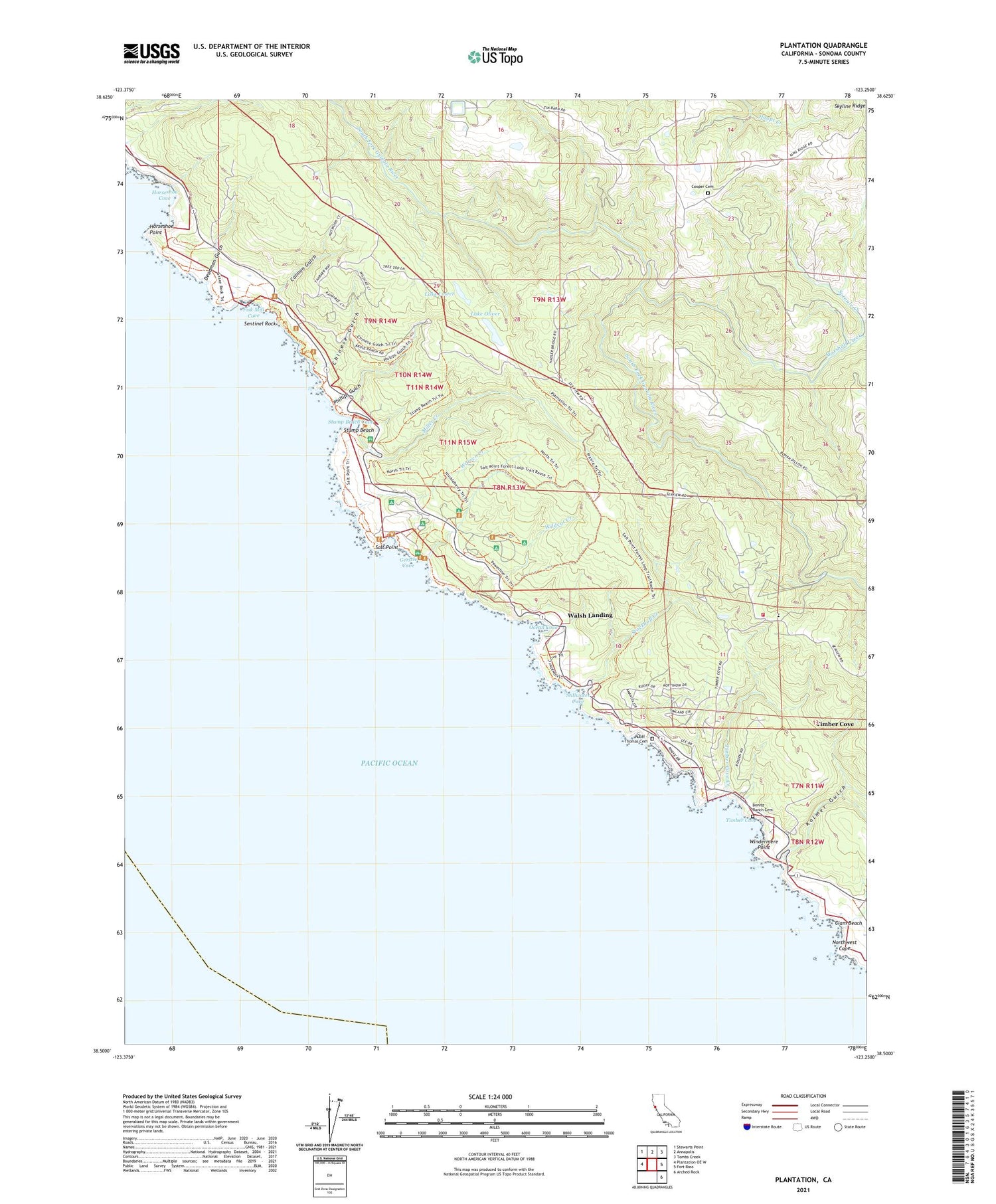
2021 topographic map quadrangle Plantation in the state of California. Scale: 1:24000. Based on the newly updated USGS 7.5' US Topo map series, this map is in the following counties: Sonoma. The map contains contour data, water features, and other items you are used to seeing on USGS maps, but also has updated roads and other features. This is the next generation of topographic maps. Printed on high-quality waterproof paper with UV fade-resistant inks.
Quads adjacent to this one:
West: Plantation OE W
Northwest: Stewarts Point
North: Annapolis
Northeast: Tombs Creek
East: Fort Ross
Southeast: Arched Rock
This map covers the same area as the classic USGS quad with code o38123e3.
Contains the following named places: Benitz Ranch Cemetery, Cannon Gulch, Chinese Gulch, Clam Beach, Cooper Cemetery, Deadman Gulch, Fisk Mill Cove, Fort Ross Elementary School, Fort Ross Schoolhouse, Gerstle Cove, Gerstle Cove Reserve, Gualala School, Hauser Bridge, Horseshoe Cove, Horseshoe Point, Kolmer Gulch, Kruse Ranch, Kruse Rhododendron State Natural Reserve, Lake Lower, Lake Oliver, Marshall Creek, Miller Creek, Moonrock Campground, Northwest Cape, Ocean Cove, Phillips Gulch, Plantation, Plantation School, Plantation Trail, Pygmy Forest, Ruoff - Thomas Cemetery, Salt Point, Salt Point State Park, Sentinel Rock, Sproule Creek, Stillwater Campground, Stillwater Cove, Stillwater Cove Regional Park, Stillwater Cove School, Stockhoff Creek, Stump Beach, Stump Beach Cove, Stump Beach Trail, Timber Cove, Timber Cove Census Designated Place, Timber Cove Creek, Timber Cove Fire Protection District, Walsh Landing, Warren Creek, Wildcat Creek, Windermere Point, Woodside Campground


