MyTopo
Tombs Creek California US Topo Map
Couldn't load pickup availability
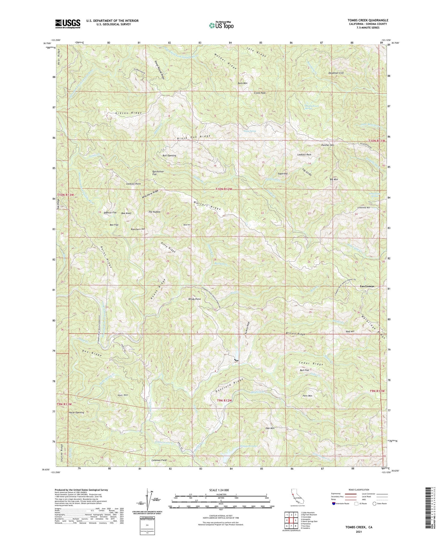
2021 topographic map quadrangle Tombs Creek in the state of California. Scale: 1:24000. Based on the newly updated USGS 7.5' US Topo map series, this map is in the following counties: Sonoma. The map contains contour data, water features, and other items you are used to seeing on USGS maps, but also has updated roads and other features. This is the next generation of topographic maps. Printed on high-quality waterproof paper with UV fade-resistant inks.
Quads adjacent to this one:
West: Annapolis
Northwest: Gube Mountain
North: Big Foot Mountain
Northeast: Cloverdale
East: Warm Springs Dam
Southeast: Cazadero
South: Fort Ross
Southwest: Plantation
This map covers the same area as the classic USGS quad with code o38123f2.
Contains the following named places: Allen Creek, Bald Hill, Bee Flat, Bee Knoll, Big Mountain, Black Oak Ridge, Britain Creek, Britain Ridge, Buck Mountain, Buckhorn Ridge, Bull Flat, Bull Opening, Burnt Ridge, Buzzard Creek, Cedar Creek, Cedar Ridge, Centennial Mountain, Cerri Cabin, Coleman Field, Cow Creek, Crane Peak, Danfield Creek, Danfield Ridge, Deadman Cliff, Dickson Ranch, Doe Ridge, Eddicut Flat, Elkhead Creek, Fern Mountain, Gibson Ridge, Hedgpeth Lake, Hedgpeth Ranch, Hillside Ranch 4420 Dam, Holt Hill, Horse Opening, House Creek, Johnny Brown Springs, Kitty Ridge, Las Lomas, Lee Nobles Ranch, Lookout Point, Lookout Rock, Lyle Ridge, Moffitt Ranch, Neese Ridge, Oak Mountain, Panther Den, Pepperwood Creek, Quicksilver Flat, Ranchero Hill, Red Hill, Sheep Repose Ridge, Skyline Ridge, Soda Spring Creek, Spanish Creek, Staley Spring, Sugarloaf, Sugarloaf Creek, The Girdle, The Nubble, Tombs Creek, Walters Ridge, Wether Ridge, Wickersham Ranch, Wild Horse Ridge, Windy Point, Wolf Creek, Yellowjacket Springs, ZIP Code: 95421