MyTopo
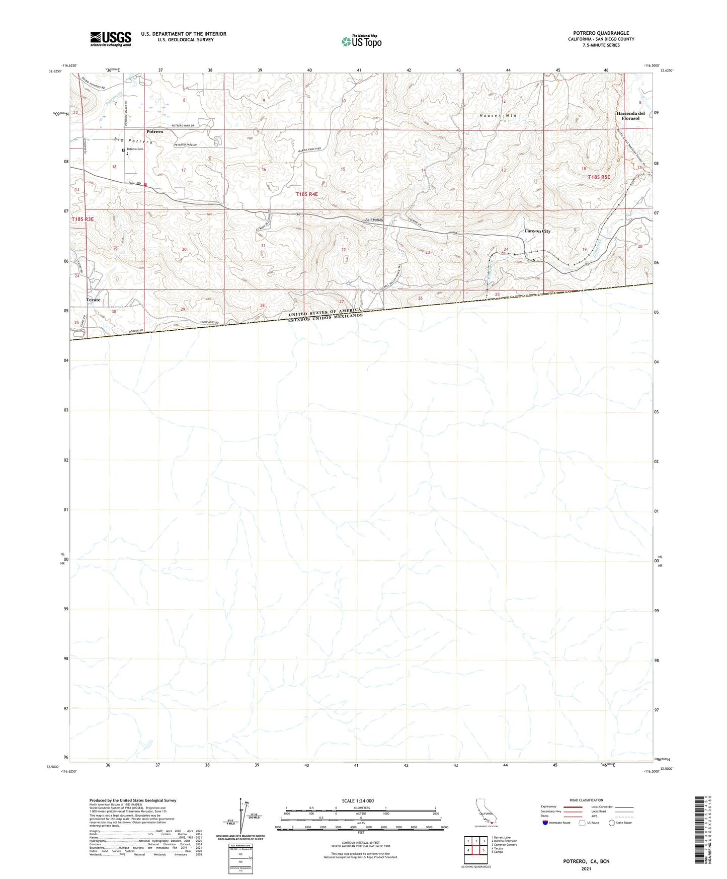
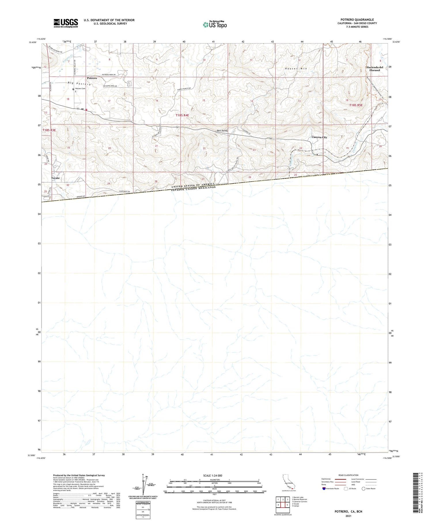
Potrero California US Topo Map
Couldn't load pickup availability
2021 topographic map quadrangle Potrero in the state of California. Scale: 1:24000. Based on the newly updated USGS 7.5' US Topo map series, this map is in the following counties: San Diego. The map contains contour data, water features, and other items you are used to seeing on USGS maps, but also has updated roads and other features. This is the next generation of topographic maps. Printed on high-quality waterproof paper with UV fade-resistant inks.
Quads adjacent to this one:
West: Tecate
Northwest: Barrett Lake
North: Morena Reservoir
Northeast: Cameron Corners
East: Campo
This map covers the same area as the classic USGS quad with code o32116e5.
Contains the following named places: Bell Valley, CAL FIRE Potrero Fire Station 39, California Department of Forestry and Fire Protection District Station 31, Campo Creek, Canyon City, Division, Hacienda del Florasol, Hauser Mountain, Potrero, Potrero Cemetery, Potrero Census Designated Place, Potrero County Park, Potrero Elementary School, Potrero Post Office, ZIP Code: 91980