
MyTopo
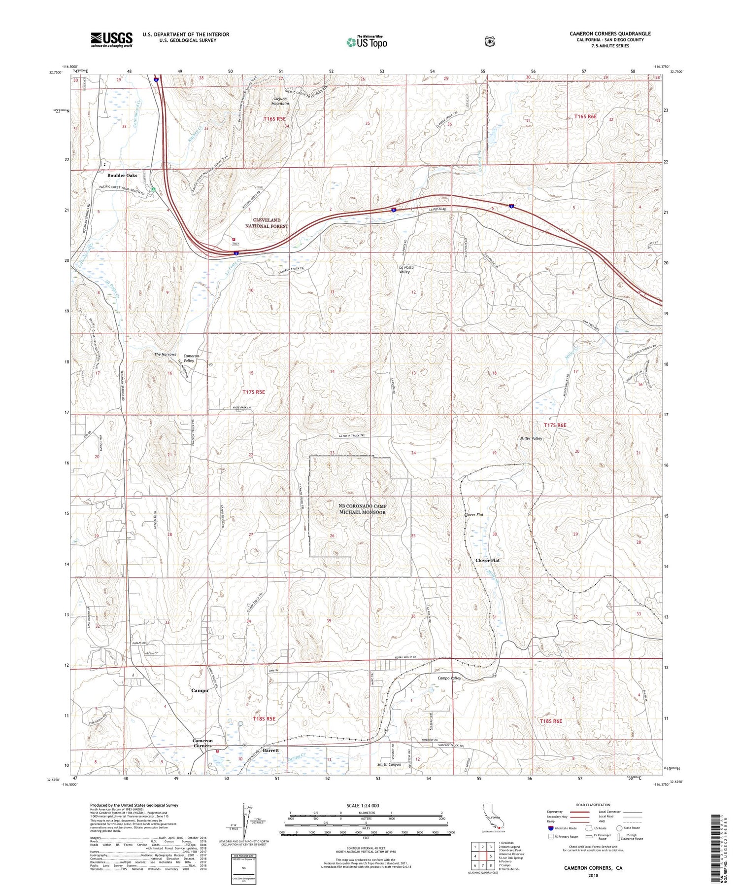
Cameron Corners California US Topo Map
Couldn't load pickup availability
Also explore the Cameron Corners Forest Service Topo of this same quad for updated USFS data
2021 topographic map quadrangle Cameron Corners in the state of California. Scale: 1:24000. Based on the newly updated USGS 7.5' US Topo map series, this map is in the following counties: San Diego. The map contains contour data, water features, and other items you are used to seeing on USGS maps, but also has updated roads and other features. This is the next generation of topographic maps. Printed on high-quality waterproof paper with UV fade-resistant inks.
Quads adjacent to this one:
West: Morena Reservoir
Northwest: Descanso
North: Mount Laguna
Northeast: Sombrero Peak
East: Live Oak Springs
Southeast: Tierra del Sol
South: Campo
Southwest: Potrero
This map covers the same area as the classic USGS quad with code o32116f4.
Contains the following named places: Barrett, Boulder Oaks, Boulder Oaks Campground, Boulder Oaks Elementary School, Boulder Oaks Trailhead, Cameron Corners, Cameron Corners Pit, Cameron Fire Station, Cameron Guard Station, Cameron Valley, Campo Branch San Diego County Library, Campo Census Designated Place, Campo Forest Fire Station, Clover Flat, Clover Flat Pit, Coogan Ranch, Four Eagles Sand and Gravel Quarry, Kitchen Creek, La Posta Creek, La Posta Indian Reservation, La Posta Microwave Station, La Posta Ranch, La Posta Service, La Posta Valley, Miller Creek, Miller Ranch, Miller Valley, Mountain Empire Division, Mountain Empire School, San Diego County Fire Authority Fire Station 40 - Campo, Smith Canyon, The Narrows, United States Forest Service Cleveland National Forest Station Cottonwood, ZIP Codes: 91906, 91962


