MyTopo
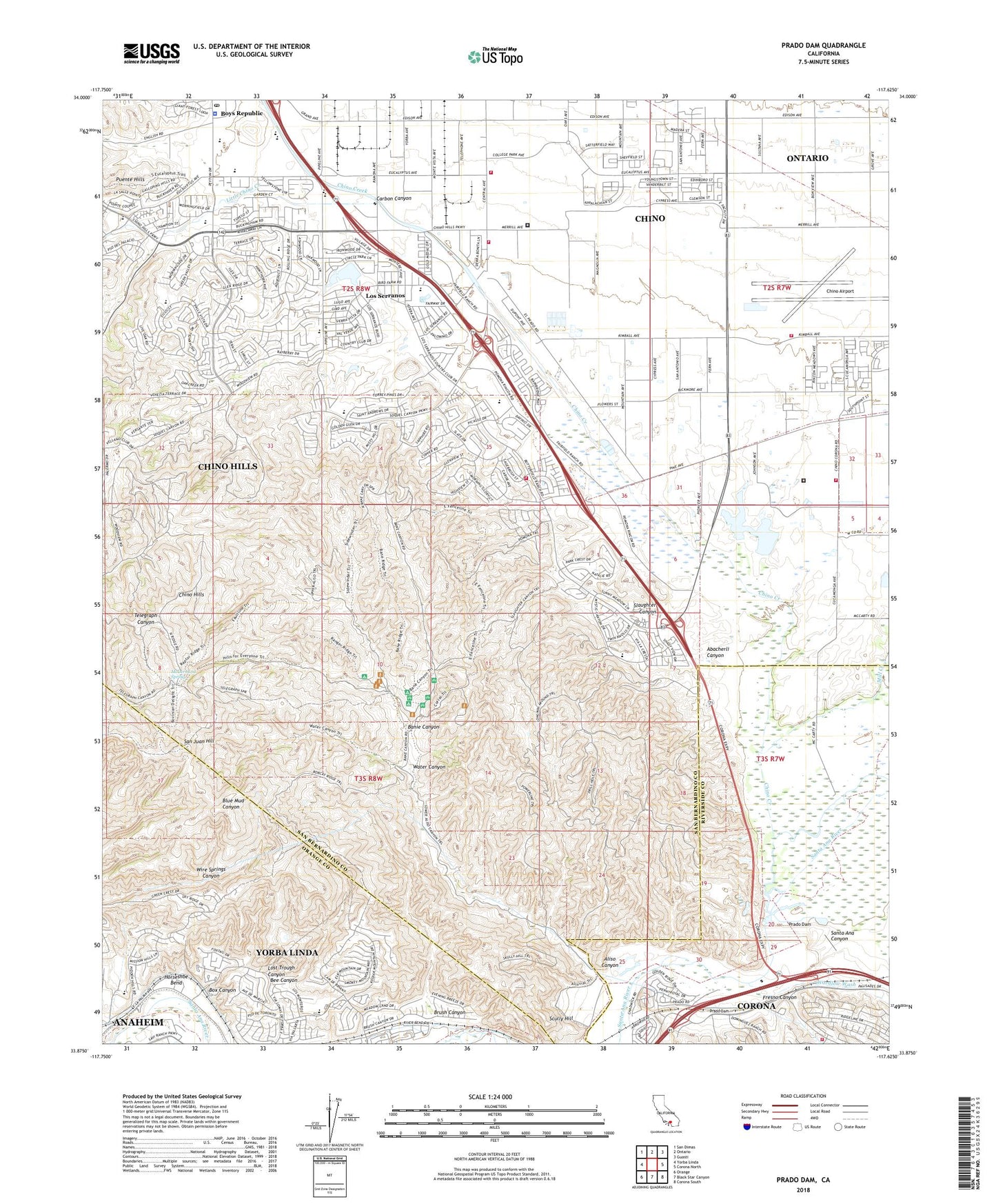
Prado Dam California US Topo Map
Couldn't load pickup availability
2022 topographic map quadrangle Prado Dam in the state of California. Scale: 1:24000. Based on the newly updated USGS 7.5' US Topo map series, this map is in the following counties: San Bernardino, Orange, Riverside. The map contains contour data, water features, and other items you are used to seeing on USGS maps, but also has updated roads and other features. This is the next generation of topographic maps. Printed on high-quality waterproof paper with UV fade-resistant inks.
Quads adjacent to this one:
West: Yorba Linda
Northwest: San Dimas
North: Ontario
Northeast: Guasti
East: Corona North
Southeast: Corona South
South: Black Star Canyon
Southwest: Orange
This map covers the same area as the classic USGS quad with code o33117h6.
Contains the following named places: Abacherli Canyon, Aliso Canyon, Banie Canyon, Box Canyon, Boys Republic, Boys Republic High School, Brush Canyon, Brush Canyon Park, C W Farm, CAL FIRE Chino Hills Fire Station, California Institution for Men, California Institution for Men Fire Department, California Institution for Women, California Institution for Women Fire Department, Camp Ayers, Canyon Hills Shopping Center, Carbon Canyon, Chaparral Elementary School, Chapel Creek Christian School, Childrens World Learning Center, Chino Airport, Chino Creek, Chino Dairy, Chino Downs, Chino Hills, Chino Hills High School, Chino Hills Marketplace Shopping Center, Chino Hills Plaza Shopping Center, Chino Hills Police Department, Chino Hills Post Office, Chino Hills State Park, Chino Valley Fire District Station 62, Chino Valley Fire District Station 63, Chino Valley Independent Fire Protection District Training Facility, City of Chino, City of Chino Hills, Coal Canyon, Coal Creek, Corona Fire Department Station 5, El Prado Golf Course, El Prado Regional Park, El Rincon, Fresno Canyon, Gerald F Litel Elementary School, Glenmeade Elementary School, Gypsum, Horseshoe Bend, KTSJ-AM (Pomona), Lake los Serranos, Little Chino Creek, Los Serranos, Los Serranos Country Club, Los Serranos Elementary School, Lost Trough Canyon, Loving Savior Lutheran School, Marquez Dairy, McDermont Ranch, McDermont Spring, Mill Creek, Montessori School of Chino Hills, New Earth Nurseries, Prado Conservation Camp, Prado Dam, Prado Dam Recreational Dog Activities Area, Prado Flood Control Basin, Prado Tiro Shooting Range, Rancho Cielito 808 Dam, Rancho Santa Ana Botanic Gardens, Robert O Townsend Junior High School, Rocha Dairy, Rolling M Ranch, Ruben S Ayala High School, Ruben S Ayala Park, San Juan Hill, Santa Ana Del Chino, Scully Hill, Slaughter Canyon, Stark Youth Training School, Sultana Dairy, Victory Christian Academy, Wardlow Wash, Water Canyon, Water Canyon Natural Preserve, Wire Springs Canyon, Yorba Slaughter Adobe, ZIP Codes: 91708, 91709, 92887