MyTopo
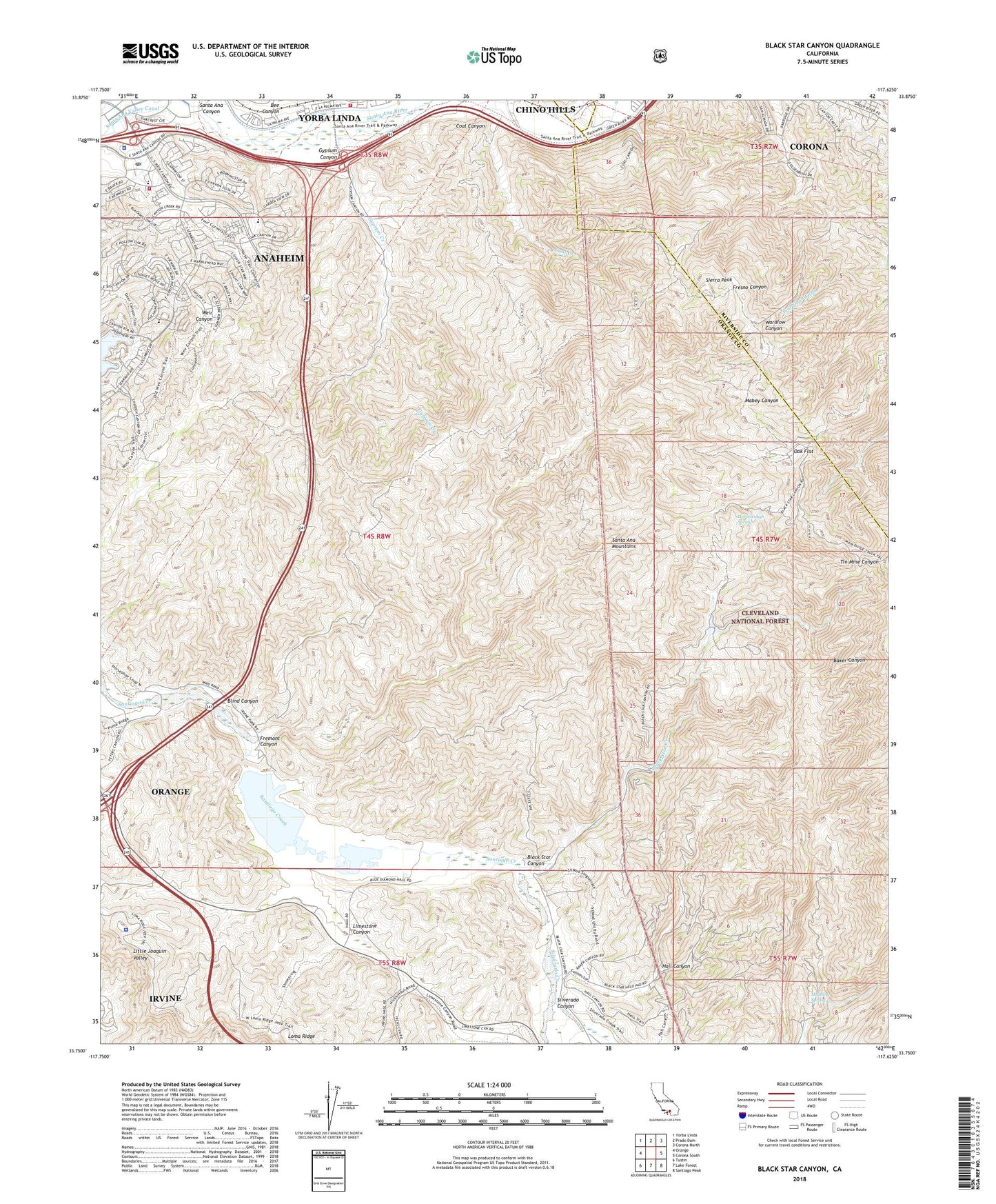
Black Star Canyon California US Topo Map
Couldn't load pickup availability
Also explore the Black Star Canyon Forest Service Topo of this same quad for updated USFS data
2022 topographic map quadrangle Black Star Canyon in the state of California. Scale: 1:24000. Based on the newly updated USGS 7.5' US Topo map series, this map is in the following counties: Orange, Riverside, San Bernardino. The map contains contour data, water features, and other items you are used to seeing on USGS maps, but also has updated roads and other features. This is the next generation of topographic maps. Printed on high-quality waterproof paper with UV fade-resistant inks.
Quads adjacent to this one:
West: Orange
Northwest: Yorba Linda
North: Prado Dam
Northeast: Corona North
East: Corona South
Southeast: Santiago Peak
South: Lake Forest
Southwest: Tustin
This map covers the same area as the classic USGS quad with code o33117g6.
Contains the following named places: Anaheim Canyon Post Office, Anaheim Fire Department Station 10, Anaheim Police Department, Baker Canyon, Bee Canyon, Beeks Place, Black Star Canyon, Black Star Coal Mine, Black Star Creek, Blind Canyon, Carbondale, Childrens Montessori Center, Claymont Clay Mine, Fremont Canyon, Gypsum Canyon, Gypsum Creek, Hall Canyon, Harvill Number 1 798-002 Dam, Harvill Number 2 798 Dam, Hidden Ranch, Horsetrough Spring, Irvine Lake, Irvine Lake Park, Irvine Park, KSRT-AM (Orange), Limestone Canyon, Lomas de Santiago, Martin Luther King Ambulatory Surgical Center, Mustang Spring, MWD Santiago Lateral, Oak Flat, Orange County Fire Authority Station 53, Orange County Sheriffs Department, Santa Ana Valley Canal, Santiago Coal Mine, Santiago Creek 75 Dam, Santiago Dam, Santiago Reservoir, Sierra Peak, Sierra Peak Guard Station, Silverado Canyon, Silverado Creek, Sycamore Park, Walnut Canyon Reservoir, ZIP Code: 92808