MyTopo
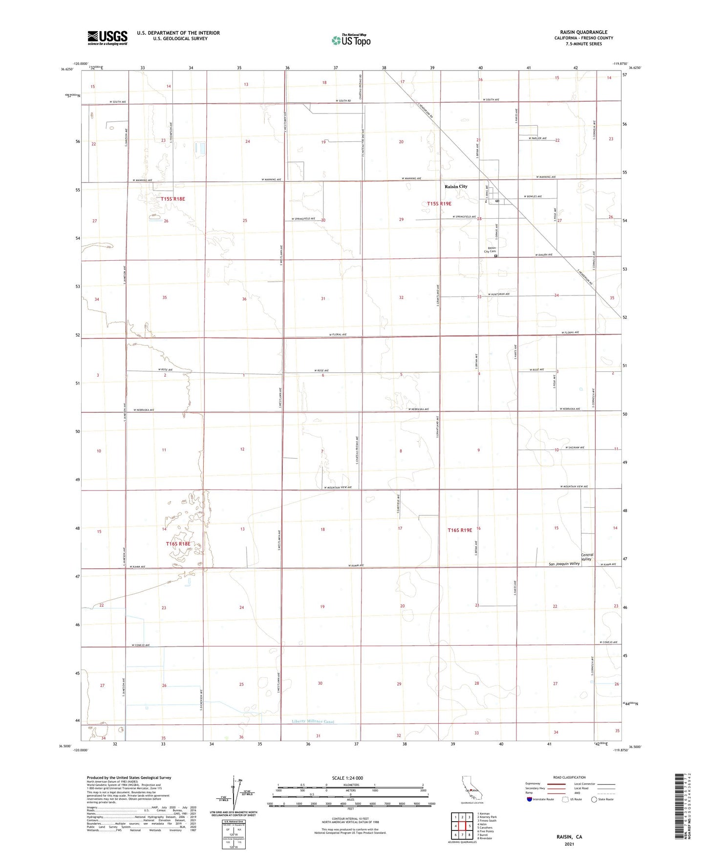
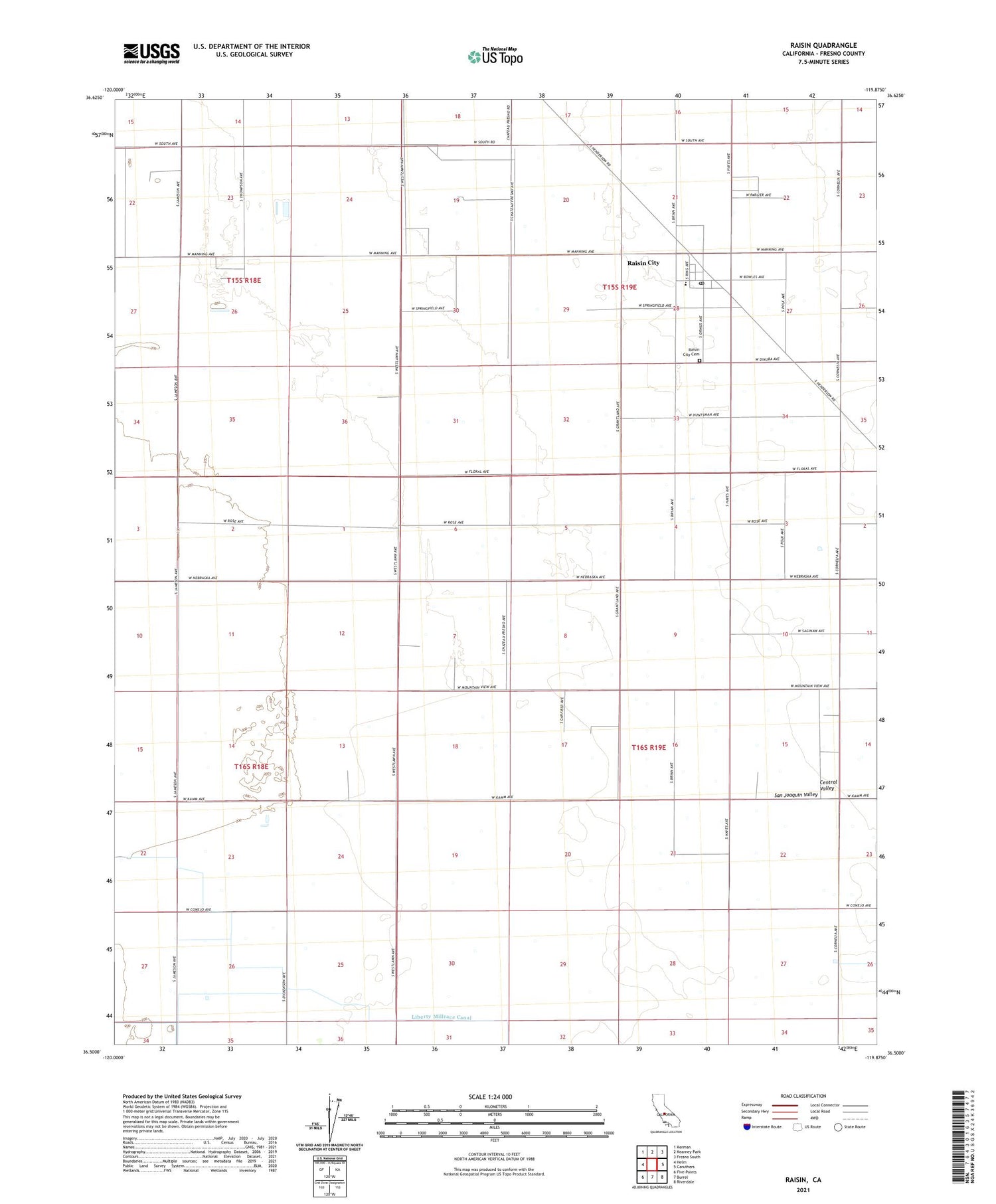
Raisin California US Topo Map
Couldn't load pickup availability
2021 topographic map quadrangle Raisin in the state of California. Scale: 1:24000. Based on the newly updated USGS 7.5' US Topo map series, this map is in the following counties: Fresno. The map contains contour data, water features, and other items you are used to seeing on USGS maps, but also has updated roads and other features. This is the next generation of topographic maps. Printed on high-quality waterproof paper with UV fade-resistant inks.
Quads adjacent to this one:
West: Helm
Northwest: Kerman
North: Kearney Park
Northeast: Fresno South
East: Caruthers
Southeast: Riverdale
South: Burrel
Southwest: Five Points
This map covers the same area as the classic USGS quad with code o36119e8.
Contains the following named places: A and M Farms Dairy, Caruthers Substation, Caruthers-Raisin City Division, Liberty Millrace, Raisin City, Raisin City Cemetery, Raisin City Census Designated Place, Raisin City Elementary School, Raisin City Post Office, Raisin Post Office, Sweet Haven Dairy, ZIP Code: 93652