MyTopo
Kerman California US Topo Map
Couldn't load pickup availability
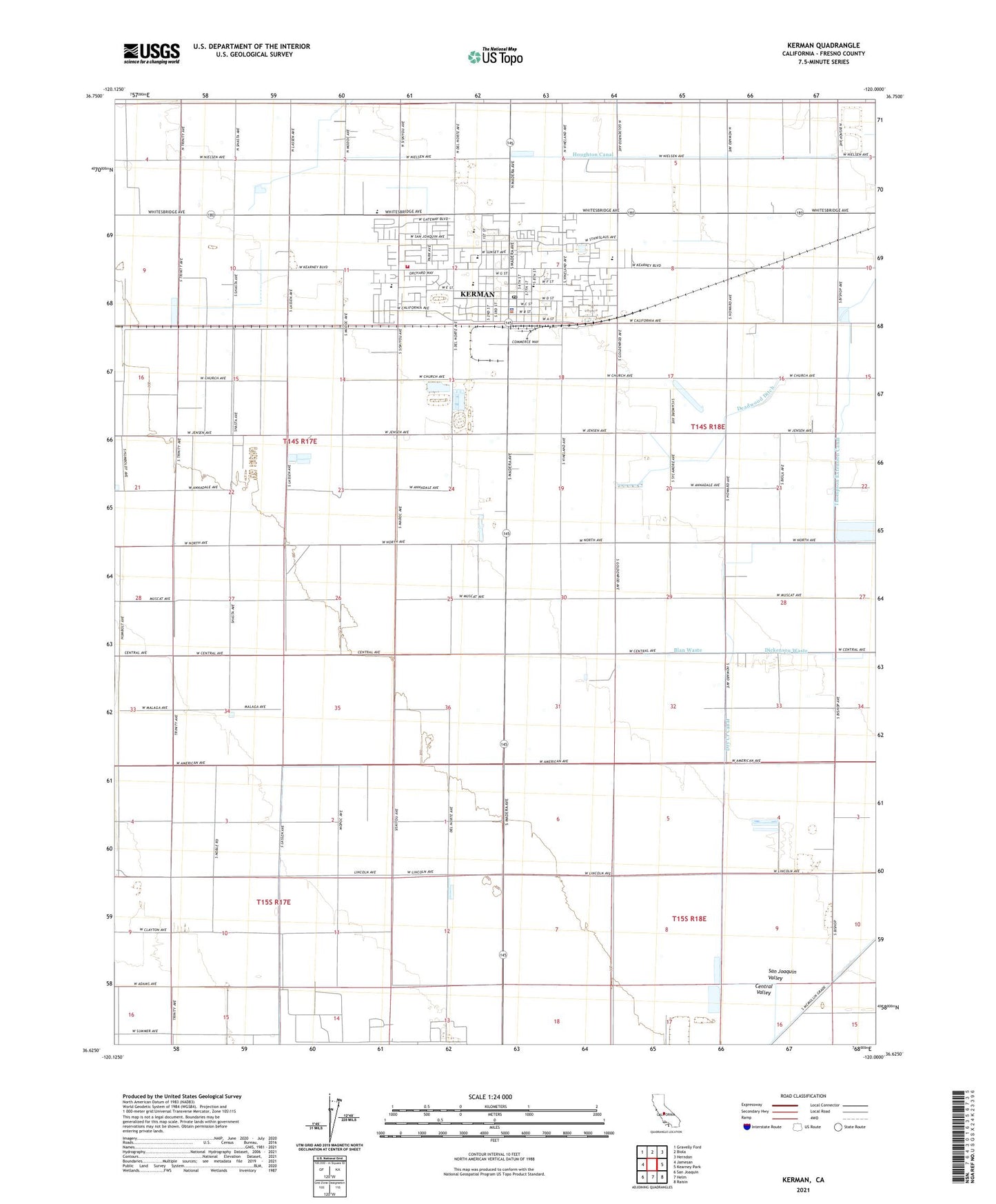
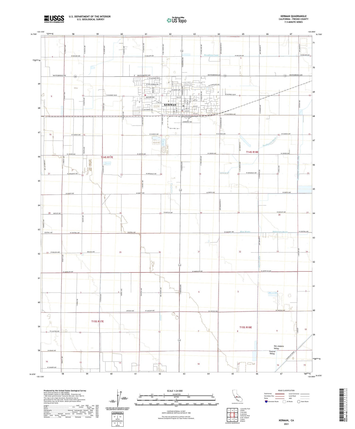
2021 topographic map quadrangle Kerman in the state of California. Scale: 1:24000. Based on the newly updated USGS 7.5' US Topo map series, this map is in the following counties: Fresno. The map contains contour data, water features, and other items you are used to seeing on USGS maps, but also has updated roads and other features. This is the next generation of topographic maps. Printed on high-quality waterproof paper with UV fade-resistant inks.
Quads adjacent to this one:
West: Jamesan
Northwest: Gravelly Ford
North: Biola
Northeast: Herndon
East: Kearney Park
Southeast: Raisin
South: Helm
Southwest: San Joaquin
This map covers the same area as the classic USGS quad with code o36120f1.
Contains the following named places: Blan Waste, Bland Field, City of Kerman, Deadwood Ditch, Green Valley Dairy, Hillview Dairy Farm, Kerman, Kerman Adult School, Kerman City Hall, Kerman Community Center, Kerman Division, Kerman High School, Kerman Middle School, Kerman Plaza Shopping Center, Kerman Police Department, Kerman Post Office, Kerman Shopping Center, Kerman Substation, Kerman-Floyd Elementary School, KMJ-AM (Fresno), KTAA-FM (Kerman), North Central Fire Protection District Station 21 Headquarters, Nova High School, Raisin City Oil Field, Rolinda Church School, Rugg, Thompson Extension Canal, Valley Shopping Center, Wootten Park, ZIP Code: 93630