MyTopo
Rocklin California US Topo Map
Couldn't load pickup availability
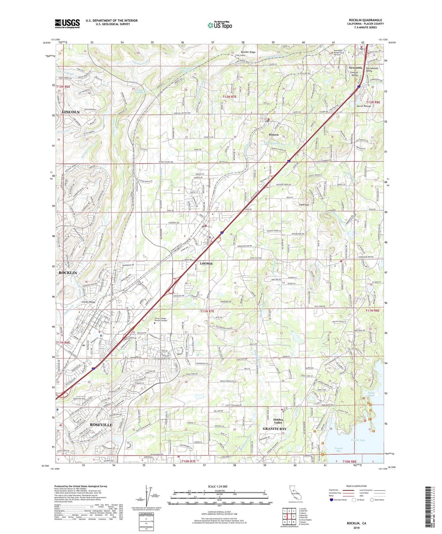
2021 topographic map quadrangle Rocklin in the state of California. Scale: 1:24000. Based on the newly updated USGS 7.5' US Topo map series, this map is in the following counties: Placer. The map contains contour data, water features, and other items you are used to seeing on USGS maps, but also has updated roads and other features. This is the next generation of topographic maps. Printed on high-quality waterproof paper with UV fade-resistant inks.
Quads adjacent to this one:
West: Roseville
Northwest: Lincoln
North: Gold Hill
Northeast: Auburn
East: Pilot Hill
Southeast: Clarksville
South: Folsom
Southwest: Citrus Heights
This map covers the same area as the classic USGS quad with code o38121g2.
Contains the following named places: Alabama Mine, Antelope Canal, Barton Canal, Baughman Canal, Beeks Bight, Ben Franklin Canal, Boulder Ridge, California Highway Patrol Valley Division - Auburn, Caperton Reservoir, Carner Hall, Center For Sierra Nevada Studies, Church of Jesus Christ of Latter Day Saints, City of Rocklin, Clark Tunnel, Clover Valley, Clover Valley 1030-005 Dam, Clover Valley Creek, Clover Valley Park, Clover Valley Reservoir, Del Oro High School, Dietrich Theatre, Dotons Point, First Assembly of God Church, First United Methodist Church, Folsom Dikes 1 2 and 3 Dam, Franklin Elementary School, Granite Bay, Granite Bay Census Designated Place, Griffith Quarry Historic Park, Hidden Valley, Highway Forty Mine, Holsclaws Stol Strip Stolport, Indian Creek Country Club, Japanese School, Johnson-Springview Park, Kokila 320 Dam, KPTO-AM (Citrus Heights), Landmark Missionary Baptist Church, Lee Hall, Lighthouse Christian Center, Loomis, Loomis Basin Regional Park, Loomis Branch Auburn-Placer County Library, Loomis Elementary School, Loomis Post Office, Mammoth Reservoir 1030-006 Dam, Mary Len Mine, Morgan Canal, Mount Saint Joseph Seminary, Newcastle, Newcastle Census Designated Place, Newcastle Elementary School, Newcastle Post Office, Newcastle Rocklin Gold Hill Cemetery, Newcastle United Methodist Church, Old Timers Park, Penryn, Penryn Canal, Penryn Census Designated Place, Penryn Elementary School, Penryn Post Office, Perry Canal, Placer Church, Placer County Fire Department Station 16 / South Placer Fire Department Station 4, Placer County Fire Department Station 19 / South Placer Fire Department Station 3, Placer County Fire Department Station 28 / Loomis Fire Protection District Station 1, Placer County Fire Department Station 29 / Loomis Fire Protection District Station 2, Placer County Fire Department Station 38 / Penryn Fire Protection District, Placer County Fire Department Station 41 / Newcastle Fire Protection District, Placer County Sheriff's Office Loomis Substation, Placer Elementary School, Quarry Park, Red Ravine Canal, Rocklin, Rocklin Branch Auburn-Placer County Library, Rocklin Cemetery, Rocklin Division, Rocklin Elementary School, Rocklin Fire Department Station 23, Rocklin Police Department, Rocklin Post Office, Roseville Fire Department Station 6, Roseville Reservoir, Saint Maria Goretti Academy, Sewell Hall, Sicily Mine, Sierra College - Rocklin Campus, Sierra Meadows Park, Spring View Middle School, Sugarloaf, Sugarloaf Canal, Sunset Oaks Country Club, Sutter Roseville Medical Center, Town of Loomis, Turner Canal, Walker Hall, Weaver Hall, William M Winstead Memorial Library, Winstead Center, Woodside Park, ZIP Codes: 95650, 95663, 95677