MyTopo
Rogers Lake South California US Topo Map
Couldn't load pickup availability
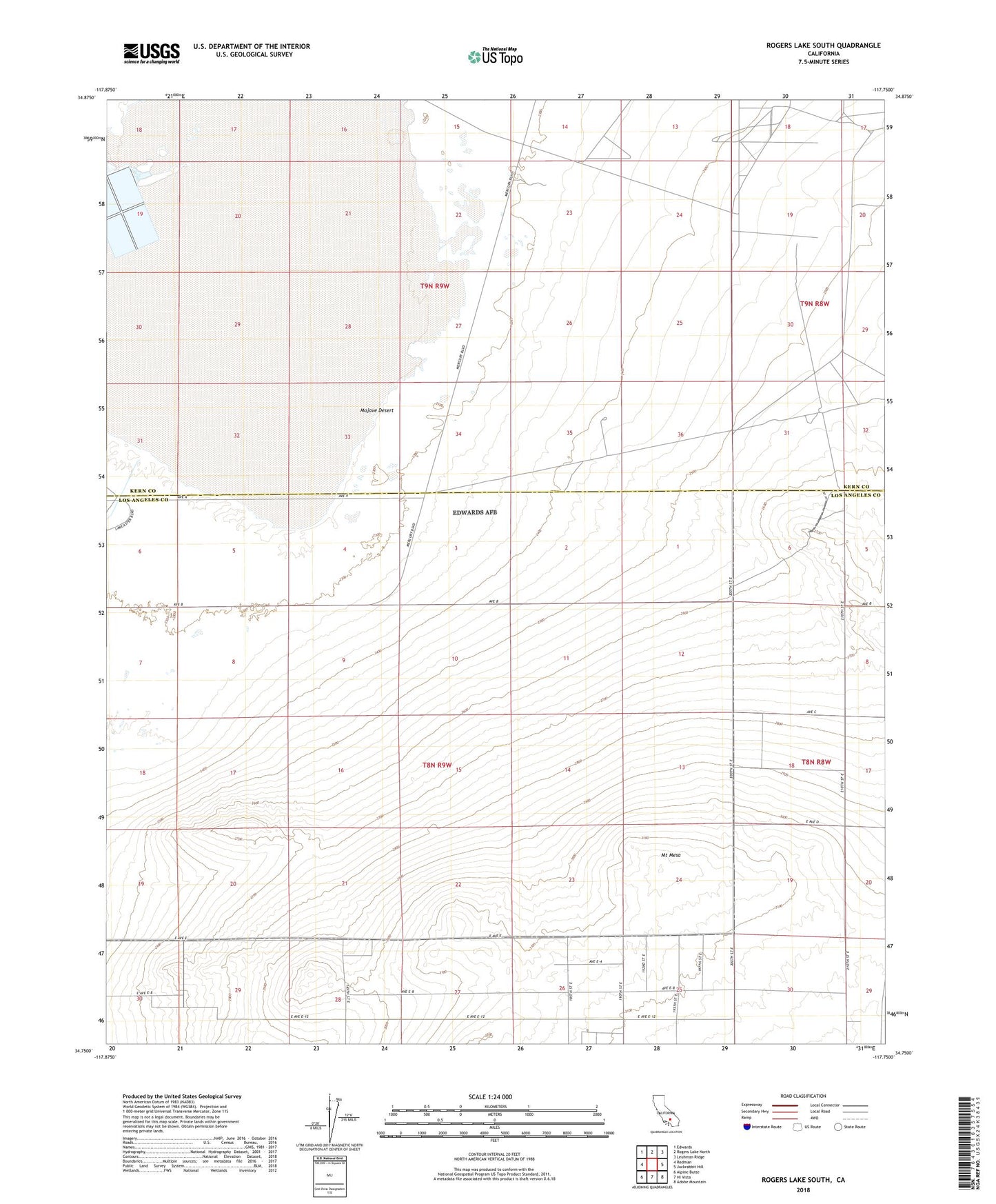
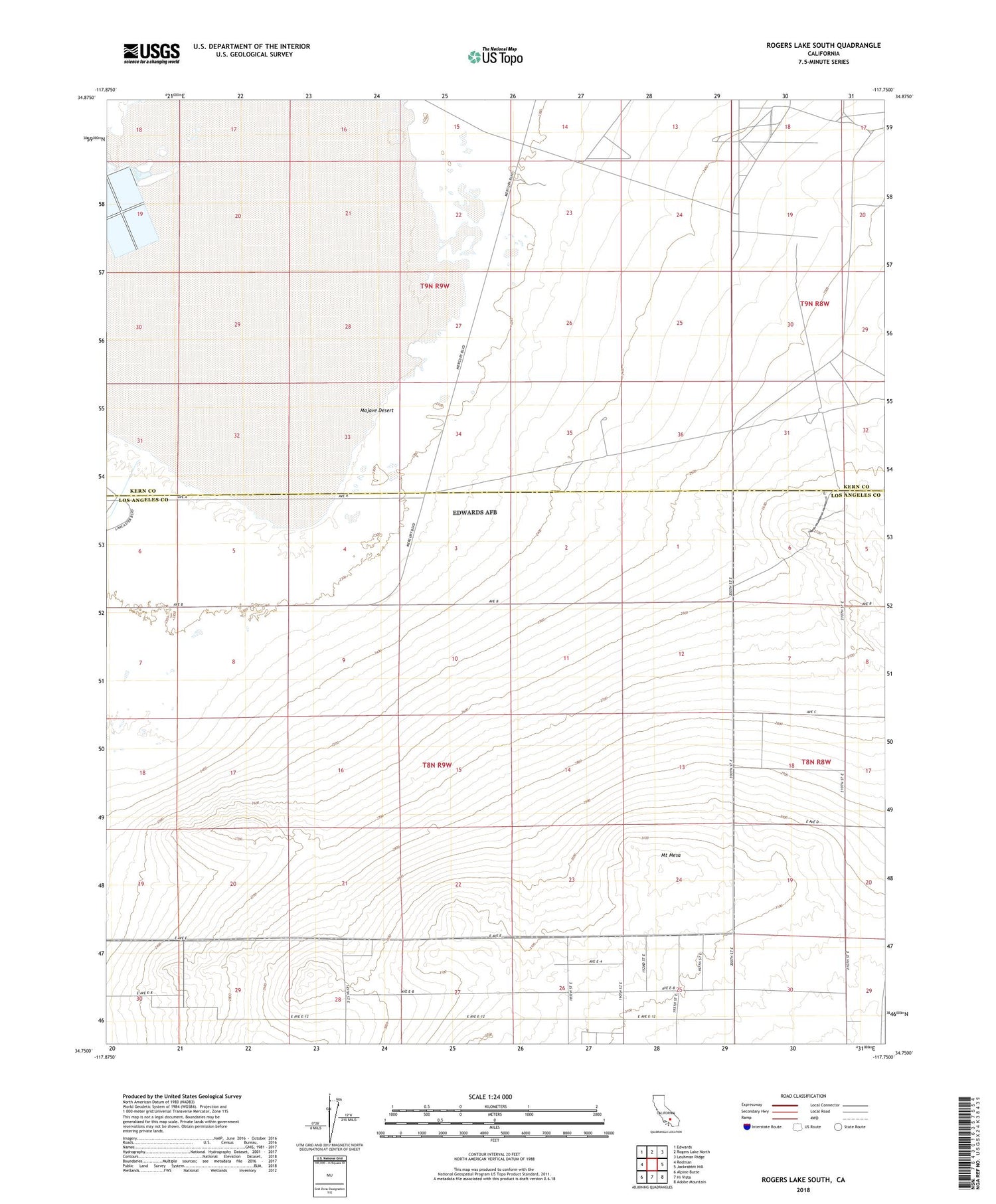
2022 topographic map quadrangle Rogers Lake South in the state of California. Scale: 1:24000. Based on the newly updated USGS 7.5' US Topo map series, this map is in the following counties: Los Angeles, Kern. The map contains contour data, water features, and other items you are used to seeing on USGS maps, but also has updated roads and other features. This is the next generation of topographic maps. Printed on high-quality waterproof paper with UV fade-resistant inks.
Quads adjacent to this one:
West: Redman
Northwest: Edwards
North: Rogers Lake North
Northeast: Leuhman Ridge
East: Jackrabbit Hill
Southeast: Adobe Mountain
South: Hi Vista
Southwest: Alpine Butte
This map covers the same area as the classic USGS quad with code o34117g7.
Contains the following named places: Mount Mesa, Mount Mesa Sanitarium