MyTopo
Edwards California US Topo Map
Couldn't load pickup availability
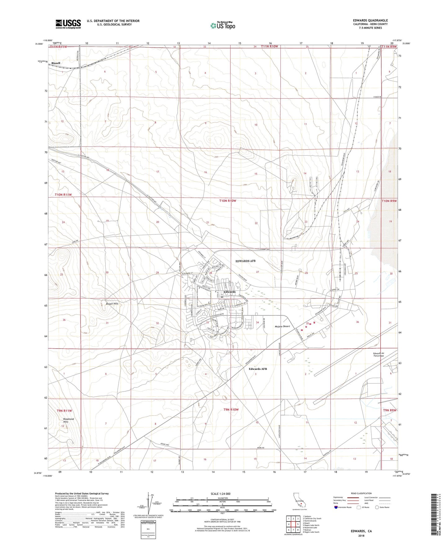
2022 topographic map quadrangle Edwards in the state of California. Scale: 1:24000. Based on the newly updated USGS 7.5' US Topo map series, this map is in the following counties: Kern. The map contains contour data, water features, and other items you are used to seeing on USGS maps, but also has updated roads and other features. This is the next generation of topographic maps. Printed on high-quality waterproof paper with UV fade-resistant inks.
Quads adjacent to this one:
West: Bissell
Northwest: Sanborn
North: California City South
Northeast: North Edwards
East: Rogers Lake North
Southeast: Rogers Lake South
South: Redman
Southwest: Rosamond Lake
This map covers the same area as the classic USGS quad with code o34117h8.
Contains the following named places: Armstrong Flight Research Center, Bailey Avenue Elementary School, Buckner Well, Desert High School, Edwards, Edwards Air Force Base, Edwards Air Force Base Ambulance Service, Edwards Air Force Base Census Designated Place, Edwards Air Force Base Fire Protection Division Station 1, Edwards Air Force Base Fire Protection Division Station 2, Edwards Air Force Base Fire Protection Division Station 3, Edwards Air Force Base Fire Protection Division Station 5, Edwards Post Office, Fluhr, Forbes Avenue Elementary School, Irving L Branch Elementary School, Muroc Golf Course, Onizuka Park, Payne Avenue Middle School, West Fly-By Tower, Wherry Housing, ZIP Code: 93524