MyTopo
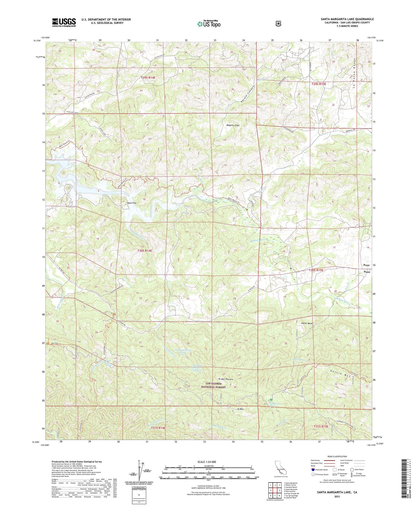
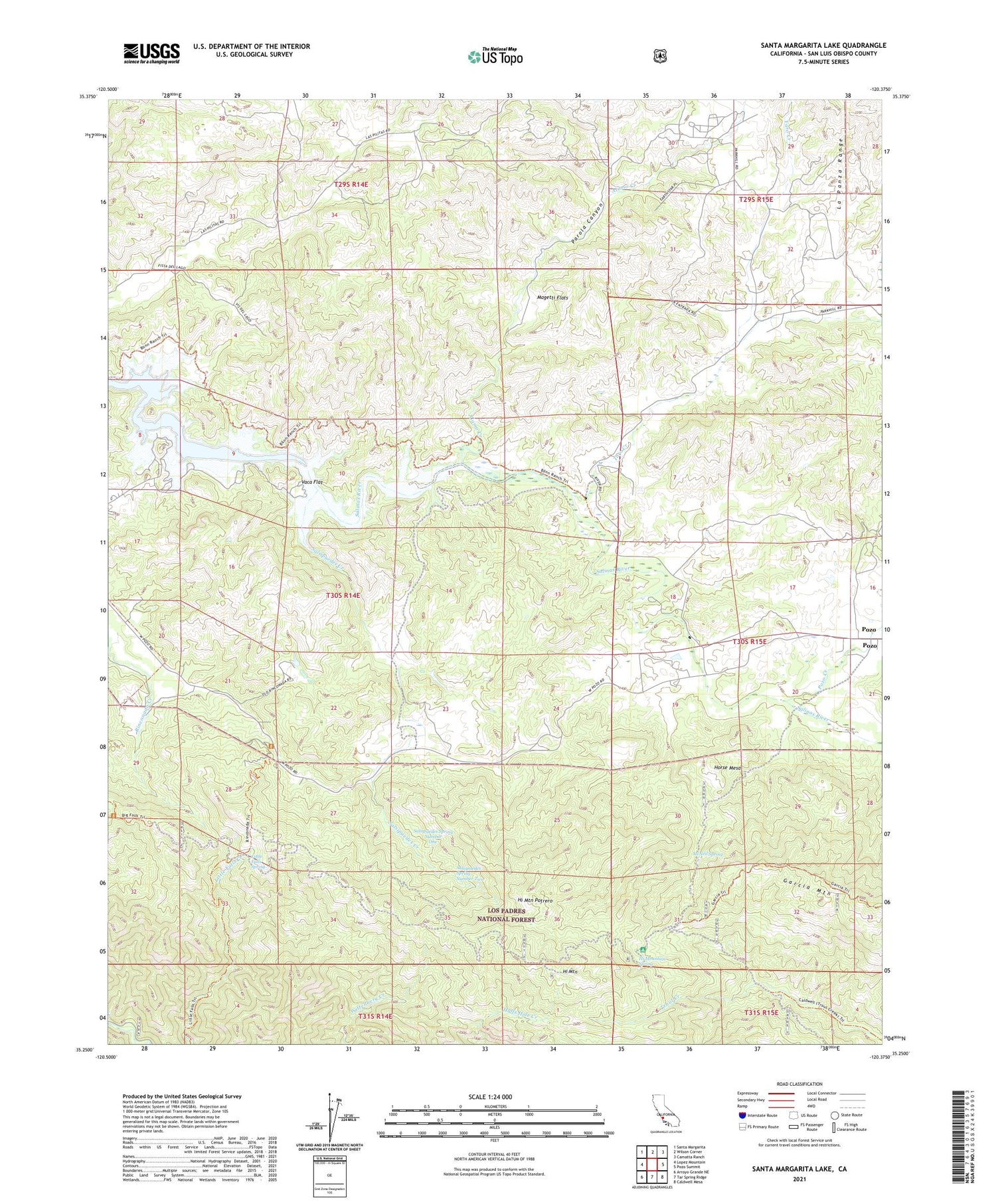
Santa Margarita Lake California US Topo Map
Couldn't load pickup availability
Also explore the Santa Margarita Lake Forest Service Topo of this same quad for updated USFS data
2021 topographic map quadrangle Santa Margarita Lake in the state of California. Scale: 1:24000. Based on the newly updated USGS 7.5' US Topo map series, this map is in the following counties: San Luis Obispo. The map contains contour data, water features, and other items you are used to seeing on USGS maps, but also has updated roads and other features. This is the next generation of topographic maps. Printed on high-quality waterproof paper with UV fade-resistant inks.
Quads adjacent to this one:
West: Lopez Mountain
Northwest: Santa Margarita
North: Wilson Corner
Northeast: Camatta Ranch
East: Pozo Summit
Southeast: Caldwell Mesa
South: Tar Spring Ridge
Southwest: Arroyo Grande NE
This map covers the same area as the classic USGS quad with code o35120c4.
Contains the following named places: Alamo Creek, El Dorado School, Hi Mountain, Hi Mountain Campground, Hi Mountain Potrero, Hi Mountain Spring, Horse Mesa, Little Falls Spring, Magetti Flats, McNeil Spring, Mercury Belle Mine, New District School, Parola Canyon, Pippin Corner, Pozo, Pozo Creek, Rinconada Mine, Salsipuedes Creek, Salsipuedes Spring Number One, Salsipuedes Spring Number Two, Santa Margarita Lake, Toro Creek, Vaca Flat, Yaro Creek