MyTopo
Santa Margarita California US Topo Map
Couldn't load pickup availability
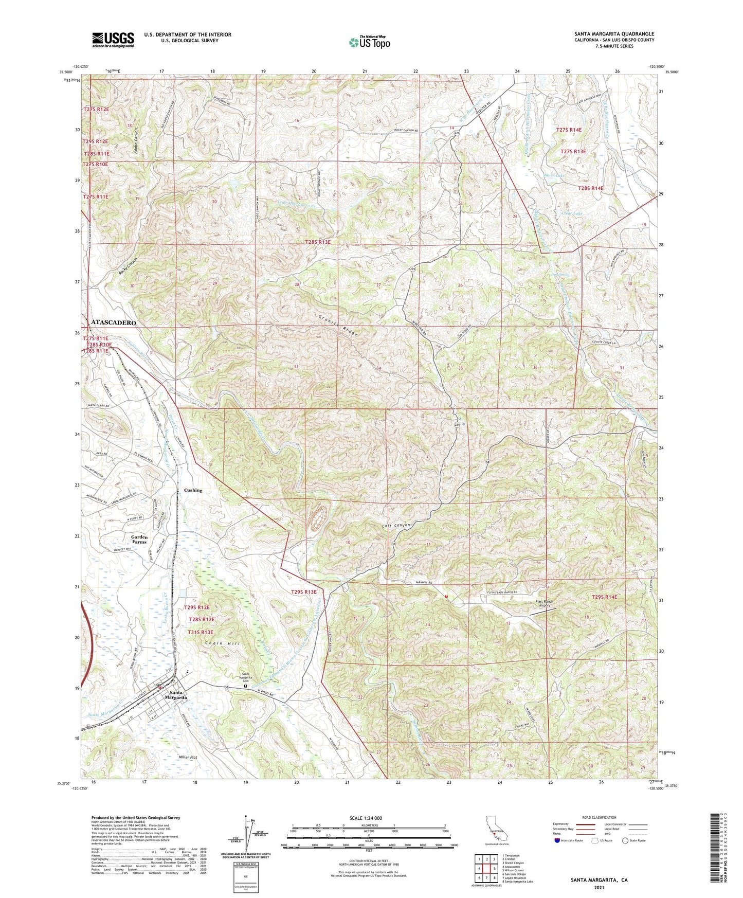
2021 topographic map quadrangle Santa Margarita in the state of California. Scale: 1:24000. Based on the newly updated USGS 7.5' US Topo map series, this map is in the following counties: San Luis Obispo. The map contains contour data, water features, and other items you are used to seeing on USGS maps, but also has updated roads and other features. This is the next generation of topographic maps. Printed on high-quality waterproof paper with UV fade-resistant inks.
Quads adjacent to this one:
West: Atascadero
Northwest: Templeton
North: Creston
Northeast: Shedd Canyon
East: Wilson Corner
Southeast: Santa Margarita Lake
South: Lopez Mountain
Southwest: San Luis Obispo
This map covers the same area as the classic USGS quad with code o35120d5.
Contains the following named places: Adobe Canyon, Asistencia de Santa Margarita, Beck Lake, Calf Canyon, California Department of Forestry and Fire Protection Station 40 Parkhill, Chalk Hill, Clear Lake, Cushing, Eaglet, Garden Farms, Garden Farms Bible Chapel, Garden Farms Census Designated Place, Granite Ridge, Happy Valley Ranch, Hart Ranch Airport, Holy Angels Catholic Church, Iron Spring, Kaiser - Santa Margarita Quarry, Moreno Creek, Onemile Bridge, Parkhill School, Rocky Canyon, Santa Margarita, Santa Margarita Branch San Luis Obispo City-County Library, Santa Margarita Cemetery, Santa Margarita Census Designated Place, Santa Margarita Community Church, Santa Margarita Community Park, Santa Margarita Creek, Santa Margarita Elementary School, Santa Margarita Fire Control Station, Santa Margarita Post Office, Santa Margarita Ranch, Santa Margarita Volunteer Fire Department, Silver Lake, Trout Creek, Yerba Buena Creek