
MyTopo
Shinn Mountain California US Topo Map
Couldn't load pickup availability
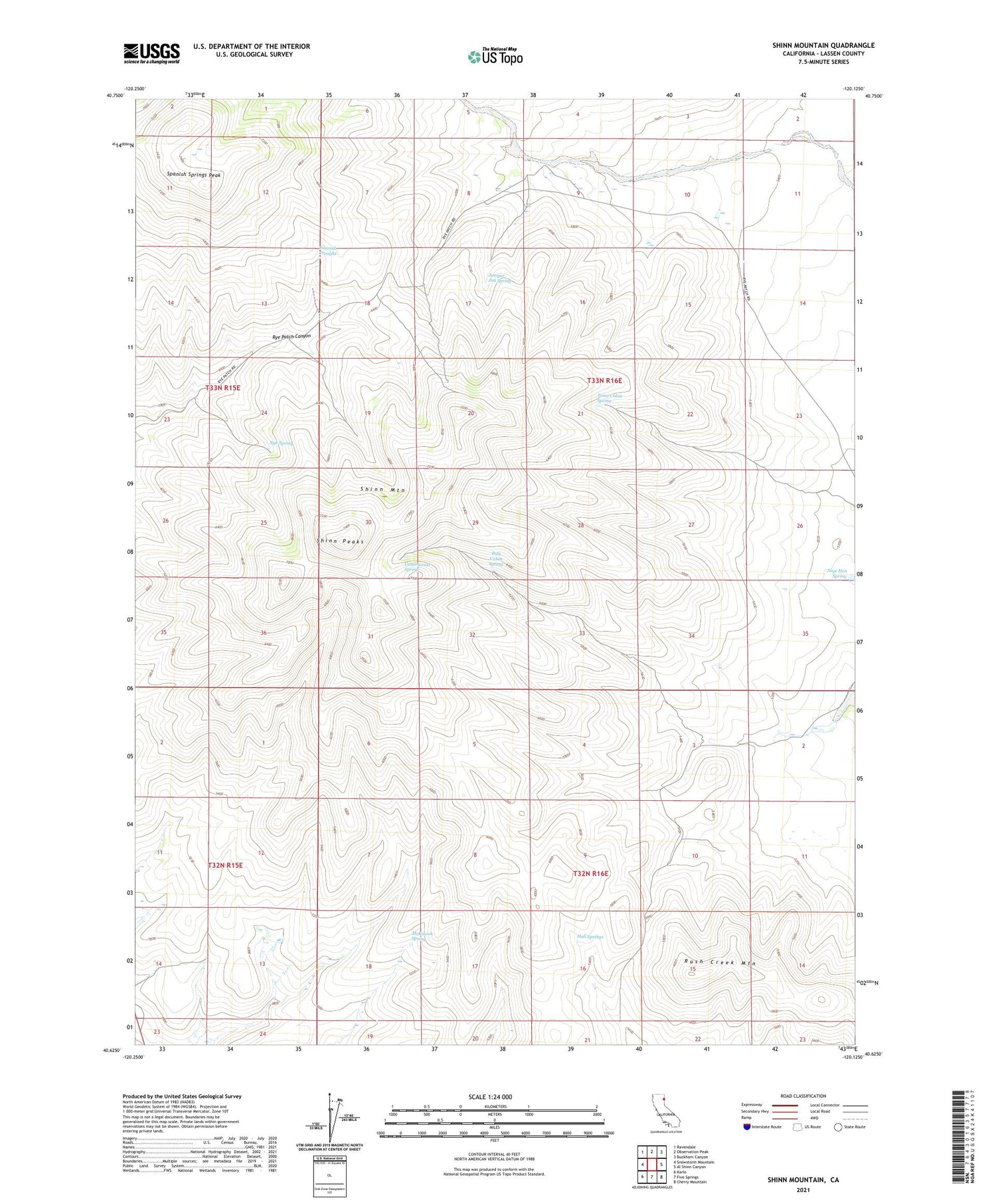
2021 topographic map quadrangle Shinn Mountain in the state of California. Scale: 1:24000. Based on the newly updated USGS 7.5' US Topo map series, this map is in the following counties: Lassen. The map contains contour data, water features, and other items you are used to seeing on USGS maps, but also has updated roads and other features. This is the next generation of topographic maps. Printed on high-quality waterproof paper with UV fade-resistant inks.
Quads adjacent to this one:
West: Snowstorm Mountain
Northwest: Ravendale
North: Observation Peak
Northeast: Buckhorn Canyon
East: Al Shinn Canyon
Southeast: Cherry Mountain
South: Five Springs
Southwest: Karlo
Contains the following named places: Bills Cabin Spring, Cottonwood Spring, Hall Springs, Juniper Jim Spring, McKissick Spring, Nye Spring, Post Camp, Sage Hen Spring, Shinn Mountain, Shinn Peaks, Spanish Springs Peak, Summit Troughs, Toms Cabin Spring


