MyTopo
Cherry Mountain California US Topo Map
Couldn't load pickup availability
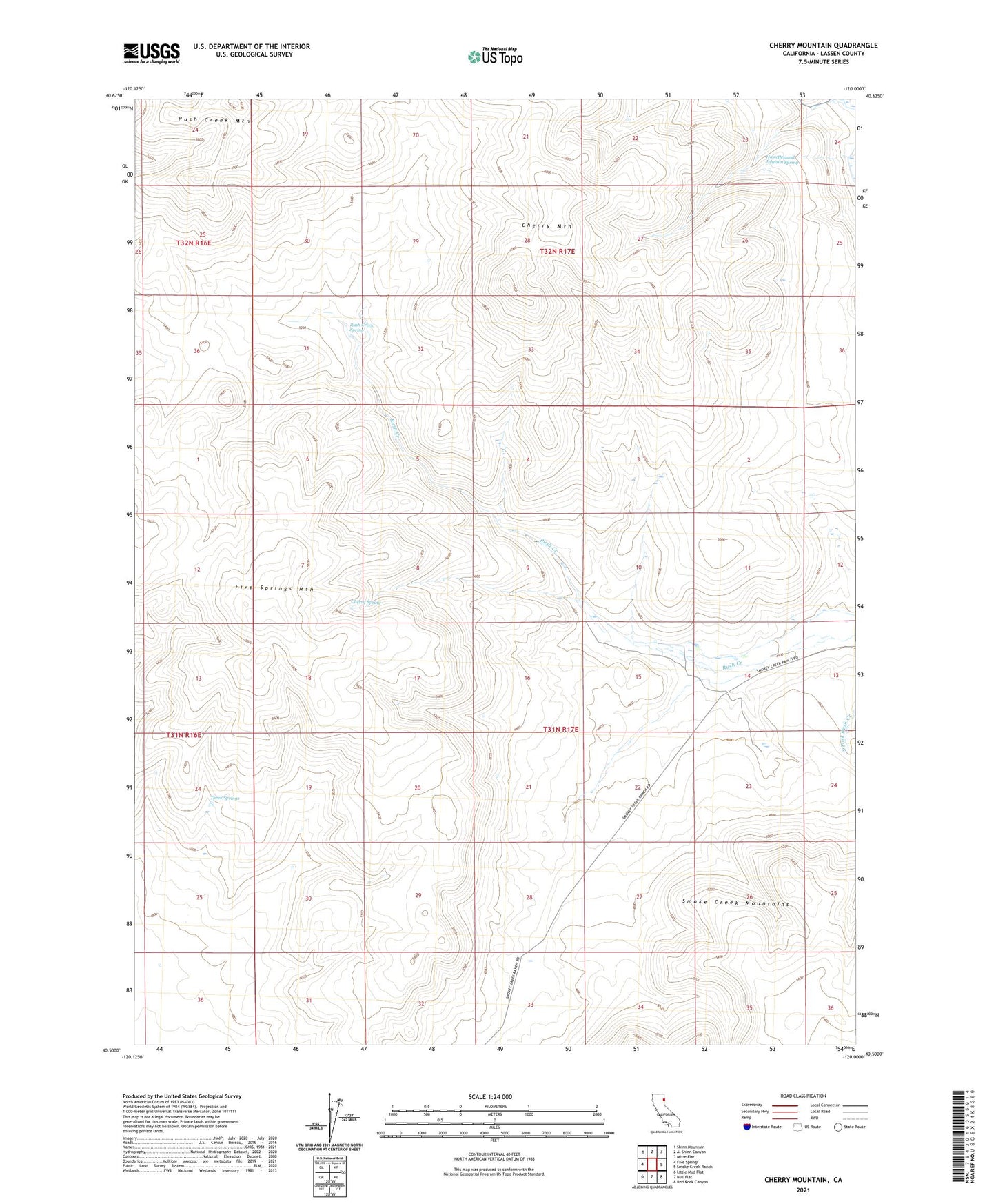
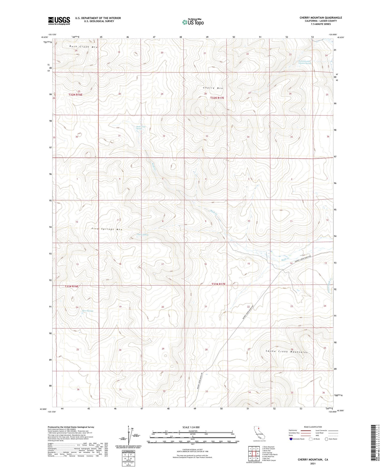
2021 topographic map quadrangle Cherry Mountain in the state of California. Scale: 1:24000. Based on the newly updated USGS 7.5' US Topo map series, this map is in the following counties: Lassen. The map contains contour data, water features, and other items you are used to seeing on USGS maps, but also has updated roads and other features. This is the next generation of topographic maps. Printed on high-quality waterproof paper with UV fade-resistant inks.
Quads adjacent to this one:
West: Five Springs
Northwest: Shinn Mountain
North: Al Shinn Canyon
Northeast: Mixie Flat
East: Smoke Creek Ranch
Southeast: Red Rock Canyon
South: Bull Flat
Southwest: Little Mud Flat
Contains the following named places: Cherry Mountain, Cherry Spring, Five Springs Mountain, Hostetter and Johnson Spring, Rush Creek Mountain, Rush Creek Spring, Three Springs