MyTopo
Spencer Creek California US Topo Map
Couldn't load pickup availability
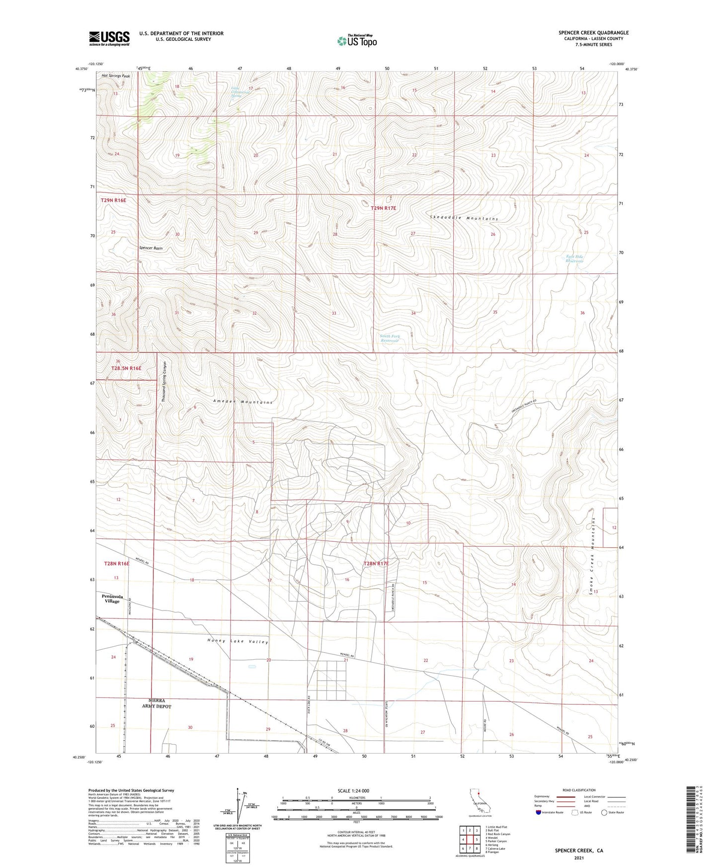
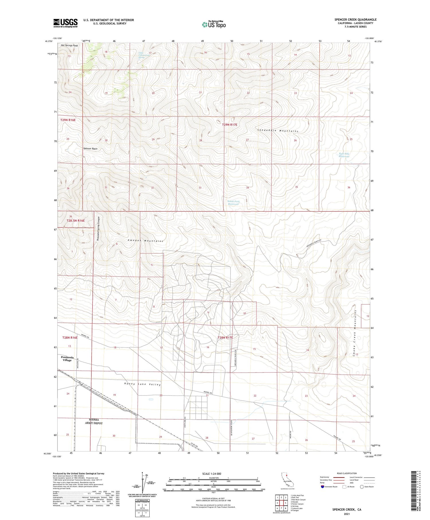
2021 topographic map quadrangle Spencer Creek in the state of California. Scale: 1:24000. Based on the newly updated USGS 7.5' US Topo map series, this map is in the following counties: Lassen. The map contains contour data, water features, and other items you are used to seeing on USGS maps, but also has updated roads and other features. This is the next generation of topographic maps. Printed on high-quality waterproof paper with UV fade-resistant inks.
Quads adjacent to this one:
West: Wendel
Northwest: Little Mud Flat
North: Bull Flat
Northeast: Red Rock Canyon
East: Parker Canyon
Southeast: Flanigan
South: Calneva Lake
Southwest: Herlong
This map covers the same area as the classic USGS quad with code o40120c1.
Contains the following named places: East Side Reservoir, Herlong, Little Cottonwood Spring, South Fork Reservoir, Spencer Basin, Spencer Creek, Thousand Spring Canyon, ZIP Code: 96136