MyTopo
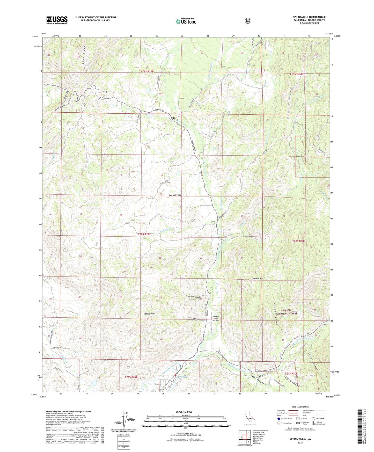
Springville California US Topo Map
Couldn't load pickup availability
Also explore the Springville Forest Service Topo of this same quad for updated USFS data
2021 topographic map quadrangle Springville in the state of California. Scale: 1:24000. Based on the newly updated USGS 7.5' US Topo map series, this map is in the following counties: Tulare. The map contains contour data, water features, and other items you are used to seeing on USGS maps, but also has updated roads and other features. This is the next generation of topographic maps. Printed on high-quality waterproof paper with UV fade-resistant inks.
Quads adjacent to this one:
West: Frazier Valley
Northwest: Chickencoop Canyon
North: Dennison Peak
Northeast: Moses Mountain
East: Camp Wishon
Southeast: Solo Peak
South: Globe
Southwest: Success Dam
This map covers the same area as the classic USGS quad with code o36118b7.
Contains the following named places: Bear Creek, Buckeye Gulch, Church of Christ at Springfield, Coffee Camp Picnic Area, Deep Canyon, Dickey Ranch, Family Healthcare Network Health Center, Hatchet Peak, Hickman Creek, Long Canyon, Lumreau Mountain, Middle Fork Tule River, Milo, Mount Whitney Ditch, North Fork Tule River, Patton House Community Center, Rancheria Creek, Scicon County School, Sequoia Dawn Senior Citizens Complex, Sequoia Ranch Airport, Siphon Canyon, Soda Spring, South Bear Creek, Springville, Springville Elementary School, Springville Post Office, Springville United Methodist Church, Springville Work Center CDF, Sycamore Creek, Tulare County, Tulare County Fire Department Battalion 2 Springville Fire Station 22, Ward Canyon