
MyTopo
Frazier Valley California US Topo Map
Couldn't load pickup availability
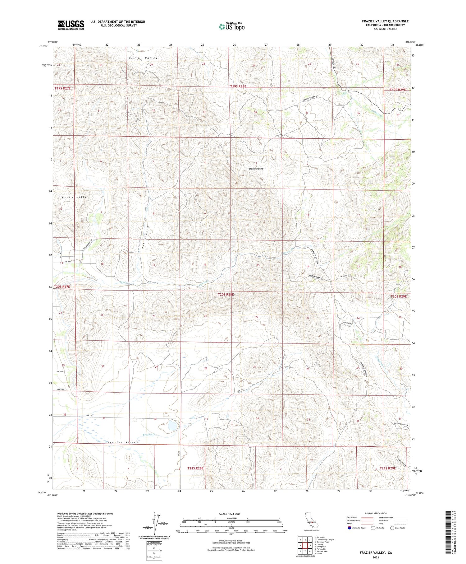
2021 topographic map quadrangle Frazier Valley in the state of California. Scale: 1:24000. Based on the newly updated USGS 7.5' US Topo map series, this map is in the following counties: Tulare. The map contains contour data, water features, and other items you are used to seeing on USGS maps, but also has updated roads and other features. This is the next generation of topographic maps. Printed on high-quality waterproof paper with UV fade-resistant inks.
Quads adjacent to this one:
West: Lindsay
Northwest: Rocky Hill
North: Chickencoop Canyon
Northeast: Dennison Peak
East: Springville
Southeast: Globe
South: Success Dam
Southwest: Porterville
This map covers the same area as the classic USGS quad with code o36118b8.
Contains the following named places: Brown Borrow Pit, Oat Canyon, Rocky Hills, Spanish Camp


