
MyTopo
Trinidad California US Topo Map
Couldn't load pickup availability
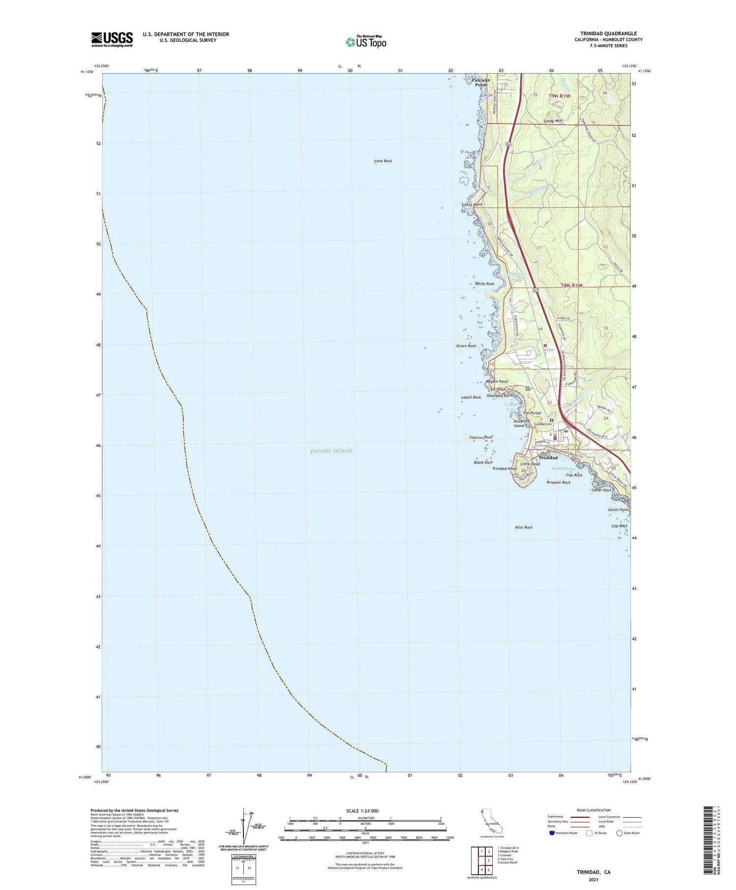
2021 topographic map quadrangle Trinidad in the state of California. Scale: 1:24000. Based on the newly updated USGS 7.5' US Topo map series, this map is in the following counties: Humboldt. The map contains contour data, water features, and other items you are used to seeing on USGS maps, but also has updated roads and other features. This is the next generation of topographic maps. Printed on high-quality waterproof paper with UV fade-resistant inks.
Quads adjacent to this one:
North: Trinidad OE N
Northeast: Rodgers Peak
East: Crannell
Southeast: Arcata North
South: Tyee City
This map covers the same area as the classic USGS quad with code o41124a2.
Contains the following named places: Blank Rock, Burris Creek, California Department of Forestry and Fire Protection Trinidad Station, Camel Rock, Candy Mountain, Cap Rock, City of Trinidad, College Cove, Cone Rock, Elk Head, Flat Rock, Flatiron Rock, Green Rock, Holy Trinity Church, Humboldt State College Marine Laboratory, Lepoil Rock, Little Head, McConnahas Mill Creek, McNeil Creek, Megwil Point, Memorial Lighthouse, Mill Creek, Omenoku Point, Patricks Point, Patricks Point School, Pewetole Island, Pilot Rock, Prisoner Rock, Savage Creek, Scotty Point, Sotsin Point, The Portal, Trinidad, Trinidad Bay, Trinidad Cemetery, Trinidad Elementary School, Trinidad Harbor, Trinidad Head, Trinidad Head Lighthouse, Trinidad Police Department, Trinidad Post Office, Trinidad Rancheria, Trinidad State Beach, Trinidad Volunteer Fire Department, Tsurai Trail, Tsurau, White Rock, ZIP Code: 95570


