MyTopo
Crannell California US Topo Map
Couldn't load pickup availability
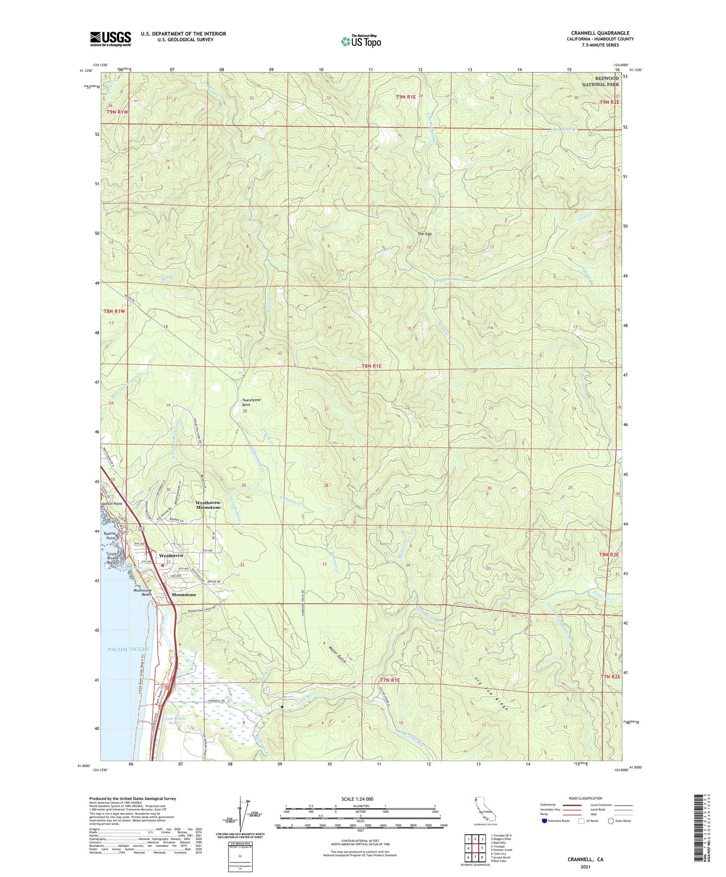
2021 topographic map quadrangle Crannell in the state of California. Scale: 1:24000. Based on the newly updated USGS 7.5' US Topo map series, this map is in the following counties: Humboldt. The map contains contour data, water features, and other items you are used to seeing on USGS maps, but also has updated roads and other features. This is the next generation of topographic maps. Printed on high-quality waterproof paper with UV fade-resistant inks.
Quads adjacent to this one:
West: Trinidad
Northwest: Trinidad OE N
North: Rodgers Peak
Northeast: Bald Hills
East: Panther Creek
Southeast: Blue Lake
South: Arcata North
Southwest: Tyee City
This map covers the same area as the classic USGS quad with code o41124a1.
Contains the following named places: Adams Fox Farm, Beach Creek, Buckley Ranch, Bulwinkle Creek, Camp Twenty, Clam Beach County Park, Clam Beach Ponds, Clear Creek, Coon Creek, Crannell, Eighteen Creek, Freeman Creek, Grassy Creek, Honda Cove, Houda Point Access, Little River, Little River Rock, Little River State Beach, Lower South Fork Little River, Luffenholtz Beach County Park, Luffenholtz Creek, M Line Creek, Moonstone, Moonstone Beach, Moonstone County Park, North Coastal Division, North Fork Luffenholtz Creek, Peters Ranch, Railroad Creek, Reimann Ranch, South Fork Little River, South Fork Luffenholtz Creek, Strawberry Prairie, Tepona Point, The Gap, Twentyone Rock, Water Gulch, Westhaven, Westhaven Volunteer Fire Department, Westhaven-Moonstone Census Designated Place