MyTopo
Tulelake California US Topo Map
Couldn't load pickup availability
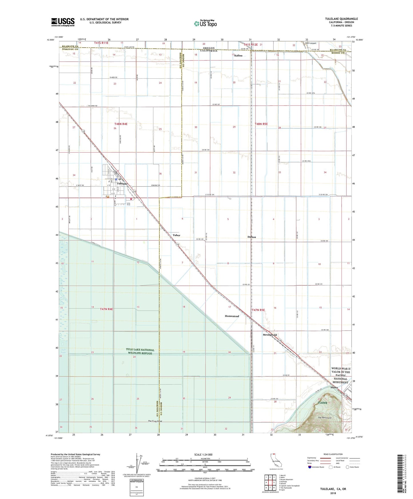
2022 topographic map quadrangle Tulelake in the states of California, Oregon. Scale: 1:24000. Based on the newly updated USGS 7.5' US Topo map series, this map is in the following counties: Modoc, Siskiyou, Klamath. The map contains contour data, water features, and other items you are used to seeing on USGS maps, but also has updated roads and other features. This is the next generation of topographic maps. Printed on high-quality waterproof paper with UV fade-resistant inks.
Quads adjacent to this one:
West: Hatfield
Northwest: Merrill
North: Malin
Northeast: Bryant Mountain
East: Newell
Southeast: Copic
South: The Panhandle
Southwest: Captain Jacks Stronghold
Contains the following named places: Butte Valley Fairgrounds, Carr School, City of Tulelake, Community Presbyterian Church, Dalton, First Baptist Church of Tulelake, Holy Cross Church, Homestead, Kalina, Malin Airport, Otis Roper Park, Staley, Stronghold, The Frog Pond, The Peninsula, Trinity Lutheran Church, Tuber, Tule Lake National Wildlife Refuge, Tulelake, Tulelake Branch Siskiyou County Public Library, Tulelake Christian Fellowship Church, Tulelake City Hall, Tulelake High School, Tulelake Middle School, Tulelake Police Department, Tulelake Post Office, Tulelake Volunteer Fire Department, WWII Valor In The Pacific National Monument - Tule Lake Unit