MyTopo
Union Wash California US Topo Map
Couldn't load pickup availability
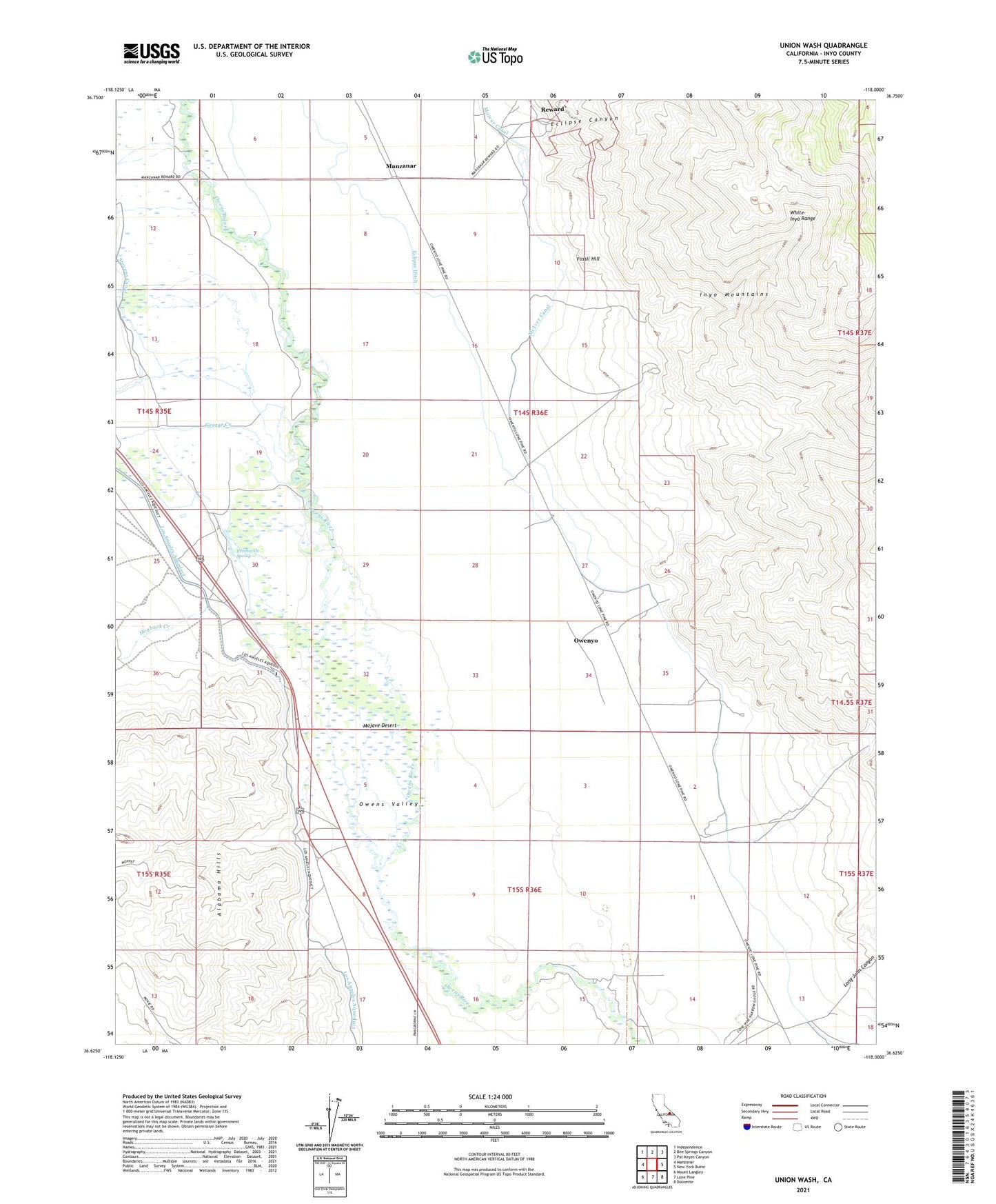
2021 topographic map quadrangle Union Wash in the state of California. Scale: 1:24000. Based on the newly updated USGS 7.5' US Topo map series, this map is in the following counties: Inyo. The map contains contour data, water features, and other items you are used to seeing on USGS maps, but also has updated roads and other features. This is the next generation of topographic maps. Printed on high-quality waterproof paper with UV fade-resistant inks.
Quads adjacent to this one:
West: Manzanar
Northwest: Independence
North: Bee Springs Canyon
Northeast: Pat Keyes Canyon
East: New York Butte
Southeast: Dolomite
South: Lone Pine
Southwest: Mount Langley
This map covers the same area as the classic USGS quad with code o36118f1.
Contains the following named places: Alabama Gates, Alabama Hills, Eclipse Canyon, Eclipse Ditch, Fossil Hill, Hogback Creek, Long John Canyon, Manzanar, McIver Canal, Mount Whitney, Owenyo, Reinhackle Spring, Reward, Union Wash