MyTopo
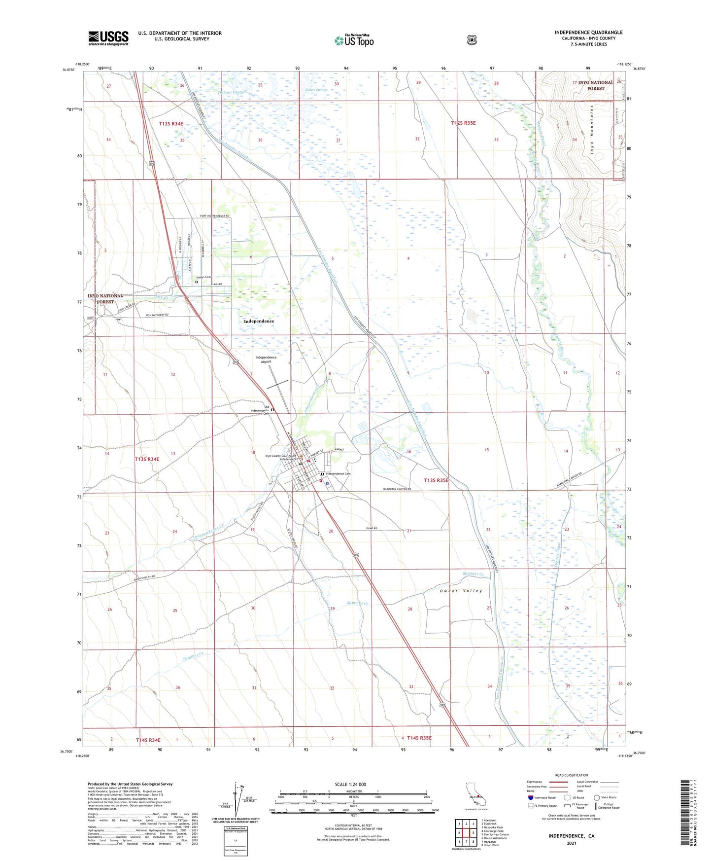
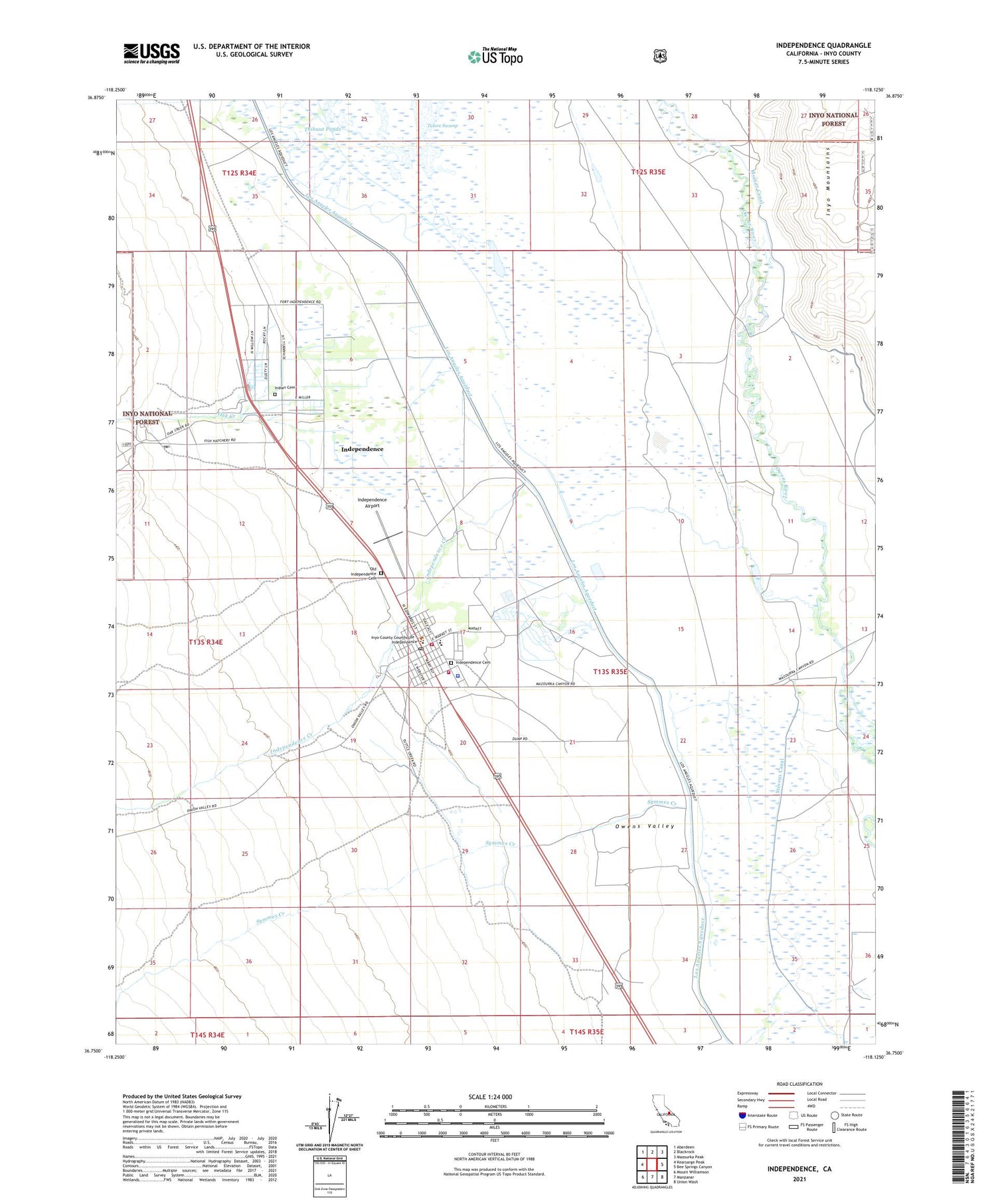
Independence California US Topo Map
Couldn't load pickup availability
Also explore the Independence Forest Service Topo of this same quad for updated USFS data
2021 topographic map quadrangle Independence in the state of California. Scale: 1:24000. Based on the newly updated USGS 7.5' US Topo map series, this map is in the following counties: Inyo. The map contains contour data, water features, and other items you are used to seeing on USGS maps, but also has updated roads and other features. This is the next generation of topographic maps. Printed on high-quality waterproof paper with UV fade-resistant inks.
Quads adjacent to this one:
West: Kearsarge Peak
Northwest: Aberdeen
North: Blackrock
Northeast: Mazourka Peak
East: Bee Springs Canyon
Southeast: Union Wash
South: Manzanar
Southwest: Mount Williamson
This map covers the same area as the classic USGS quad with code o36118g2.
Contains the following named places: Dehy Park, Department of Forestry and Fire Protection Station 59 Independence, Duck Lake, Eastern California Museum, Fort Independence Campground, Fort Independence Reservation, Independence, Independence Airport, Independence Cemetery, Independence Census Designated Place, Independence Creek, Independence Creek Campground, Independence Fire Department, Independence Post Office, Indian Cemetery, Inyo County Courthouse, Inyo County Free Library, Inyo County Sheriff's Office Independence, Jackrabbit Prospect, KNYO-AM (Independence), Mount Whitney Fish Hatchery, N R A Prospect, Oak Creek, Old Independence Cemetery, Owens Valley Elementary School, Owens Valley High School, Stevens Canal, Symmes Creek, Symmes Creek Campground, Tulare Swamp