MyTopo
Valley Mountain California US Topo Map
Couldn't load pickup availability
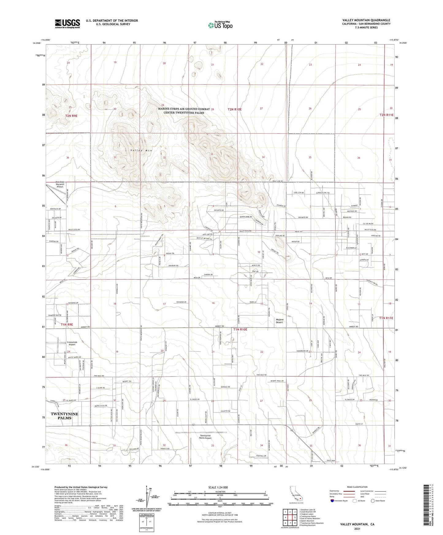
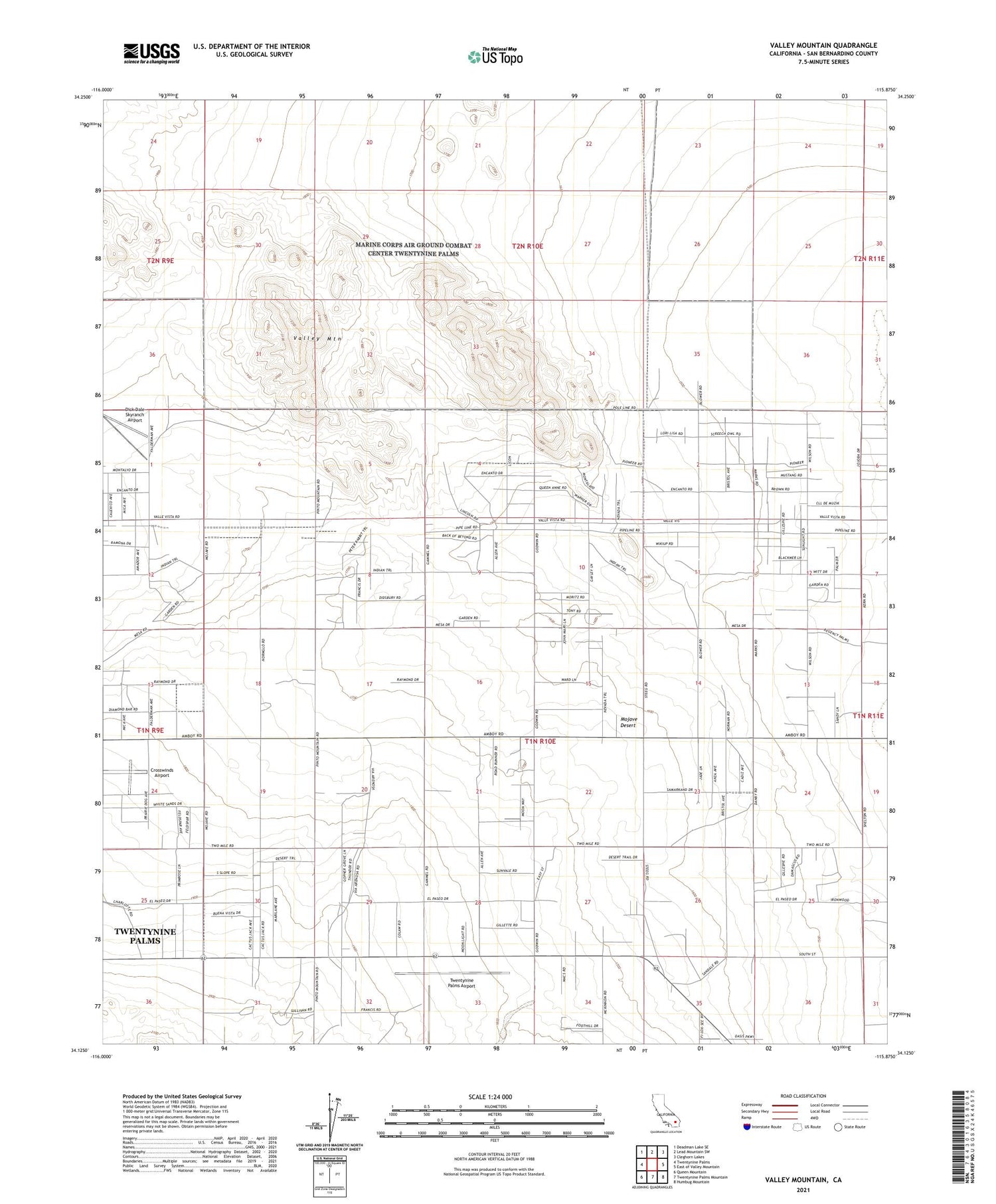
2021 topographic map quadrangle Valley Mountain in the state of California. Scale: 1:24000. Based on the newly updated USGS 7.5' US Topo map series, this map is in the following counties: San Bernardino. The map contains contour data, water features, and other items you are used to seeing on USGS maps, but also has updated roads and other features. This is the next generation of topographic maps. Printed on high-quality waterproof paper with UV fade-resistant inks.
Quads adjacent to this one:
West: Twentynine Palms
Northwest: Deadman Lake SE
North: Lead Mountain SW
Northeast: Cleghorn Lakes
East: East of Valley Mountain
Southeast: Humbug Mountain
South: Twentynine Palms Mountain
Southwest: Queen Mountain
Contains the following named places: Ben Butler Mine, Crosswinds Airport, San Bernardino County Fire Department Station 45 - Wonder Valley, Twentynine Palms Airport, Valley Mountain