
MyTopo
Verona California US Topo Map
Couldn't load pickup availability
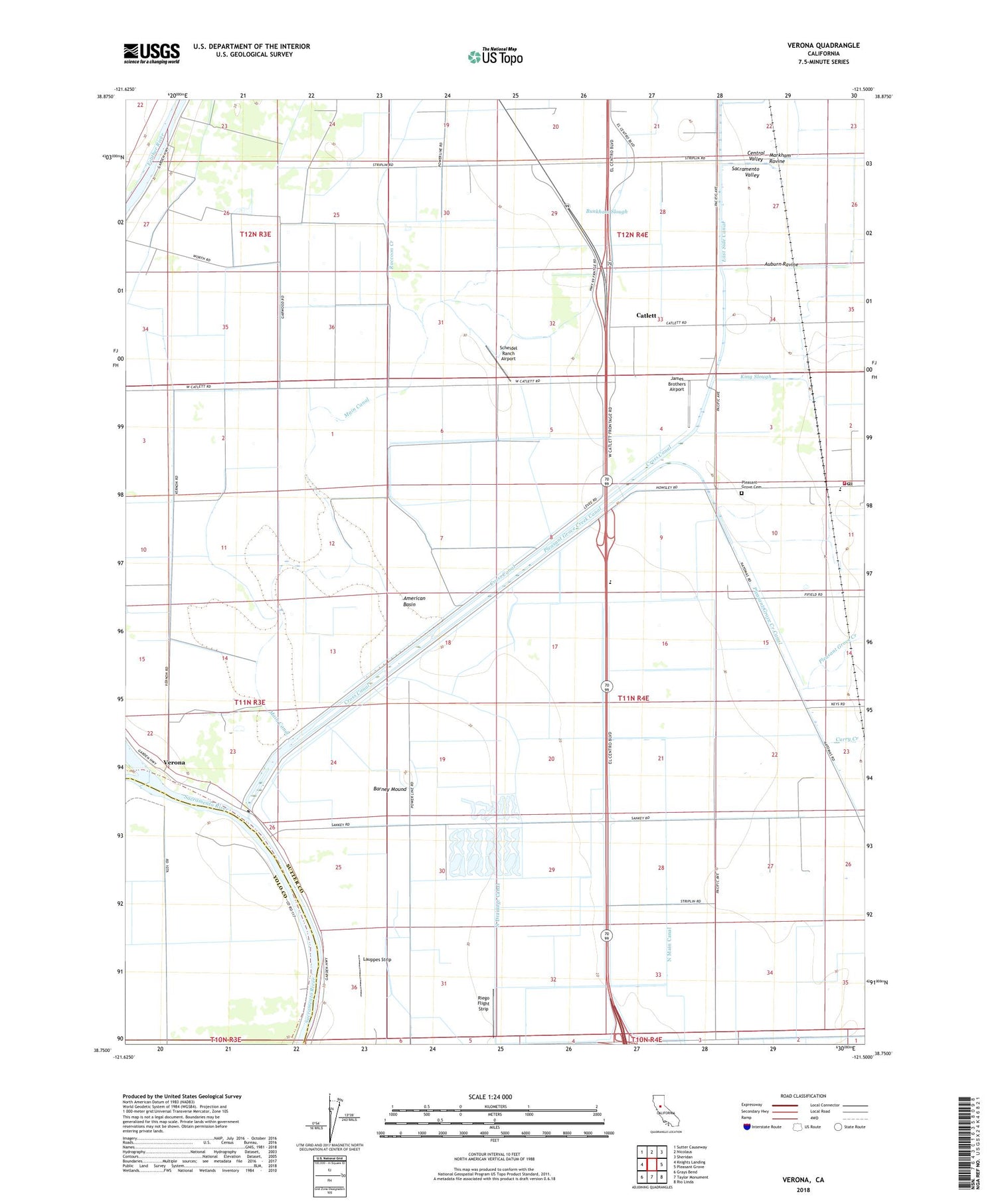
2022 topographic map quadrangle Verona in the state of California. Scale: 1:24000. Based on the newly updated USGS 7.5' US Topo map series, this map is in the following counties: Sutter, Yolo. The map contains contour data, water features, and other items you are used to seeing on USGS maps, but also has updated roads and other features. This is the next generation of topographic maps. Printed on high-quality waterproof paper with UV fade-resistant inks.
Quads adjacent to this one:
West: Knights Landing
Northwest: Sutter Causeway
North: Nicolaus
Northeast: Sheridan
East: Pleasant Grove
Southeast: Rio Linda
South: Taylor Monument
Southwest: Grays Bend
This map covers the same area as the classic USGS quad with code o38121g5.
Contains the following named places: Auburn Ravine, Barney Mound, Catlett, Cottonwood School, Cross Canal, Curry Creek, East Side Canal, Feather River, Fremont Landing, James Brothers Airport, Joes Landing, King Slough, Lauppes Strip, Lee School, Main Canal, Markham Ravine, Murphy Lake, North Drainage Canal, North Main Canal, Pleasant Grove, Pleasant Grove Cemetery, Pleasant Grove Creek, Pleasant Grove Creek Canal, Pleasant Grove Elementary School, Pleasant Grove Fire Department, Pleasant Grove Post Office, Pleasant Grove Station, Raccoon Creek, Riego Flight Strip, Scheidel Ranch Airport, South Sutter Division, Striplin, Tenco Tractor Airport, Verona, Vestal Strip Airport, ZIP Code: 95659


