
MyTopo
Taylor Monument California US Topo Map
Couldn't load pickup availability
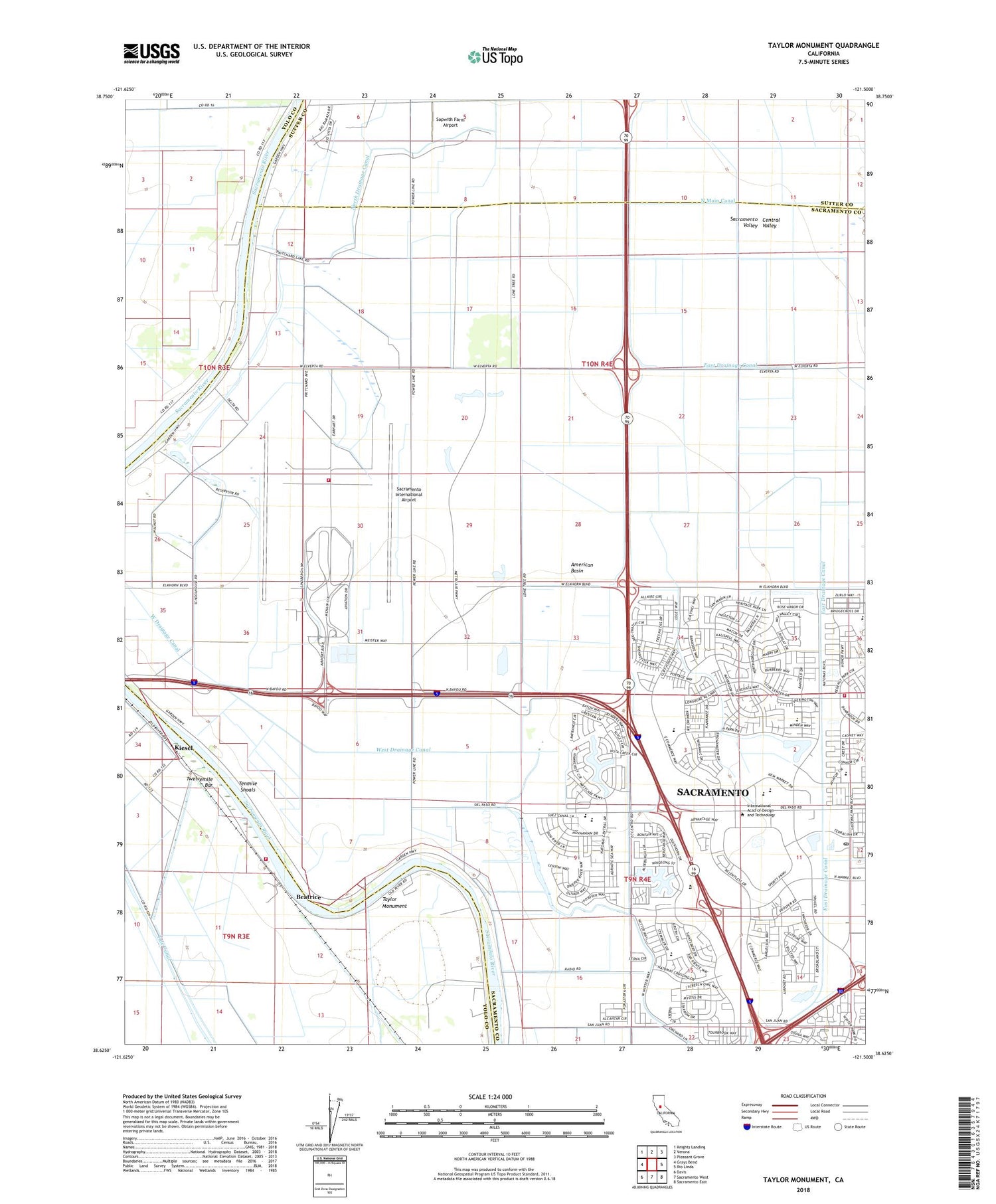
2021 topographic map quadrangle Taylor Monument in the state of California. Scale: 1:24000. Based on the newly updated USGS 7.5' US Topo map series, this map is in the following counties: Sacramento, Yolo, Sutter. The map contains contour data, water features, and other items you are used to seeing on USGS maps, but also has updated roads and other features. This is the next generation of topographic maps. Printed on high-quality waterproof paper with UV fade-resistant inks.
Quads adjacent to this one:
West: Grays Bend
Northwest: Knights Landing
North: Verona
Northeast: Pleasant Grove
East: Rio Linda
Southeast: Sacramento East
South: Sacramento West
Southwest: Davis
This map covers the same area as the classic USGS quad with code o38121f5.
Contains the following named places: American Basin, Arco Arena, Beatrice, Calvary Christian Center, Calvary Church of Deliverance, Central Pumping Station, Dateys Ferry, East Drainage Canal, Elkhorn Pumping Station, Elkhorn Regional Park, Elkhorn Volunteer Fire Department, Elkhorn Weir, Fishermans Lake, KCTC-AM (Sacramento), Kiesel, KYMX-FM (Sacramento), Lonetree Island, Marty, Mound Ranch, Natomas Airport, Natomas Marketplace Shopping Center, Natomas Middle School, Natomas Park Elementary School, North Natomas Post Office, Prichard Lake Pumping Station, Pumping Station Number Three, Sacramento City Fire Department Station 30, Sacramento County Airport System Fire Department Station 98, Sacramento International Airport, Sixmile Bar, Sopwith Farm Airport, Taylor Monument, Teal Bend Golf Club, Tenmile Shoals, Todhunters Lake, Tule Canal, Twelvemile Bar, Vin, West Drainage Canal, Witter Ranch Elementary School, ZIP Codes: 95691, 95834, 95835, 95837


