
MyTopo
Waucoba Canyon California US Topo Map
Couldn't load pickup availability
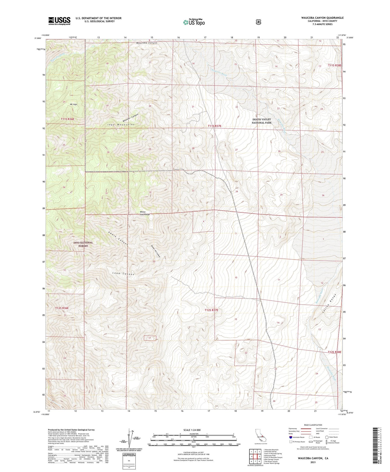
2021 topographic map quadrangle Waucoba Canyon in the state of California. Scale: 1:24000. Based on the newly updated USGS 7.5' US Topo map series, this map is in the following counties: Inyo. The map contains contour data, water features, and other items you are used to seeing on USGS maps, but also has updated roads and other features. This is the next generation of topographic maps. Printed on high-quality waterproof paper with UV fade-resistant inks.
Quads adjacent to this one:
West: Mazourka Peak
Northwest: Waucoba Mountain
North: Waucoba Spring
Northeast: East of Waucoba Spring
East: East of Waucoba Canyon
Southeast: Lower Warm Springs
South: Pat Keyes Canyon
Southwest: Bee Springs Canyon
This map covers the same area as the classic USGS quad with code o36117h8.
Contains the following named places: Addle Canyon, Blue Monster Mine, Bunker Hill Canyon, Bunker Hill Mine, Custer Mine, Independence Claims, Independence Division, Inyo King Prospect, Inyo Mountains, Inyo Queen Number 1 Mine, Inyo Queen Number 2 Mine, Lead Canyon, Lucky Boy Mine, Lucky Josephine Number 10 Prospect, Mount Inyo, Pick Up Prospect, Valley View Prospect, Waucoba Canyon, Waucoba Mine, Wheeler Canyon


