MyTopo
Waucoba Spring California US Topo Map
Couldn't load pickup availability
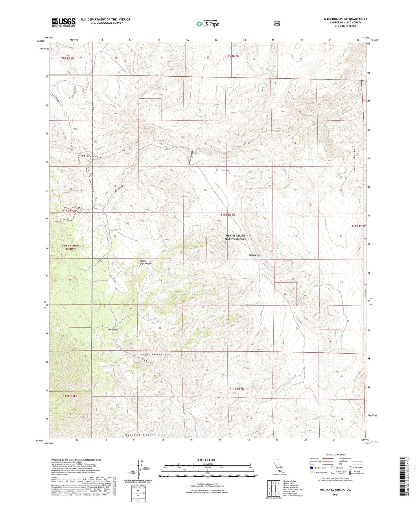
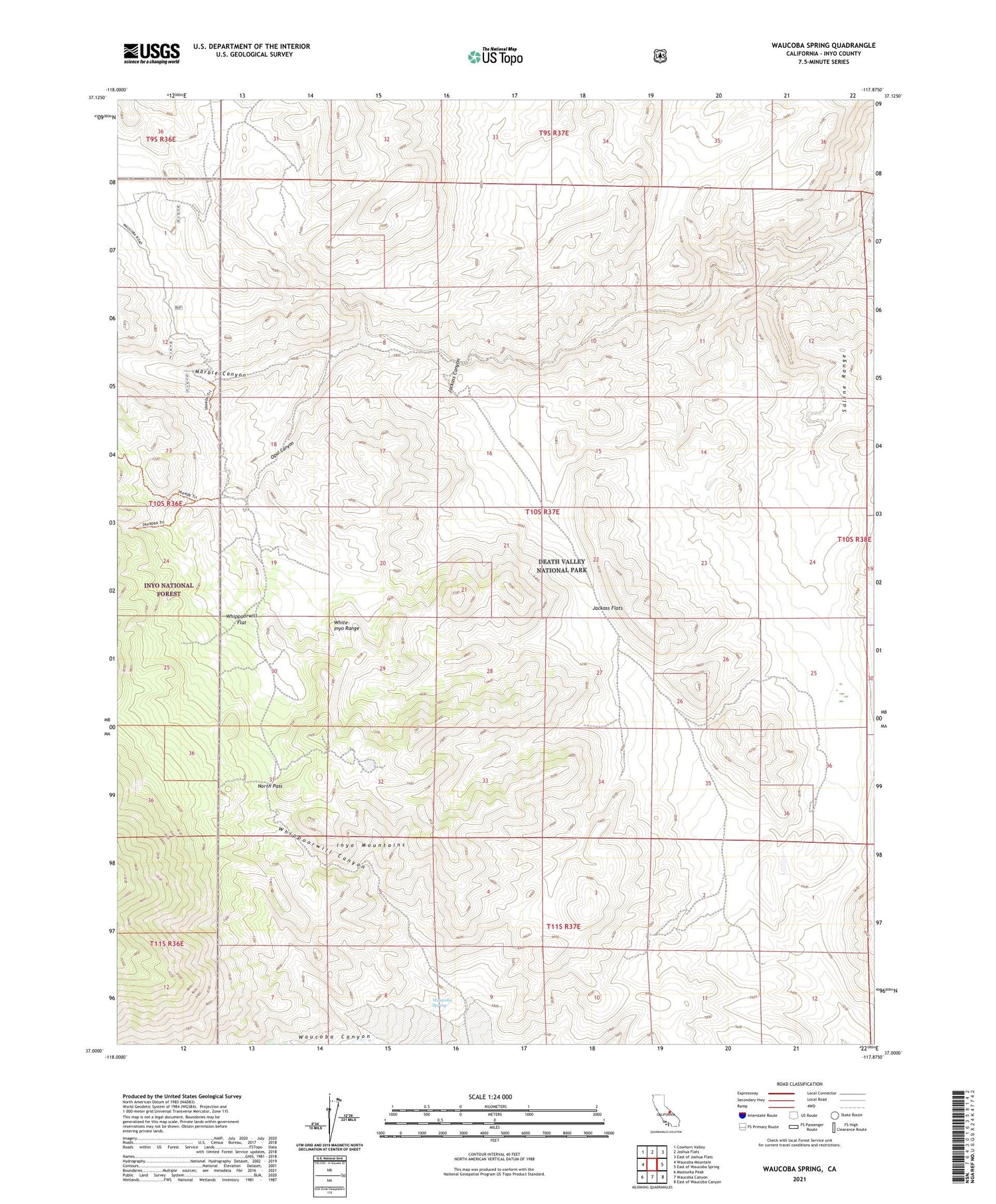
2021 topographic map quadrangle Waucoba Spring in the state of California. Scale: 1:24000. Based on the newly updated USGS 7.5' US Topo map series, this map is in the following counties: Inyo. The map contains contour data, water features, and other items you are used to seeing on USGS maps, but also has updated roads and other features. This is the next generation of topographic maps. Printed on high-quality waterproof paper with UV fade-resistant inks.
Quads adjacent to this one:
West: Waucoba Mountain
Northwest: Cowhorn Valley
North: Joshua Flats
Northeast: East of Joshua Flats
East: East of Waucoba Spring
Southeast: East of Waucoba Canyon
South: Waucoba Canyon
Southwest: Mazourka Peak
This map covers the same area as the classic USGS quad with code o37117a8.
Contains the following named places: Friend Prospect, Good Enough Prospect, Iron Nugget Placer Mine, Jackass Canyon, Jackass Flats, Jean Apex Prospect, KIFS Prospect, North Pass, Opal Canyon, Opal Mine, Silver Spur Prospect, Waucoba Spring, Whippoorwill Canyon, Whippoorwill Flat