MyTopo
West of Shenandoah Peak California US Topo Map
Couldn't load pickup availability
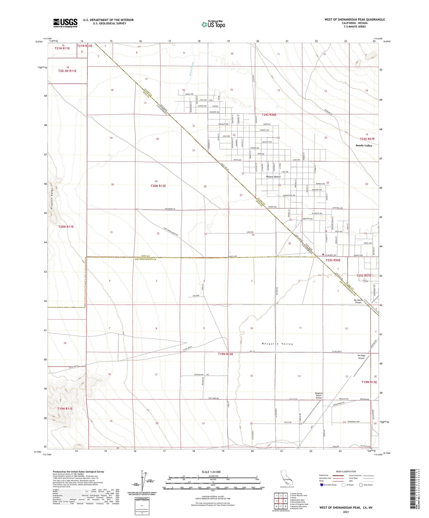
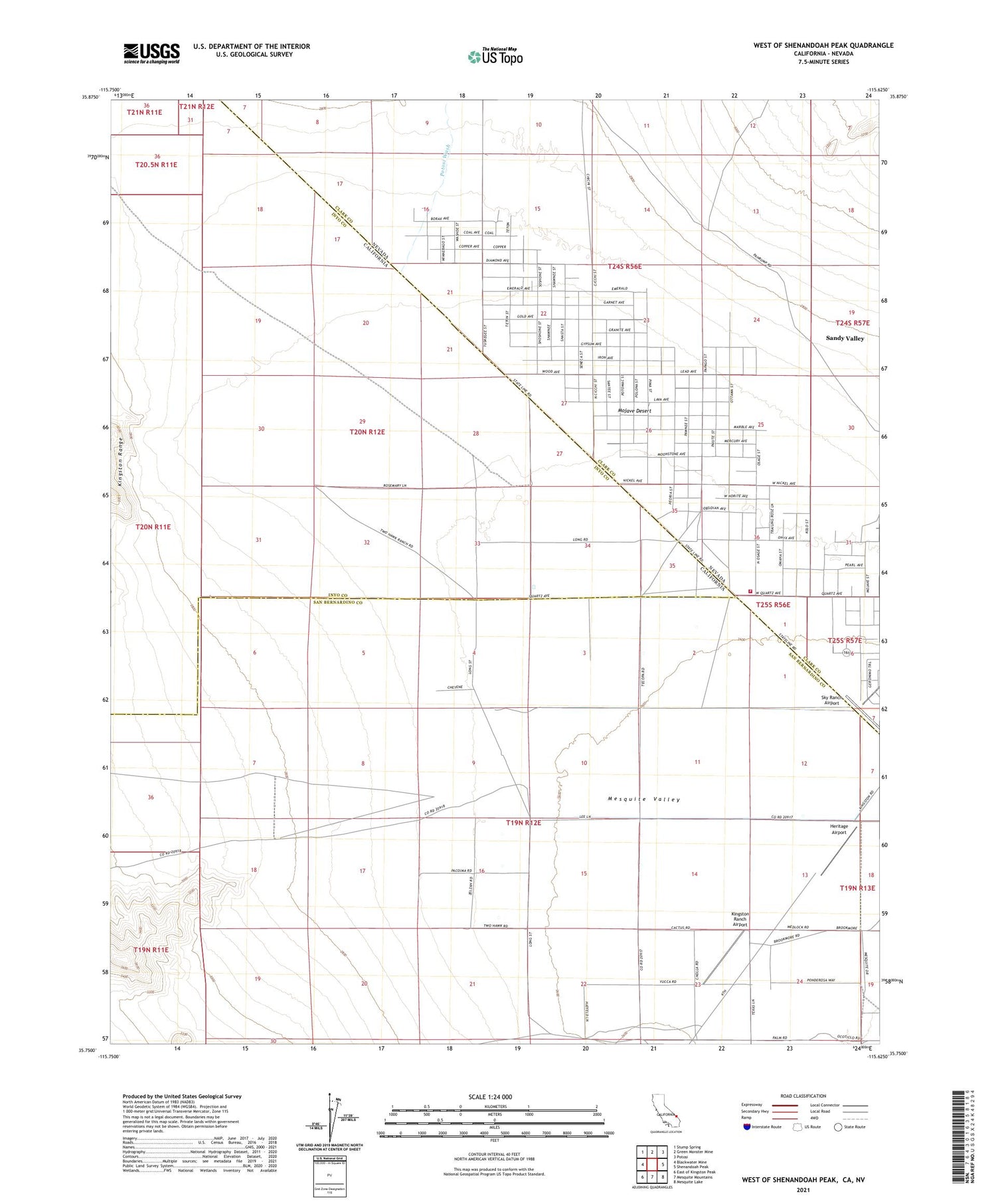
2021 topographic map quadrangle West of Shenandoah Peak in the states of California, Nevada. Scale: 1:24000. Based on the newly updated USGS 7.5' US Topo map series, this map is in the following counties: Inyo, San Bernardino, Clark. The map contains contour data, water features, and other items you are used to seeing on USGS maps, but also has updated roads and other features. This is the next generation of topographic maps. Printed on high-quality waterproof paper with UV fade-resistant inks.
Quads adjacent to this one:
West: Blackwater Mine
Northwest: Stump Spring
North: Green Monster Mine
Northeast: Potosi
East: Shenandoah Peak
Southeast: Mesquite Lake
South: Mesquite Mountains
Southwest: East of Kingston Peak
Contains the following named places: Clark County Fire Department Station 77, Heritage Airport, Kingston Ranch Airport, Mandolin, Peace Park, Potosi Wash, Sandy Valley, Sandy Valley Census Designated Place, Sandy Valley Community Center, Sky Ranch Airport, Wilsons Well, ZIP Code: 89019