MyTopo
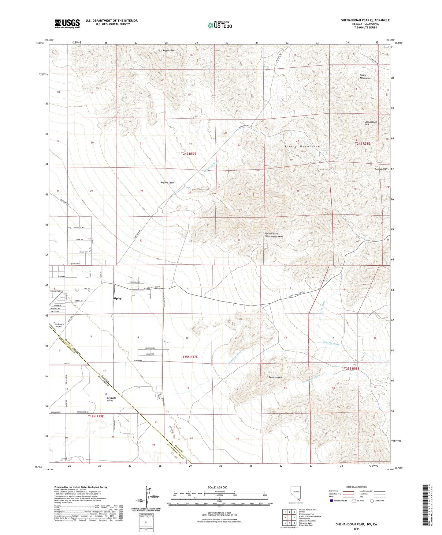
Shenandoah Peak Nevada US Topo Map
Couldn't load pickup availability
2021 topographic map quadrangle Shenandoah Peak in the states of Nevada, California. Scale: 1:24000. Based on the newly updated USGS 7.5' US Topo map series, this map is in the following counties: Clark, San Bernardino. The map contains contour data, water features, and other items you are used to seeing on USGS maps, but also has updated roads and other features. This is the next generation of topographic maps. Printed on high-quality waterproof paper with UV fade-resistant inks.
Quads adjacent to this one:
West: West of Shenandoah Peak
Northwest: Green Monster Mine
North: Potosi
Northeast: Cottonwood Pass
East: Goodsprings
Southeast: State Line Pass
South: Mesquite Lake
Southwest: Mesquite Mountains
This map covers the same area as the classic USGS quad with code o35115g5.
Contains the following named places: Akron Mine, Azurite Mine, Bill Nye Mine, Bonanza Hill, Bonanza Wash, Boss Mine, Cairn East of Shenandoah Mine, Chiquita Mine, Clementina Mine, Copper Chief Mine, Copper Flower Mine, Copperside Mine, Cub Lee Well, Galena Wash, Golden Chariot Mine, Goodsprings Mining District, Highline Mine, Hoodoo Mine, Ironside Mine, Keystone Academy, Keystone Mill, Keystone Mine, Keystone Post Office, Keystone Wash, Kirby Mine, Kirby Wash, Lincoln City, McVicar Mine, Mobile Mine, Oro Amigo Mine, Platina, Platina Mine, Platina Post Office, Ragged Peak, Rattler Hill, Ripley, Ripley Post Office, Root Camp, Root Mine, Sandy Mill, Sandy Post Office, Sandy Valley Middle School, Shenandoah Mill, Shenandoah Mine, Shenandoah Peak, Singer Mine, Singer Wash, Smithsonite Mine, Spelter Mine, Sultan Mine, Tiffin Mine, Whale Mine