MyTopo
Wolf California US Topo Map
Couldn't load pickup availability
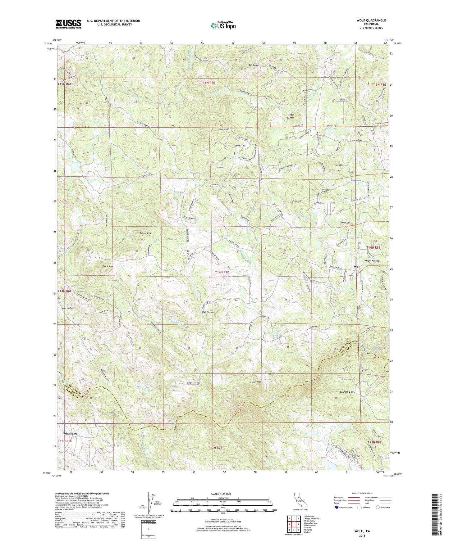
2022 topographic map quadrangle Wolf in the state of California. Scale: 1:24000. Based on the newly updated USGS 7.5' US Topo map series, this map is in the following counties: Nevada, Placer. The map contains contour data, water features, and other items you are used to seeing on USGS maps, but also has updated roads and other features. This is the next generation of topographic maps. Printed on high-quality waterproof paper with UV fade-resistant inks.
Quads adjacent to this one:
West: Camp Far West
Northwest: Smartsville
North: Rough And Ready
Northeast: Grass Valley
East: Lake Combie
Southeast: Auburn
South: Gold Hill
Southwest: Lincoln
This map covers the same area as the classic USGS quad with code o39121a2.
Contains the following named places: Alderman Creek, Austin Flat, Bald Mountain, Bald Rock Mountain, Banner Grange, Bushy Mountain, Cole Ditch, Cole Hill, Cranston Ranch, Elster Memorial Cemetery, Garden Bar, Hog Hill, Indian Springs Creek, Iron Mountain, Little Wolf Creek, Loney - Sanford Ranch Cemetery, Lucas Hill, Pine Hill, Pine Hill Mine, Rab Ravine, Redinger Ditch, Rock Mountain, Sugar Loaf Mountain, Sweet Ranch, Wolf, Wolf Creek, Wolf Ditch, ZIP Code: 95949