MyTopo
Lake Combie California US Topo Map
Couldn't load pickup availability
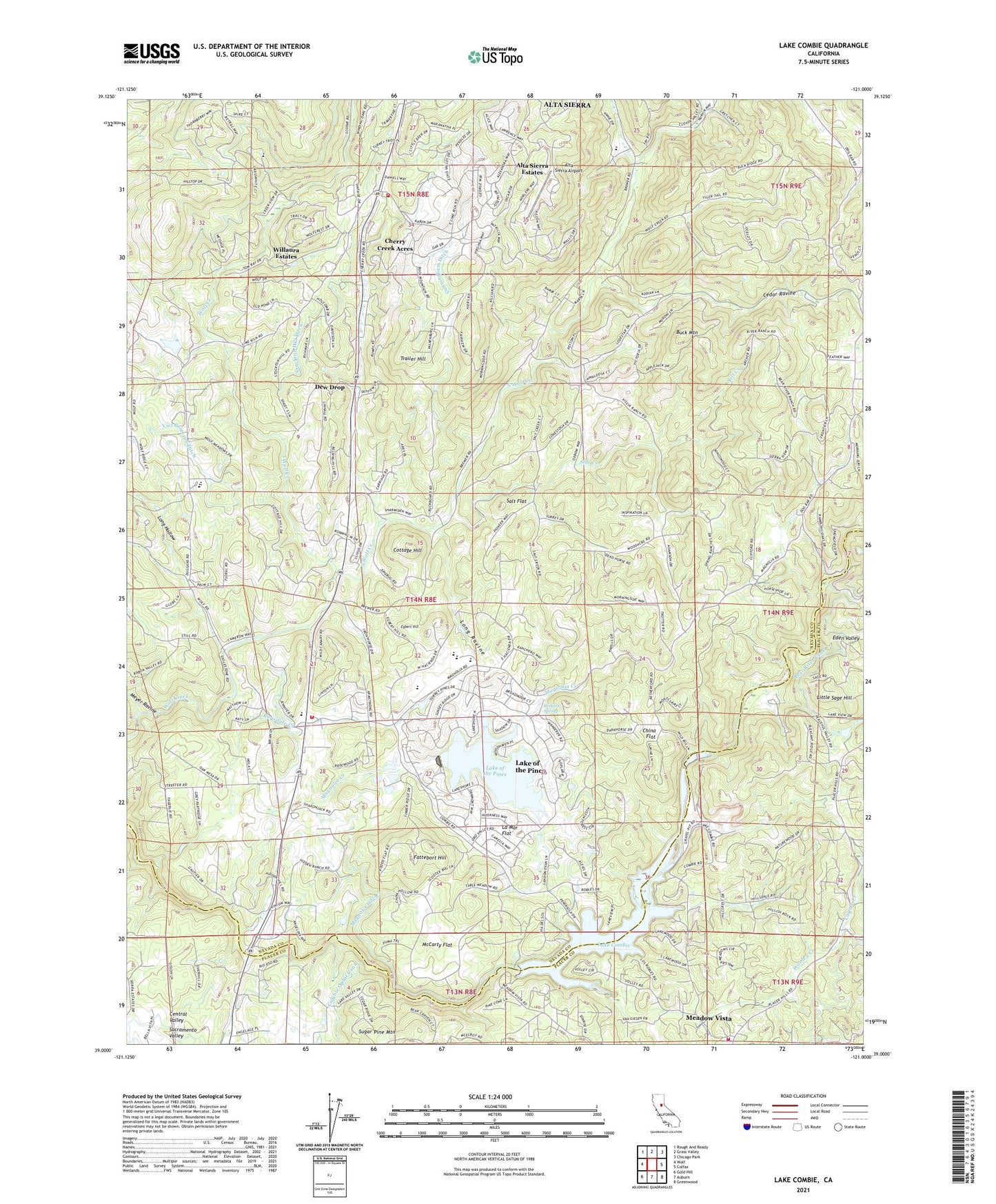
2021 topographic map quadrangle Lake Combie in the state of California. Scale: 1:24000. Based on the newly updated USGS 7.5' US Topo map series, this map is in the following counties: Nevada, Placer. The map contains contour data, water features, and other items you are used to seeing on USGS maps, but also has updated roads and other features. This is the next generation of topographic maps. Printed on high-quality waterproof paper with UV fade-resistant inks.
Quads adjacent to this one:
West: Wolf
Northwest: Rough And Ready
North: Grass Valley
Northeast: Chicago Park
East: Colfax
Southeast: Greenwood
South: Auburn
Southwest: Gold Hill
This map covers the same area as the classic USGS quad with code o39121a1.
Contains the following named places: Alta Sierra Airport, Alta Sierra Census Designated Place, Alta Sierra Elementary School, Alta Sierra Estates, Alta Sierra Ranches, B Canal, Bear River High School, Buck Mountain, Cedar Ravine, Cherry Creek Acres, China Flat, Combie 61-009 Dam, Combie Crossing, Combie Ophir Canal, Cottage Hill, Cottage Hill Elementary School, Coyote Creek, Cunningham Ditch, Dew Drop, Dog Bar Bridge, Eden Valley, Egbert Hill, Fattebort Hill, Gautier Bridge, Higgins Area Fire Protection District, Higgins Corner, Kyler Ditch, La Mar Flat, Lake Combie, Lake Combie Pit, Lake of the Pines, Lake of the Pines Census Designated Place, Limekiln School, Little Sage Hill, Long Hollow, Long Ravine, Magnolia 1302 Dam, Magnolia Creek, Magnolia Ditch, McCarty Flat, Meadow Vista, Meadow Vista Census Designated Place, Meyer Ravine, Nevada County Consolidated Fire District Station 90, Nickerson Ranch, Perkins Spring, Placer County Fire Department Station 84 / Placer Hills Fire Department Station 1, Pleasant Ridge Charter School, Ragsdale Creek, Salt Creek, Salt Flat, Sierra Knoll Estates, South Wolf Creek, State Foresty Guard Station, Stockton Hill Ditch, Stockton Hill Mine, Trailer Hill, Van Giesen Dam, Viet Cameron Ditch, Willaura Estates, Wooley Creek, ZIP Code: 95722