
MyTopo
Anvil Points Colorado US Topo Map
Couldn't load pickup availability
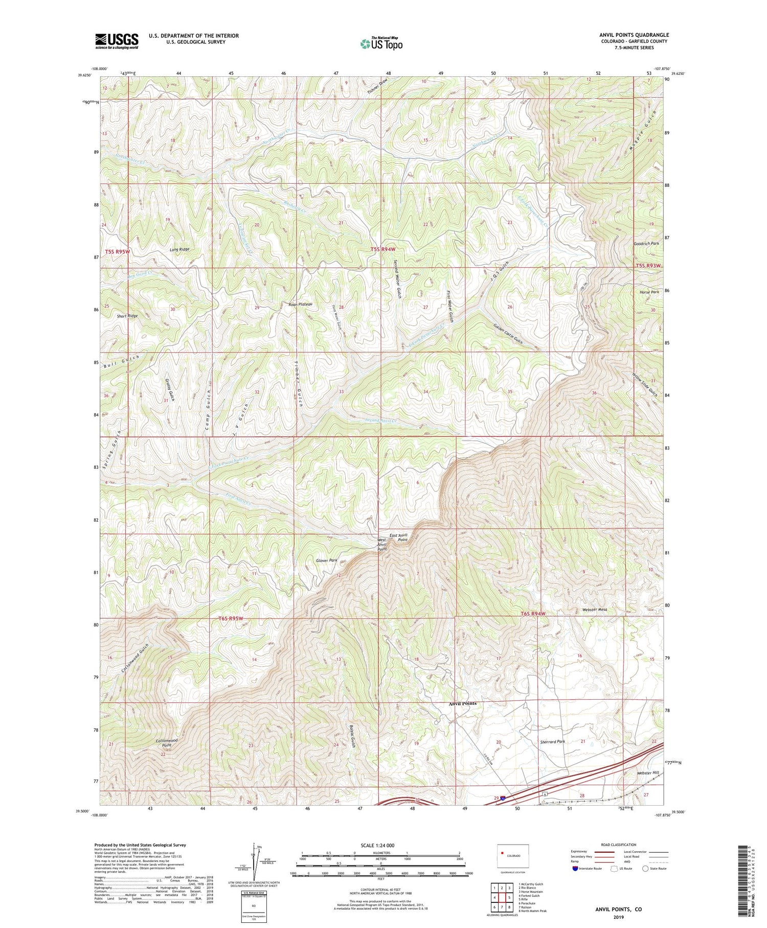
2022 topographic map quadrangle Anvil Points in the state of Colorado. Scale: 1:24000. Based on the newly updated USGS 7.5' US Topo map series, this map is in the following counties: Garfield. The map contains contour data, water features, and other items you are used to seeing on USGS maps, but also has updated roads and other features. This is the next generation of topographic maps. Printed on high-quality waterproof paper with UV fade-resistant inks.
Quads adjacent to this one:
West: Forked Gulch
Northwest: McCarthy Gulch
North: Rio Blanco
Northeast: Horse Mountain
East: Rifle
Southeast: North Mamm Peak
South: Rulison
Southwest: Parachute
This map covers the same area as the classic USGS quad with code o39107e8.
Contains the following named places: Anvil Points, Anvil Points Oil Shale Mines, Balzac Gulch, Bureau of Mines Oil Shale Experiment Station, Camp Gulch, Cottonwood Point, Doyle Trail, East Anvil Point, First Anvil Creek, First Water Gulch, Garfield County, Garfield County Landfill, Glover Park, Golden Castle Gulch, Grassy Gulch, J Q S Gulch, J V Gulch, Long Ridge, Rasberry Creek, Roan Plateau, Rulison Oil Shale Mine, Second Anvil Creek, Second Water Gulch, Sharrard Park, Third Water Gulch, Tichner Draw, Timber Gulch, Webster Hill, Webster Mesa, West Anvil Point, Yellowjacket Creek


