MyTopo
Carlton Colorado US Topo Map
Couldn't load pickup availability
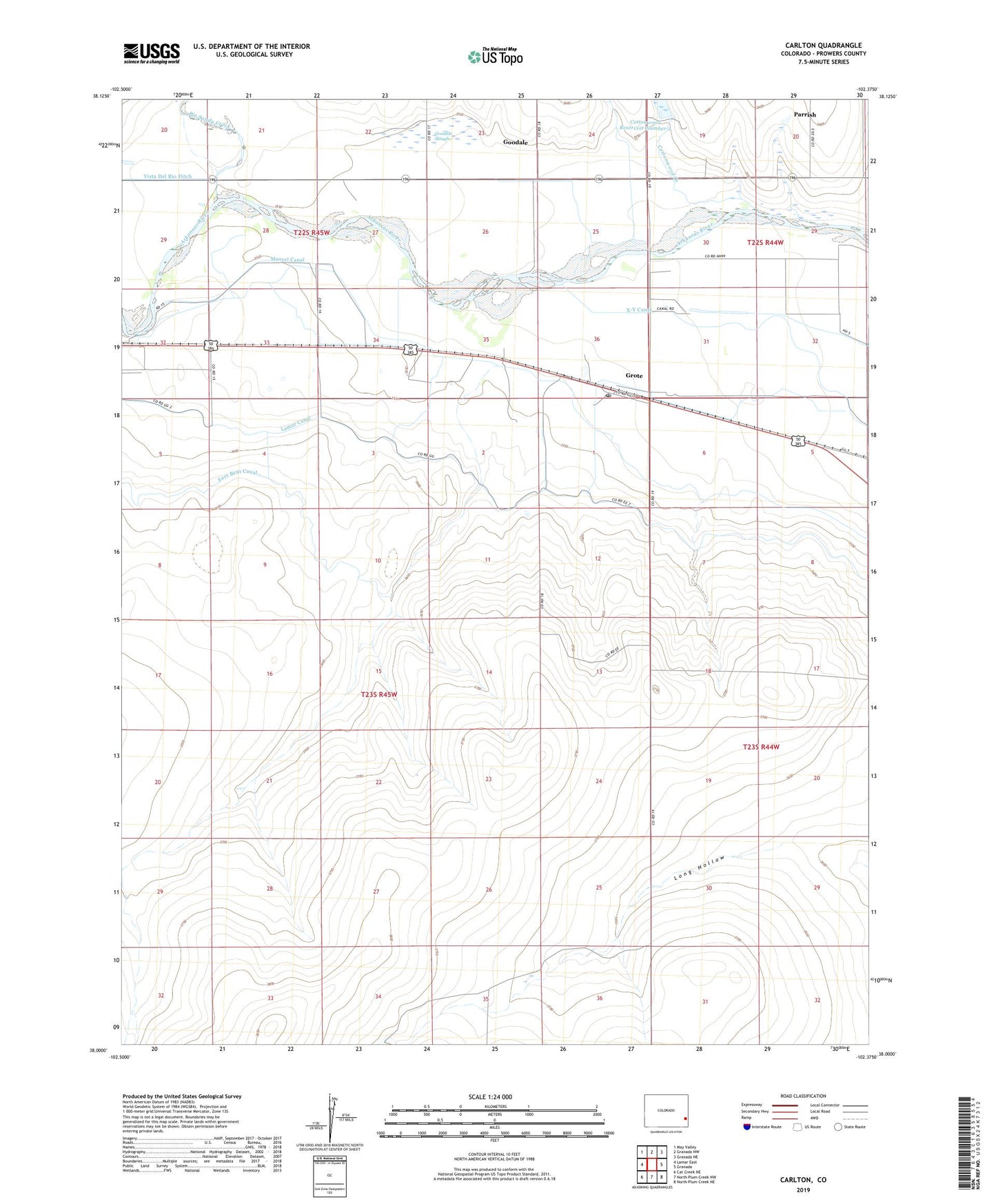
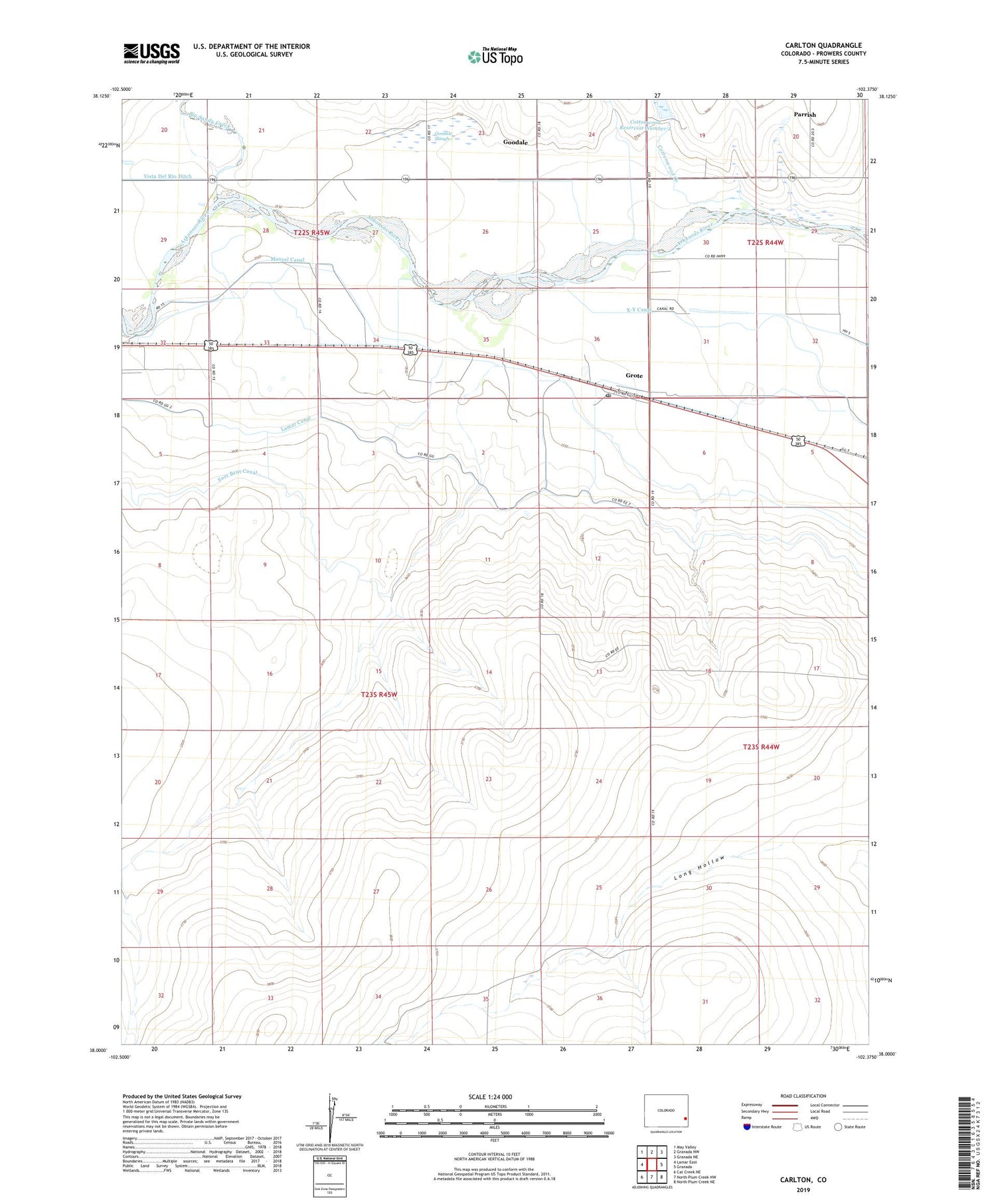
2022 topographic map quadrangle Carlton in the state of Colorado. Scale: 1:24000. Based on the newly updated USGS 7.5' US Topo map series, this map is in the following counties: Prowers. The map contains contour data, water features, and other items you are used to seeing on USGS maps, but also has updated roads and other features. This is the next generation of topographic maps. Printed on high-quality waterproof paper with UV fade-resistant inks.
Quads adjacent to this one:
West: Lamar East
Northwest: May Valley
North: Granada NW
Northeast: Granada NE
East: Granada
Southeast: North Plum Creek NE
South: North Plum Creek NW
Southwest: Cat Creek NE
This map covers the same area as the classic USGS quad with code o38102a4.
Contains the following named places: Big Sandy Creek, Carlton, Carlton Post Office, Carlton School, Center Farm, Cottonwood Creek, Cottonwood Number 2 Dam, Cottonwood Reservoir Number 2, Goodale, Goodale Slough, Grote, Lamar Canal, Long Hollow, Manvel Canal, Parrish, Roosevelt School, Smith Arroyo