MyTopo
Lamar East Colorado US Topo Map
Couldn't load pickup availability
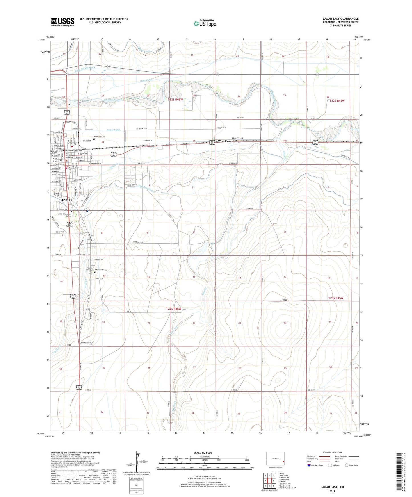
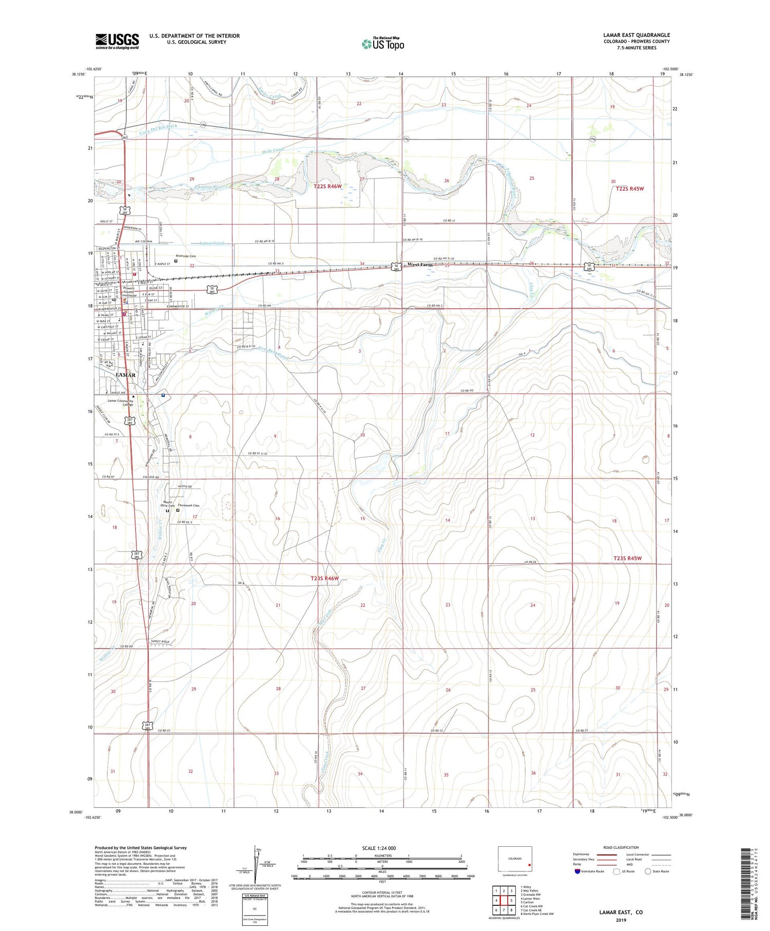
2022 topographic map quadrangle Lamar East in the state of Colorado. Scale: 1:24000. Based on the newly updated USGS 7.5' US Topo map series, this map is in the following counties: Prowers. The map contains contour data, water features, and other items you are used to seeing on USGS maps, but also has updated roads and other features. This is the next generation of topographic maps. Printed on high-quality waterproof paper with UV fade-resistant inks.
Quads adjacent to this one:
West: Lamar West
Northwest: Wiley
North: May Valley
Northeast: Granada NW
East: Carlton
Southeast: North Plum Creek NW
South: Cat Creek NE
Southwest: Cat Creek NW
This map covers the same area as the classic USGS quad with code o38102a5.
Contains the following named places: City of Lamar, Clay Creek, Clay Creek School, Clucas, Colorado State Patrol Lamar Troop Office 2C, Fairmount Cemetery, Hyde Canal, KLMR-AM (Lamar), KSEC-FM (Lamar), Lamar, Lamar Fire Department Station 1, Lamar Fire Department Station 2 / Prowers County Rural Fire Department, Lamar Police Department, Lamar Post Office, Lamar Reservoirs, Lamar Waterworks, Markham, Markham Arroyo, Mike Higbee State Wildlife Area, Mount Olive Cemetery, Paradox School, Prowers County Jail, Prowers County Sheriff's Office, Prowers Medical Center, Riverside Cemetery, Southeast Colorado Fairgrounds, Vista Del Rio Ditch, West Farm, Willow Creek Park