MyTopo
Center North Colorado US Topo Map
Couldn't load pickup availability
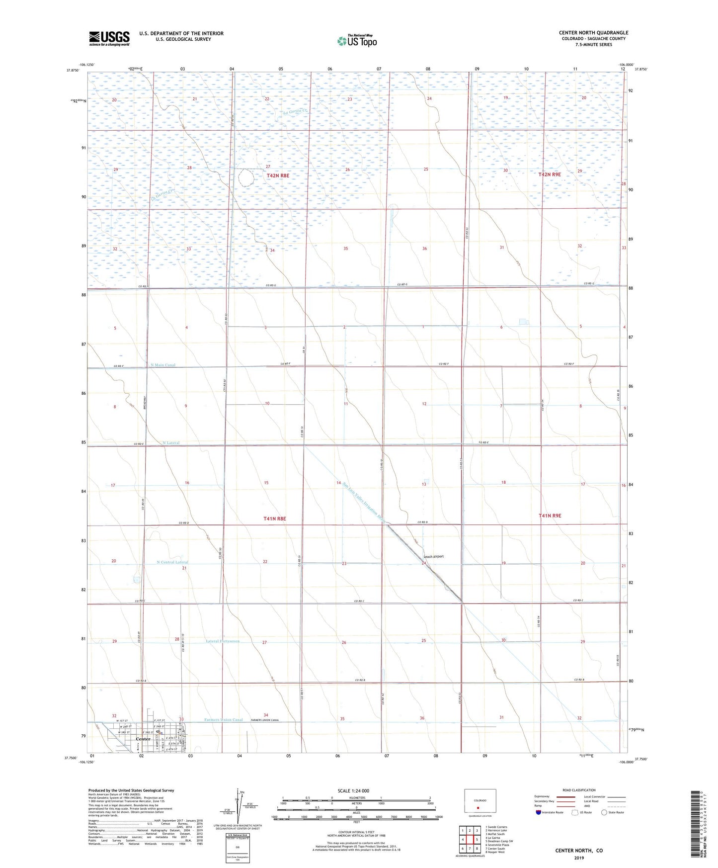
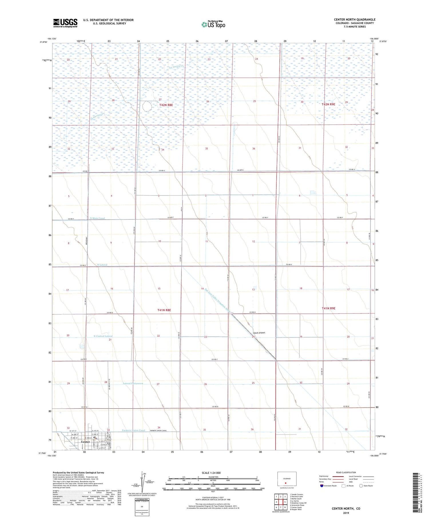
2022 topographic map quadrangle Center North in the state of Colorado. Scale: 1:24000. Based on the newly updated USGS 7.5' US Topo map series, this map is in the following counties: Saguache. The map contains contour data, water features, and other items you are used to seeing on USGS maps, but also has updated roads and other features. This is the next generation of topographic maps. Printed on high-quality waterproof paper with UV fade-resistant inks.
Quads adjacent to this one:
West: La Garita
Northwest: Swede Corners
North: Harrence Lake
Northeast: Moffat South
East: Deadman Camp SW
Southeast: Hooper West
South: Center South
Southwest: Sevenmile Plaza
This map covers the same area as the classic USGS quad with code o37106g1.
Contains the following named places: Center, Center Police Department, Center Post Office, Farmers Union Canal, Finley Airport, First Baptist Church, Haskin Elementary School, Lanier Ranch, Leach Airport, Meadow Ranch, North Lateral, Saint Francis Jerome Catholic Church, Skoglund Middle School, Town of Center, ZIP Code: 81125