MyTopo
Coal Creek Colorado US Topo Map
Couldn't load pickup availability
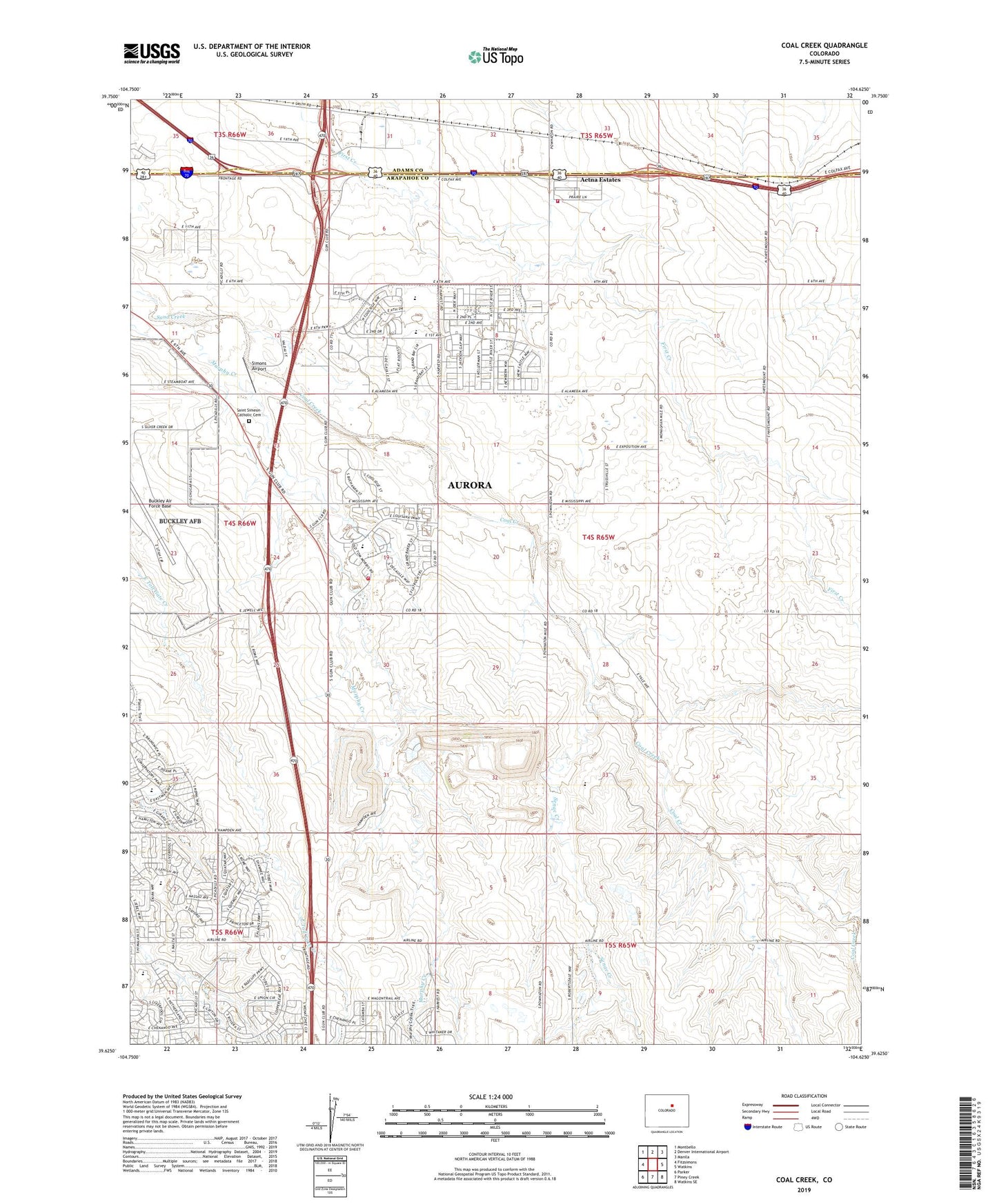
2022 topographic map quadrangle Coal Creek in the state of Colorado. Scale: 1:24000. Based on the newly updated USGS 7.5' US Topo map series, this map is in the following counties: Arapahoe, Adams. The map contains contour data, water features, and other items you are used to seeing on USGS maps, but also has updated roads and other features. This is the next generation of topographic maps. Printed on high-quality waterproof paper with UV fade-resistant inks.
Quads adjacent to this one:
West: Fitzsimons
Northwest: Montbello
North: Denver International Airport
Northeast: Manila
East: Watkins
Southeast: Watkins SE
South: Piney Creek
Southwest: Parker
This map covers the same area as the classic USGS quad with code o39104f6.
Contains the following named places: Aetna Estates Census Designated Place, Arapahoe Park Racetrack, Aurora Airpark, Aurora Fire Department Station 15, Aurora Frontier P - 8 School, Buckley Field Manganese Deposit Mine, City of Aurora, Coal Creek, Coal Creek Rodeo Arena, Cross Creek, Dakota Valley Elementary School, East Quincy Highlands, Gun Club Estates, KYBG-AM (Aurora), Lowry Landfill, Mesa, Murphy Creek, Murphy Creek Golf Course, Murphy Creek School, Ridge View Academy Charter School, Sable Altura Fire Rescue Station 1, Saint Simeon Catholic Cemetery, Senac Creek, Simons Airport, Sky Vista Middle School, Spring Creek Meadows, Thunderbird Estates, Vista Peak Exploratory School, Vista Peak Preparatory School, Washington School, ZIP Code: 80018